Event Overview
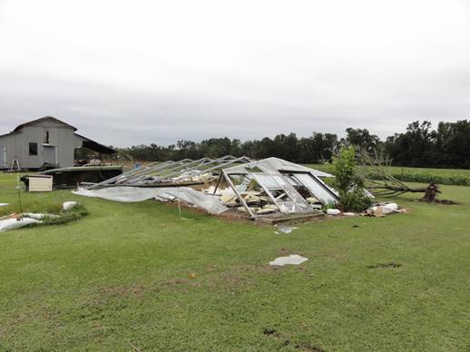
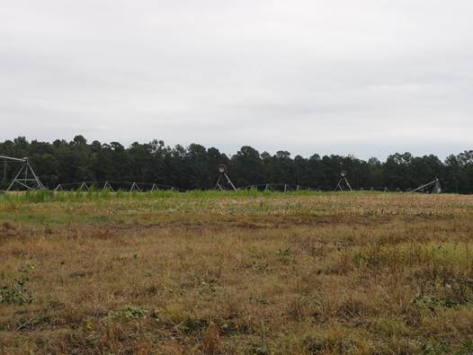
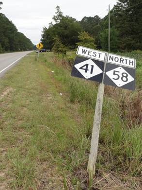
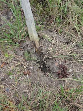
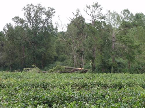
The National Weather Service in Newport/Morehead City, NC has confirmed a tornado near Trenton in Jones County, NC on September 18, 2012. There were three distinct damage paths from what appeared to be three separate touchdowns along the 5 mile total path. The first touchdown tracked for about 0.15 miles and was about 100 yards wide. It downed a large tree onto Highway 41, destroyed a greenhouse and damaged a shed and outbuilding at a residence. A vehicle was damaged by flying debris. The second touchdown was mainly evident in tree damage. It also flipped a farm irrigation system. It was estimated to be about 150 yards wide and may have tracked for about 0.5 miles. The third and final touchdown was about 300 yards wide and tracked for about 0.25 miles. It occurred near the intersection of Highway 41 and Whitaker road. Aside from knocking down one very large tree, damage was mostly limited to large tree limbs and branches, and a few road signs. The damage category never exceeded an EF0.
Summary
Location...near Trenton in Jones County North Ccarolina
Date...September 18 2012
Estimated Time...424 PM EDT
Maximum EF-scale rating...EF0
Estimated Maximum Wind Speed...65 to 85 MPH
Maximum Path Width...300 Yards
Path Length...5 Miles
Beginning Lat/Lon...35.04N / 77.46 W
Ending Lat/Lon...35.07N / 77.38 W
* The information in this statement is preliminary and subject to
Change pending final review of the event(s) and publication in NWS
Storm data.
For reference...the Enhanced Fujita Scale classifies tornadoes into the following categories:
EF0...Wind speeds 65 to 85 mph.
EF1...Wind speeds 86 to 110 mph.
EF2...Wind speeds 111 to 135 mph.
EF3...Wind speeds 136 to 165 mph.
EF4...Wind speeds 166 to 200 mph.
EF5...Wind speeds greater than 200 mph.
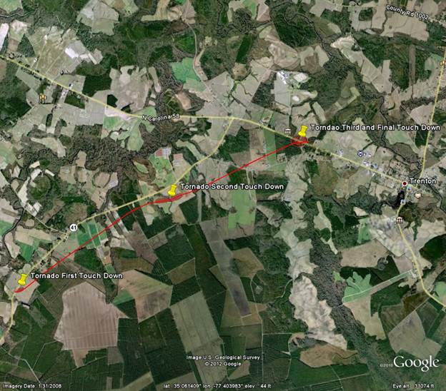
Red line shows total path of storm. Pins and shaded areas represent three distinct touchdowns and damage paths.
|


.png) Surf Forecast/Rip Currents
Surf Forecast/Rip Currents Map View
 Weather Hazard Briefing (when applicable)
 Forecaster Discussion
 Marine
 Text Products
.png) Skywarn
Skywarn Submit Storm Reports
 Coastal Flood
 Follow us on YouTube