April 2, 2005 Coastal Flooding
Event Overview
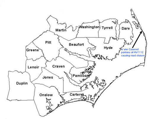
A strong cold front associated with a deep surface low over the Mid-Atlantic crossed eastern North Carolina on the afternoon of Saturday, April 2, 2005. The cold front exited the coast at 2:00 pm on Saturday afternoon, causing strong southerly and south-southeasterly winds at the surface to shift to the west-southwest and west. Strong southerly winds ahead of the front piled water up into the northern portion of the Pamlico Sound, and, when the winds suddenly shifted to the west-southwest, this water was blown into the northern Outer Banks. Emergency Management officials reported about 1 foot of water on portions of NC Route 12 south of Oregon Inlet that necessitated closing of the road for about 3 hours early in the morning. No property damage was reported. Dare County Emergency Management considered this event a moderate flood event. Officials noted winds during the event were 35 to 40 MPH with higher gusts.
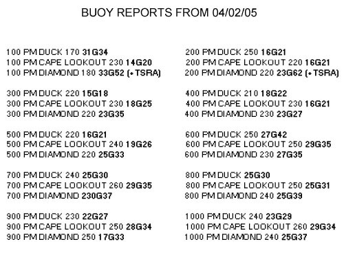
Coastal Flooding Reports - Reports of coastal flooding from April 2, 2005.
Synoptic Overview
A strong cold front associated with a deep surface low over the Mid-Atlantic crossed eastern North Carolina on the afternoon of Saturday, April 2, 2005. A deep, closed 500 mb low was located just upstream of the surface low. Widespread strong convection was occurring along and ahead of the cold front. The storms produced minor flooding east of Highway 17. A storm that indicated strong rotation prompted a tornado warning for eastern Carteret County, although, no damage occurred and no tornado was ever confirmed. The cold front exited the coast at 2:00 pm on Saturday afternoon, causing southerly winds at the surface to shift to the west-southwest and west. After the convection moved offshore, strong post-frontal gradient winds affected eastern North Carolina. Winds in South Carolina were gusting to Wind Advisory criteria (46+ mph), while winds in eastern North Carolina were gusting close to Wind Avisory criteria. Strong southerly wind gusts (35+ knots) ahead of the front piled water into the northern portion of the Pamlico Sound, and, when the front passed and winds suddenly shifted to the west-southwest, this water was subsequently blown into the northern portion of the Outer Banks.
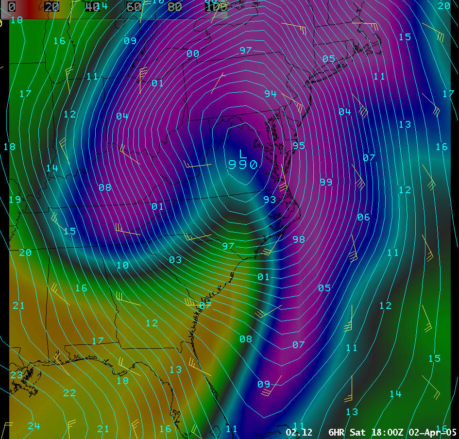
Model Data - 04/02/05 18Z (12Z 6-hr forecast) GFS MSLP, surface winds and 1000-500mb relative humidity showing a deep, 990 mb surface low over the Mid-Atlantic with a strong cold front in eastern NC trailing south off the coast of SC/GA into southern FL.
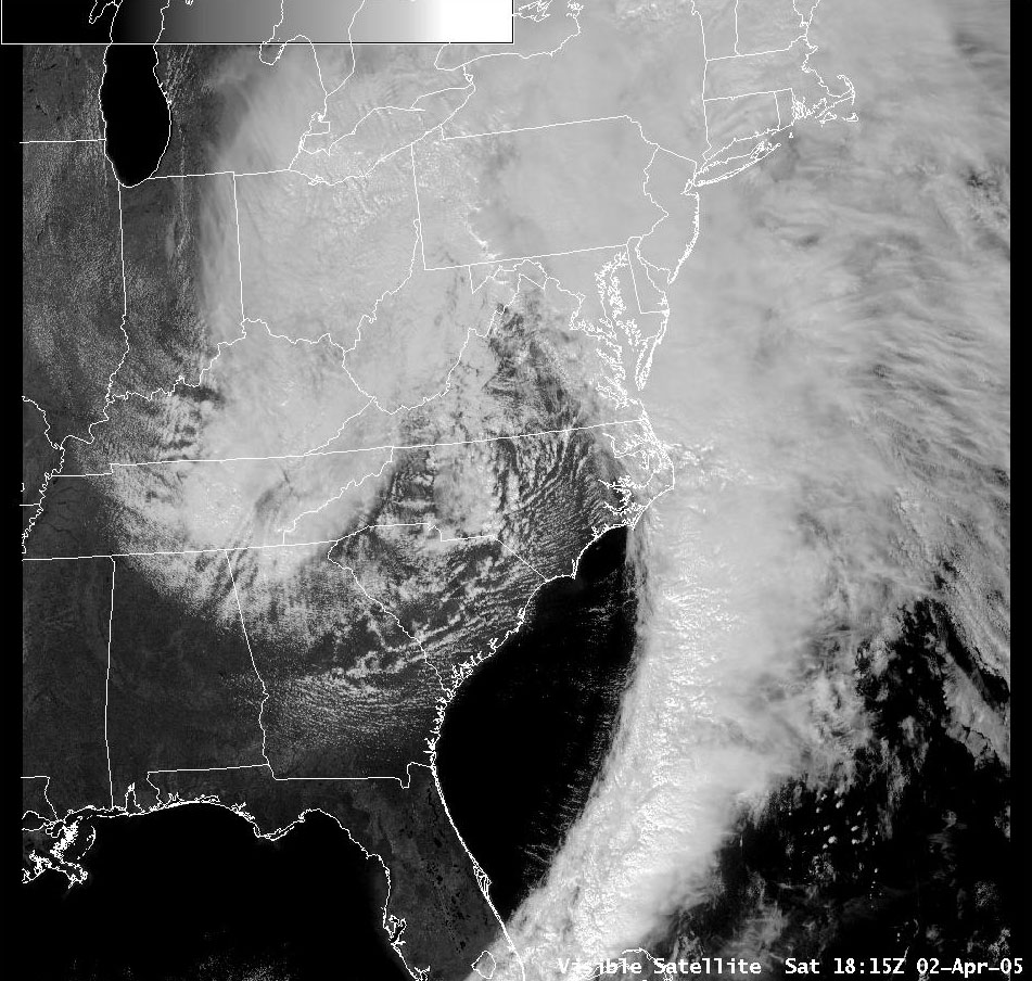
Visible Satellite - 04/02/05 1815Z (115pm) Visible Satellite image showing a deep surface low over the Mid-Atlantic with a strong cold front in eastern NC trailing south off the coast of SC/GA into southern FL.
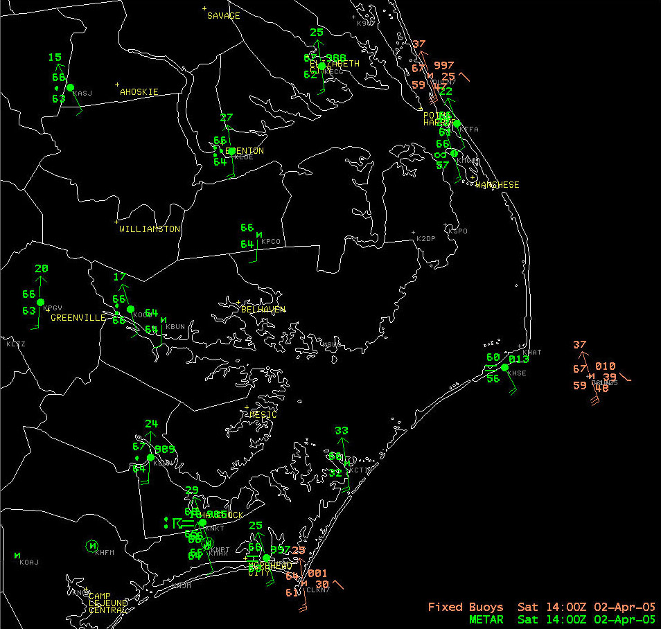
Surface Data - 14Z 04/02/05 Surface data showing strong south (S) and south-southeasterly (SSE) wind gusts over the Pamlico Sound. Note: These strong southerly winds helped to push water into the northern portion of the Pamlico Sound.
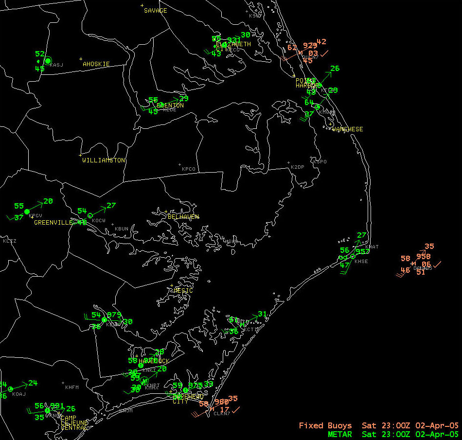
Surface Data - 23Z 04/02/05 Surface data showing strong west southwest (WSW) winds over the Pamlico Sound after the cold frontal passage. Note: These strong southwest winds helped to push the excess water in the northern Pamlico Sound into the Outer Banks.
Case Study Team:
Brandon Vincent
John Elardo


.png) Surf Forecast/Rip Currents
Surf Forecast/Rip Currents Map View
 Weather Hazard Briefing (when applicable)
 Forecaster Discussion
 Marine
 Text Products
.png) Skywarn
Skywarn Submit Storm Reports
 Coastal Flood
 Follow us on YouTube