
Scattered thunderstorms and widespread showers are expected from the Texas coast to the central Appalachians today. Heavy to excessive rainfall will continue in southern California into the Desert Southwest through Saturday. Heavy rain will pose a risk of flash flooding, especially across burn scar and urbanized regions. Read More >
Last Map Update: Sun, Nov 23, 2025 at 2:50:29 am PST


|
Text Product Selector (Selected product opens in current window)
|
|


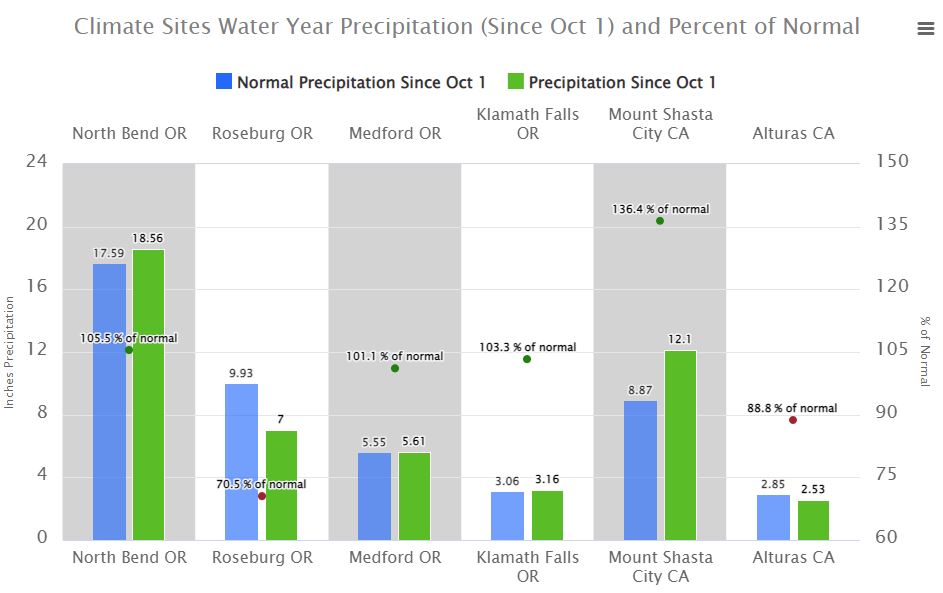 Precipitation Tracker
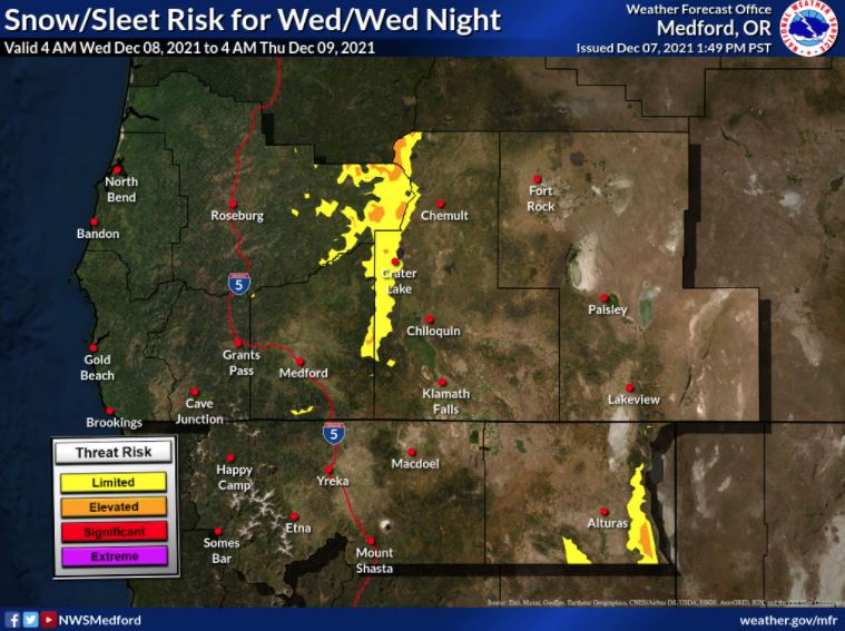 Graphical Hazards Outlook
 RADAR and Satellite
 Forecast Discussion
 Snowfall and Depth With Crater Lake Details
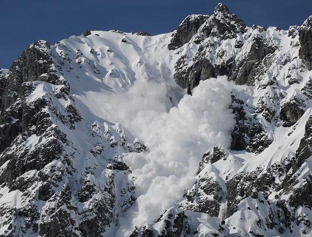 Avalanche Guidance
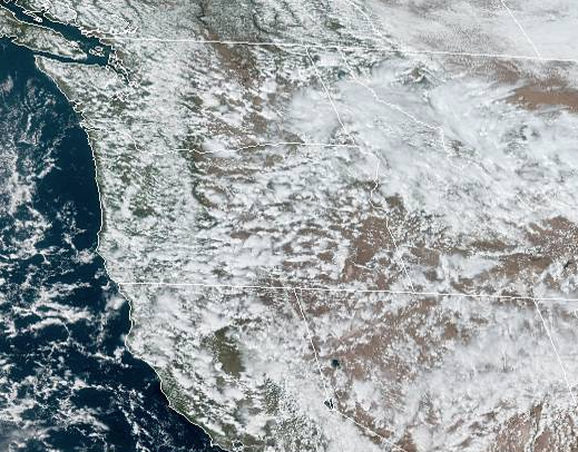 NESDIS Geocolor
 Weather Map
 Forecast Weather Tables
 Marine
 Fire Weather
 Crater Chronicle and Monthly Climate Summaries
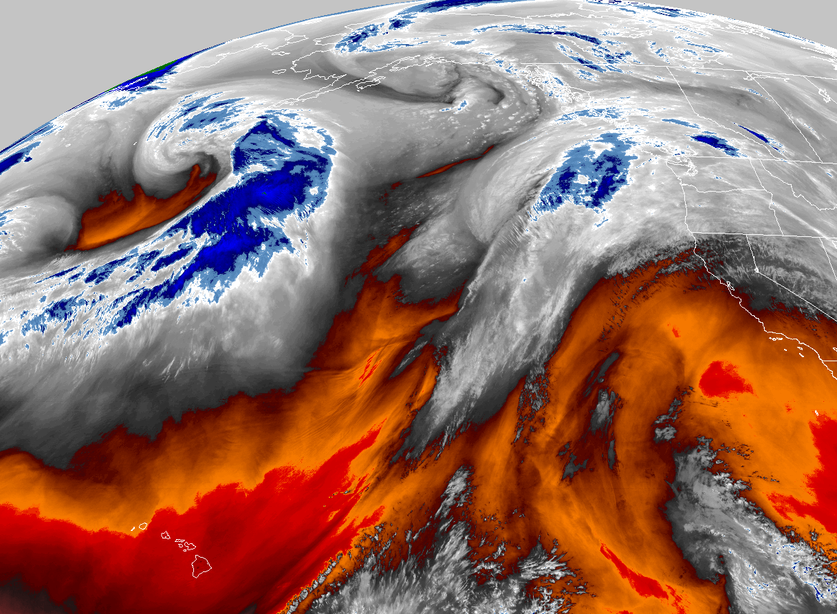 GOES 18 Water Vapor Imagery
 Mountain Pass Forecasts
 Local Climate Data
 Alternate Point Forecast