National Weather Service United States Department of Commerce

Excessive Rainfall and Severe Thunderstorms Threaten the Southern U.S. Again Friday

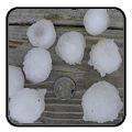
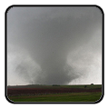
Heavy to excessive rainfall is forecast for eastern Louisiana into central Alabama which could bring flash, urban, and riverine flooding Friday. Scattered severe thunderstorms with a few tornadoes, very large hail, and damaging winds are possible across parts of the Gulf Coast States Friday and Friday night. Read More >

Click a location below for detailed forecast.

Last Map Update: Fri, May. 17, 2024 at 2:43:58 am CDT

National Weather Service Albuquerque, NMNational Weather Service Lubbock, TXNational Weather Service Fort Worth/Dallas, TX
National Weather Service El Paso, TXZoom
Out

National Weather Service San Angelo, TX
National Weather Service Austin/San Antonio, TX

Below average temperatures hold today and tomorrow as a cold front slides through the area. Severe storms will be possible today, mainly over the Permian Basin. Isolated storms possible over the Davis Mountains for Friday. Dry and hot conditions begin to take hold on Saturday where temperatures reach into the upper 90s to low 100s.

Text Product Selector (Selected product opens in current window)
Submit Storm Report Spotter Briefing Skywarn Storm Data Tornado Statistics Social Media
Storm Reports Spotter Briefing Storm Spotters Storm Data Tornado Statistics Social Media
 
Area Forecast Discussion Hourly Forecast Graphs Digital Forecasts Fire Weather Aviation Hydrology
Forecast Discussion Hourly Forecast Graphical Forecast Fire Weather Aviation Hydrology
 
Observations Air Quality Satellite Climate Past Events weather Radio
Observations Air Quality Satellite Climate Past Events Weather Radio