|
Relief from the heat, and rain for many! |
|
 |
|
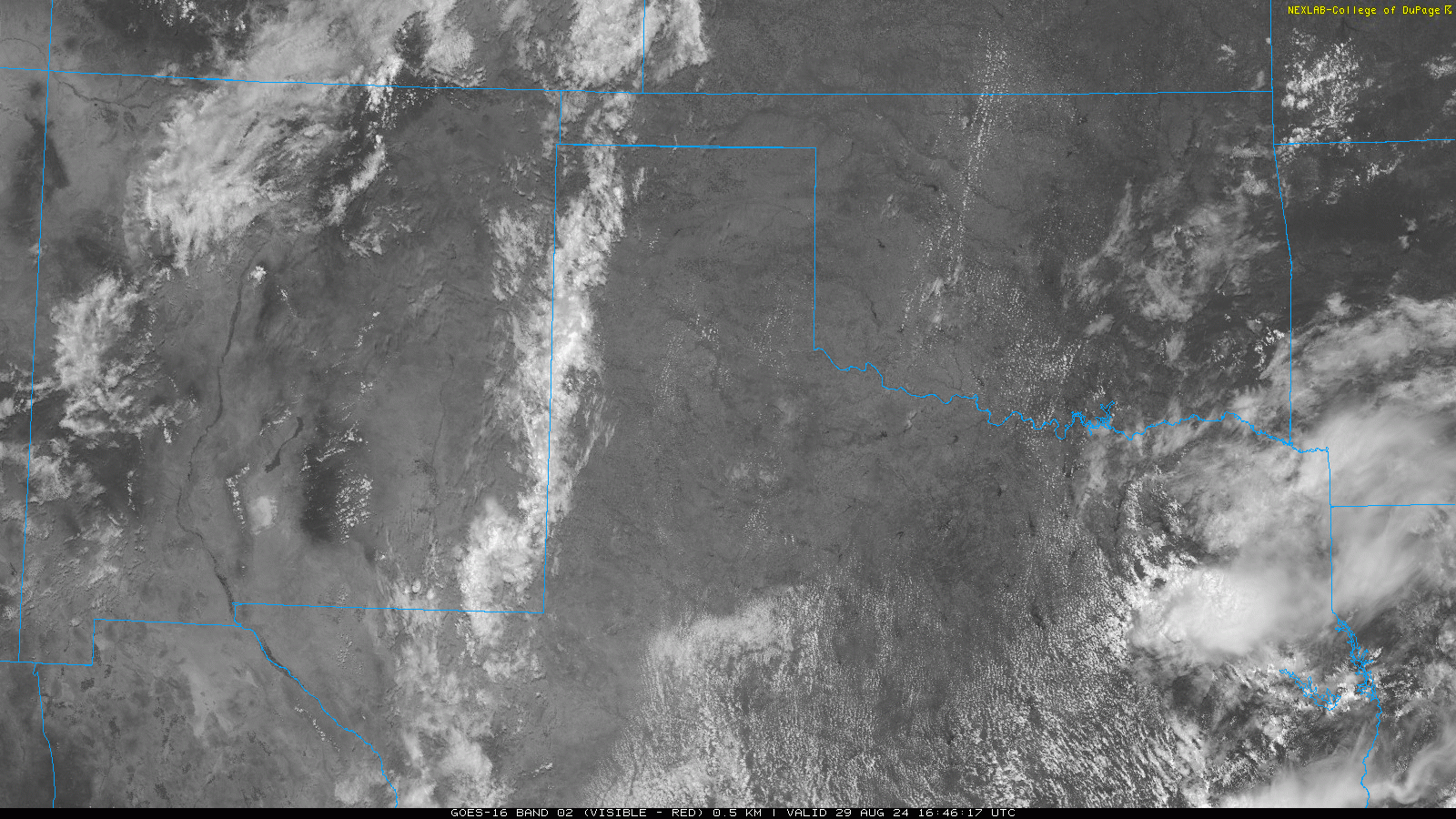
| Visible satellite image valid from 11:46 am to 1:51 pm on Thursday (29 August 2024). | |
|
Dry conditions and scorching heat through much of August finally yielded cooler temperatures and a return of rainfall late month into early September. The initial hint of the upcoming change occurred on Thursday, August 29th, when scattered thunderstorms developed along a surface trough over the western South Plains and Texas Panhandle. This activity brought spotty heavy rain and welcome cooler temperatures as it spread eastward through the afternoon and evening hours. |
|
 |
|
|
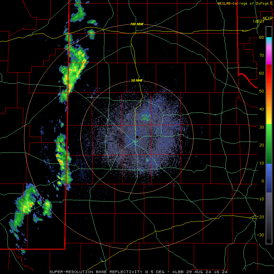
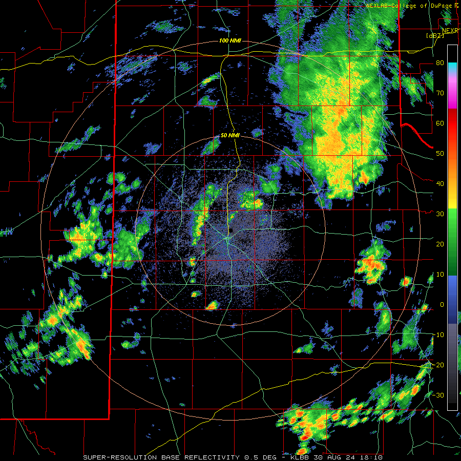
Lubbock WSR-88D radar animation valid from 11:29 am to 3:01 pm on Thursday (29 August 2024). |
|
| The first wave of showers and thunderstorms faded during the evening hours. However additional rounds of showers and thunderstorms followed, moving out of eastern New Mexico late Thursday and developing well into the South Plains by early Friday morning. This activity was aided by abundant moisture and a weak disturbance aloft, in combination with a cold front advancing through the region. | |
 |
|
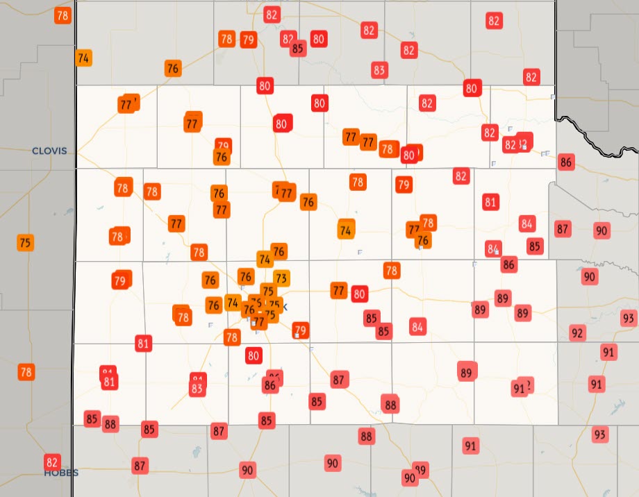
| Observed high temperatures on Friday (30 August 2024). The data are courtesy of the NWS COOP observers and the West Texas Mesonet (WTM). | |
| Where rain fell, it often came down hard thanks to the abundant moisture in place through much of the lower atmosphere. The cloudy conditions and periods of rain kept temperatures from rising much. In fact, high temperatures on Friday only rose into the middle 70s to middle 80s for many locations across the southern Texas Panhandle into the South and Rolling Plains. The cool highs felt extra impressive given that much of the region experienced lows in the range through most of August, while triple digit highs were commonplace. | |
 |
|
| Lubbock WSR-88D radar animation valid from 5:28 pm on Thursday to 7:37 am on Friday (29-30 August 2024). An additional radar animation, valid from 6:02 am to 9:41 am on Friday, can be VIEWED HERE. | |
| Despite the cooler temperatures and abundant cloud cover, additional showers and thunderstorms redeveloped over portions of the region Friday afternoon, before shifting to the south, into the Permian Basin, during the evening. | |
 |
|
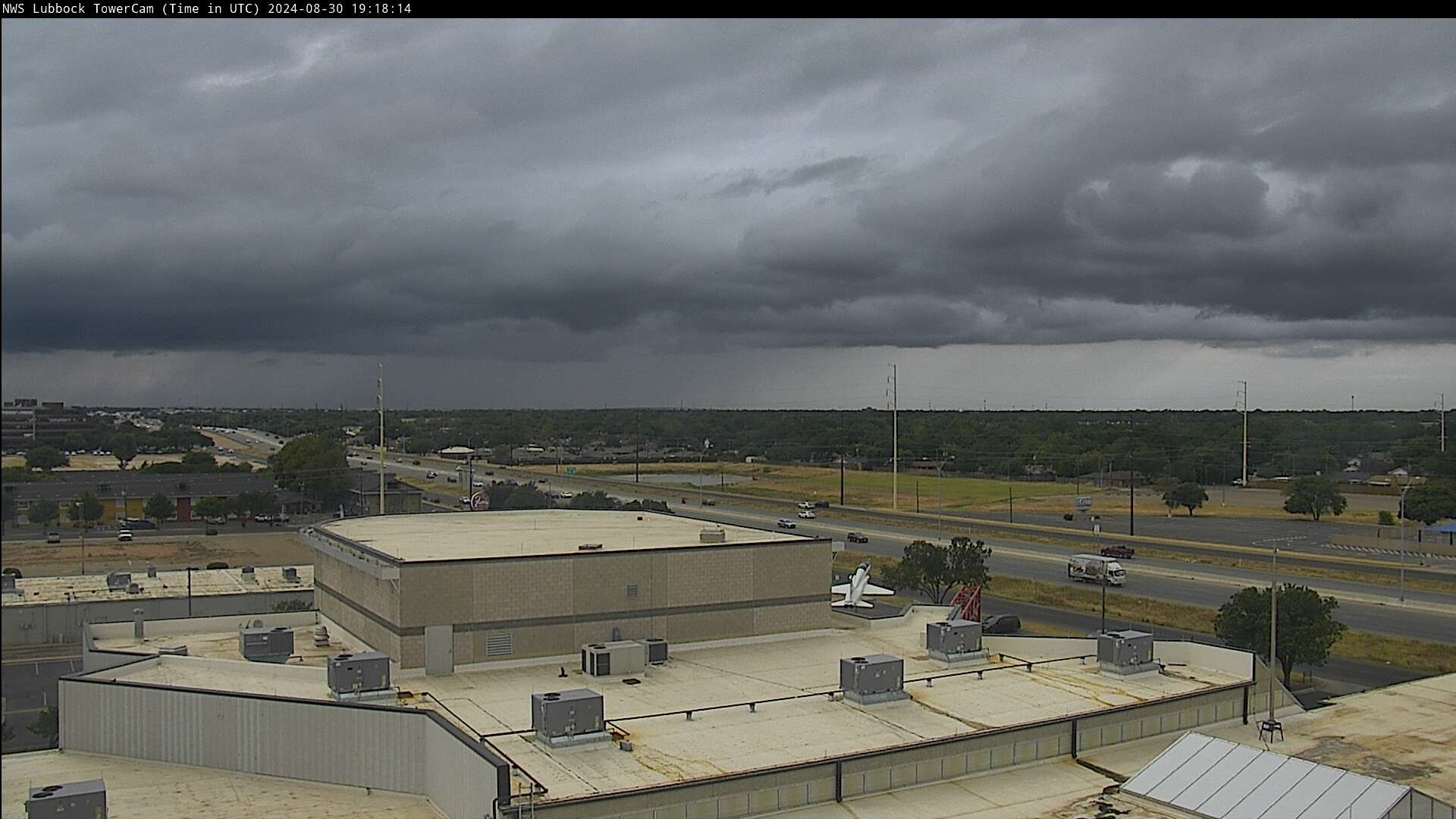
| View of thunderstorms approaching Lubbock Friday afternoon (30 August 2024). | |
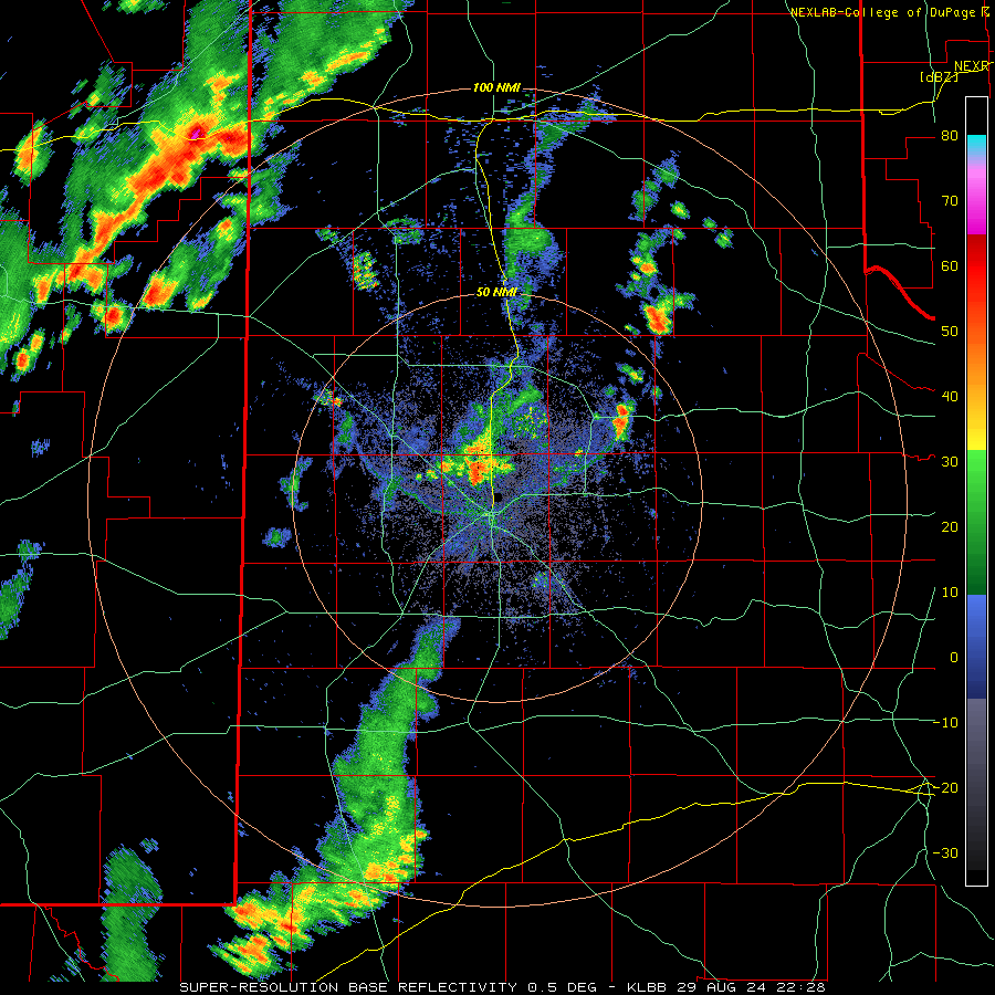
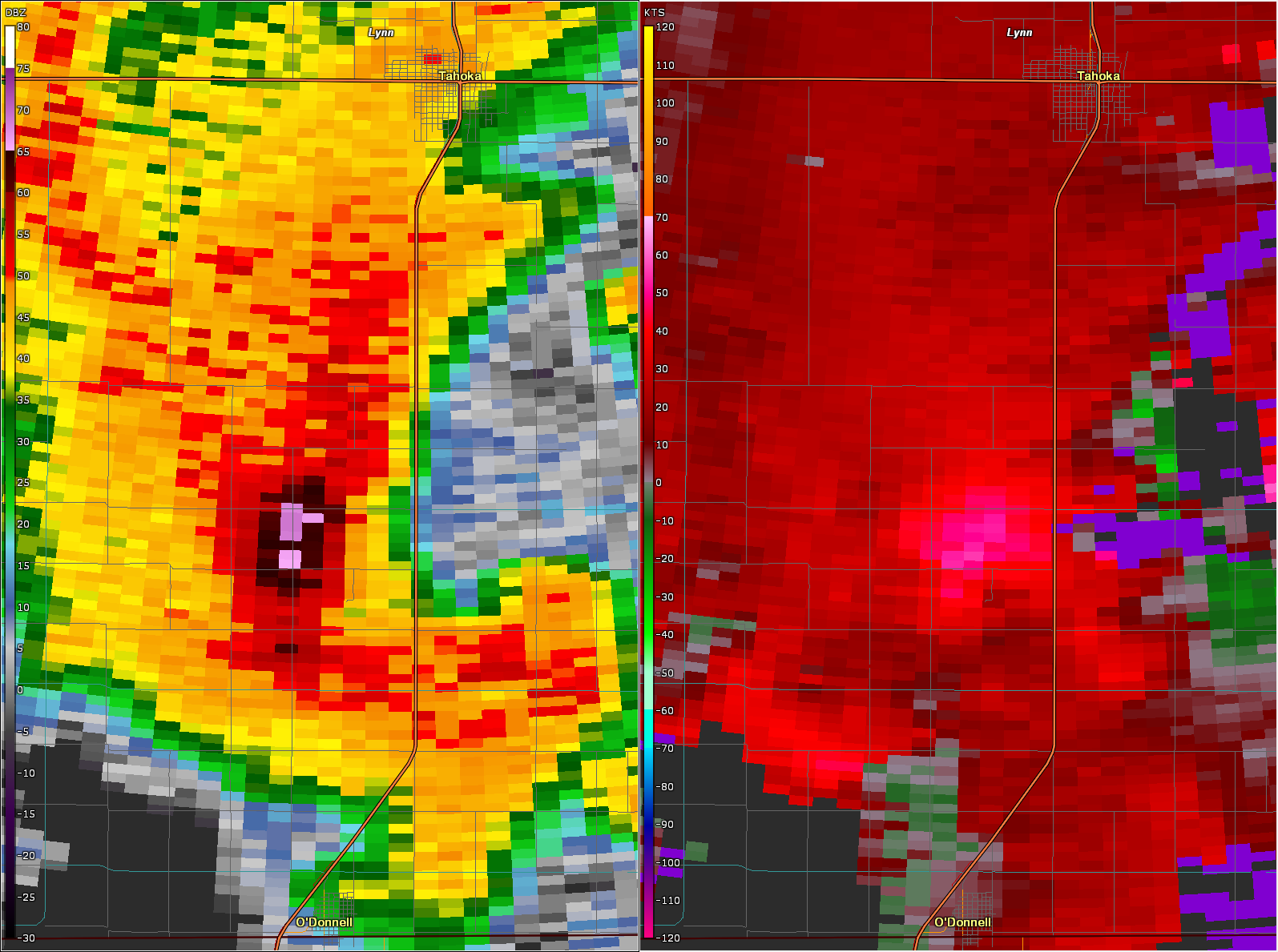
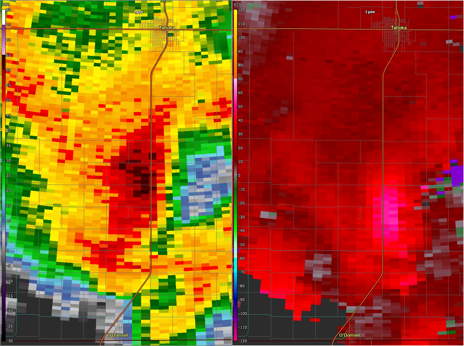
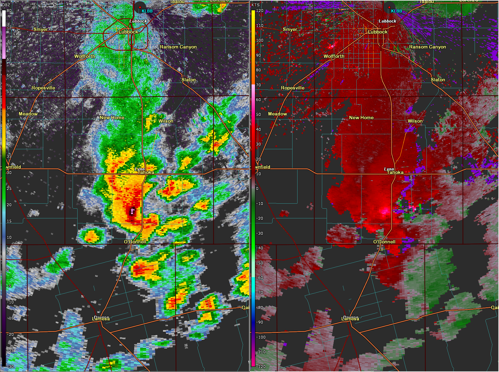
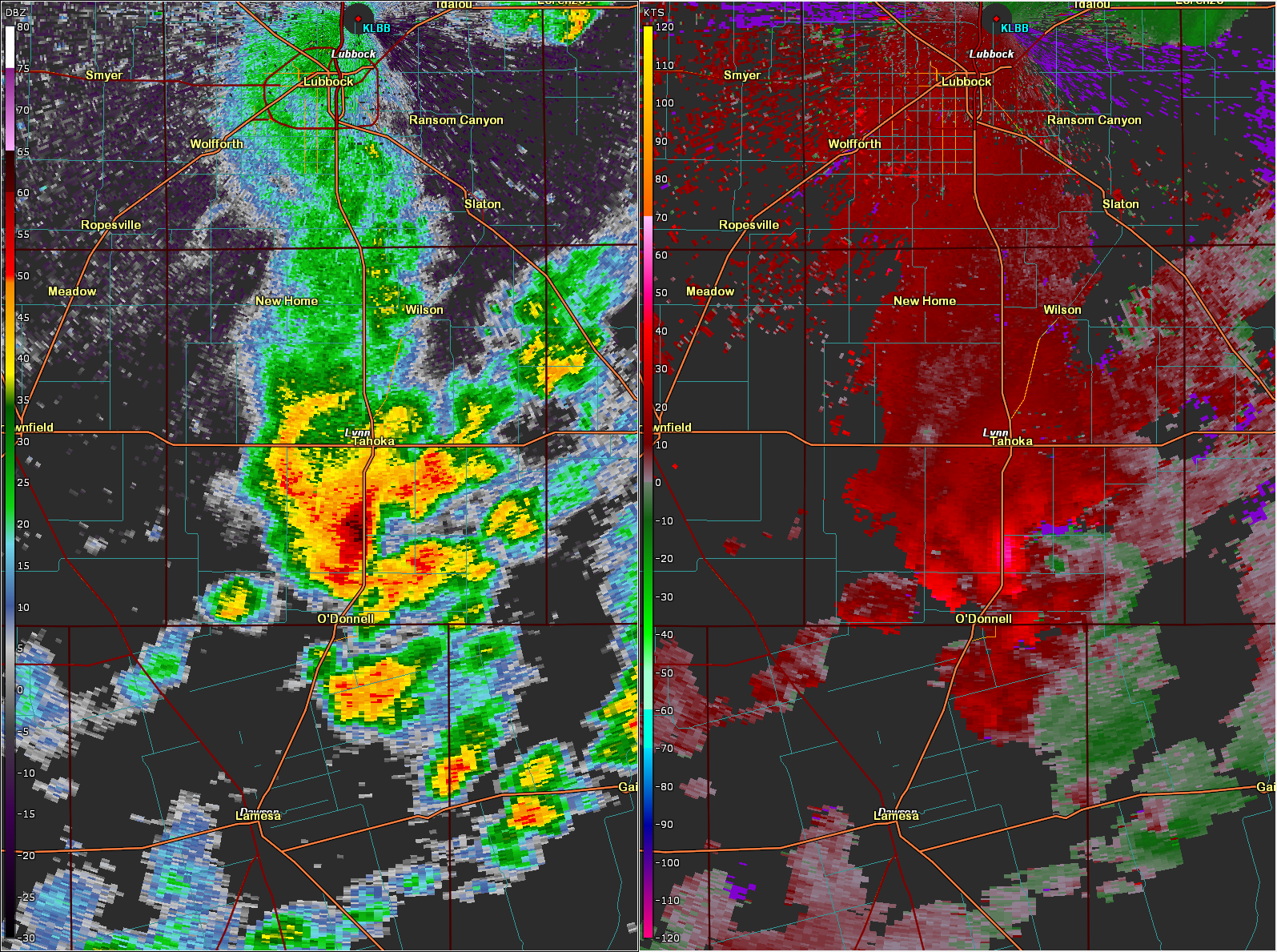
| Where the warmest temperatures and most unstable air developed across the southern South Plains, a few thunderstorms became more intense. The strongest storm of the afternoon targeted portions of south-central Lynn County. This storm produced wind-driven hail that caused crop and property damage, in addition to heavy rain and even a couple of gustnadoes. The strongest wind signature on radar was detected just after 4 pm between Tahoka and O'Donnell. Shortly thereafter the West Texas Mesonet (WTM) site near O'Donnell measured a peak wind gust of 62 mph. This storm moved fairly quickly, but still managed to produce enough rain to induce flooding in and around Highway 87. | |
 |
|
 |
|
| Lubbock WSR-88D radar base reflectivity (left) and velocity (right) over south-central Lynn County at 4:02 pm (top) and 4:07 pm (bottom) on Friday (30 August 2024). For an expanded view of the radar at 4:02 pm CLICK HERE, and at 4:07 pm CLICK HERE. In addition, a Lubbock WSR-88D radar animation valid from 1:24 pm to 10:05 pm on Friday (30 August 2024) can be VIEWED HERE. | |
| The following day was pleasant, with mild temperatures and dry conditions. This didn't last long, though, as a mid-upper level disturbance took shape over Central and South Texas. This disturbance, feeding on a rich tap of moisture, triggered widespread moderate to heavy rain over a good portion of the state just in time for the new month of September to kick off. | |
 |
|
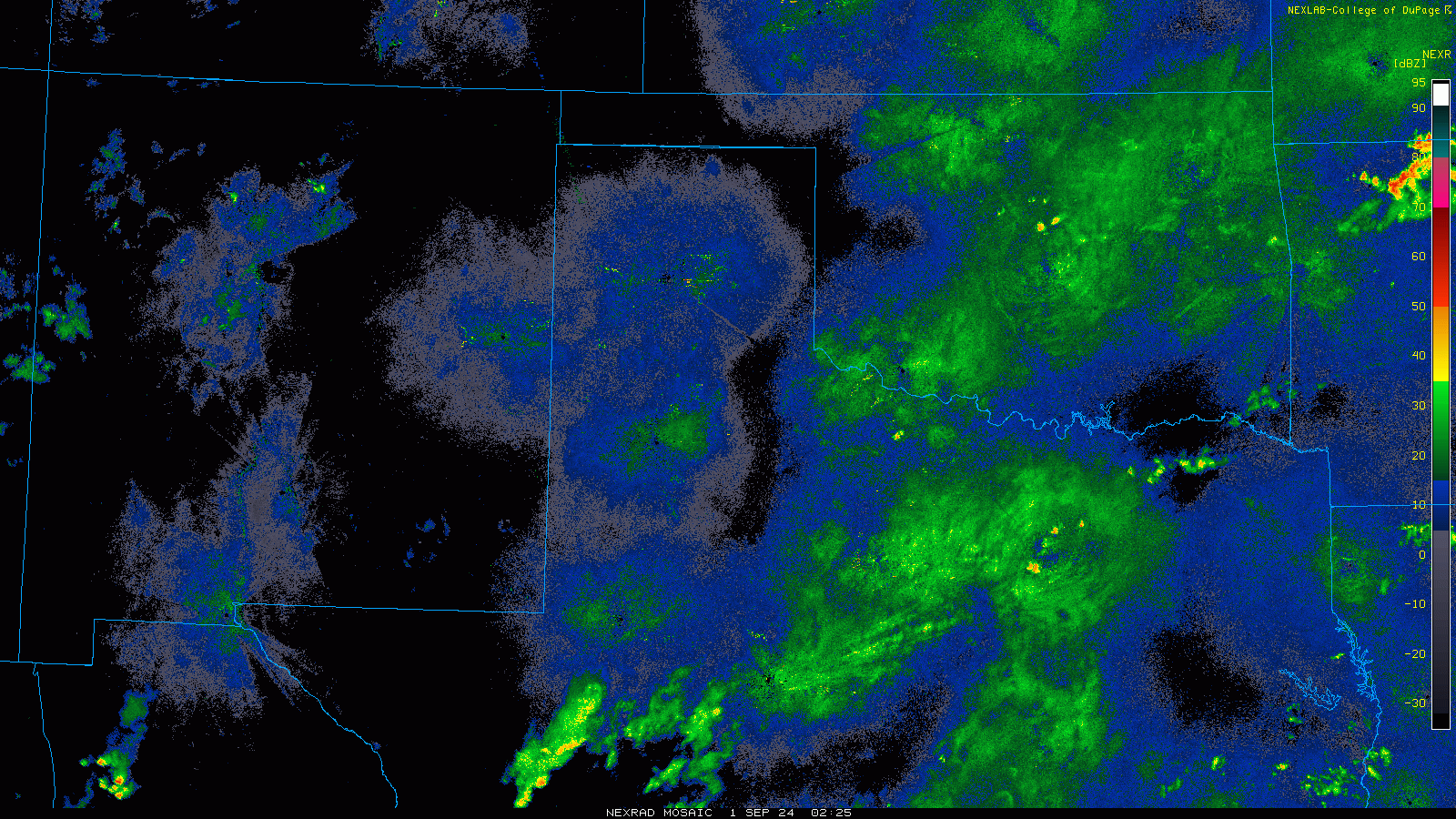
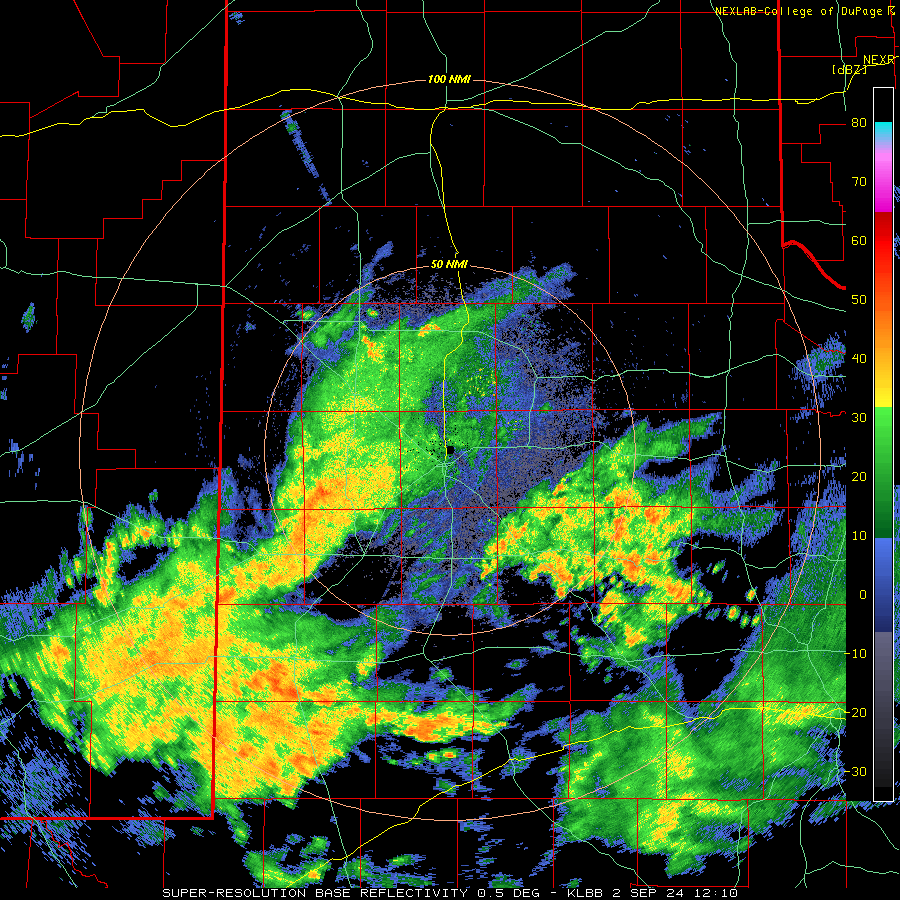
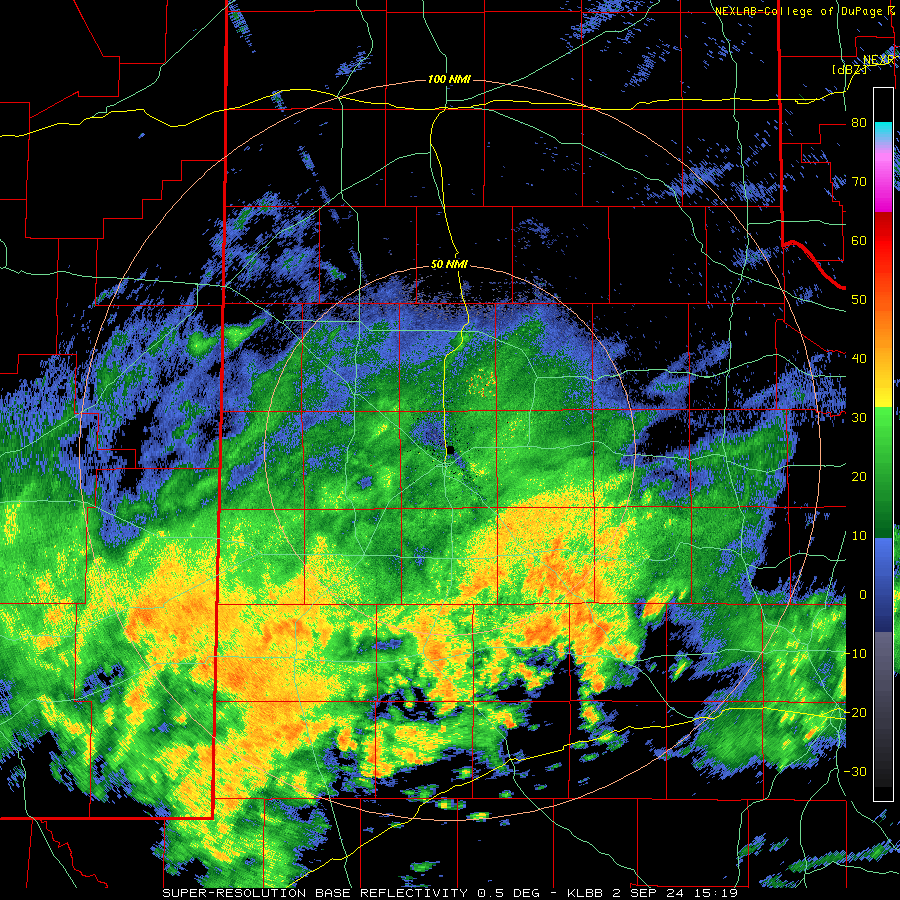
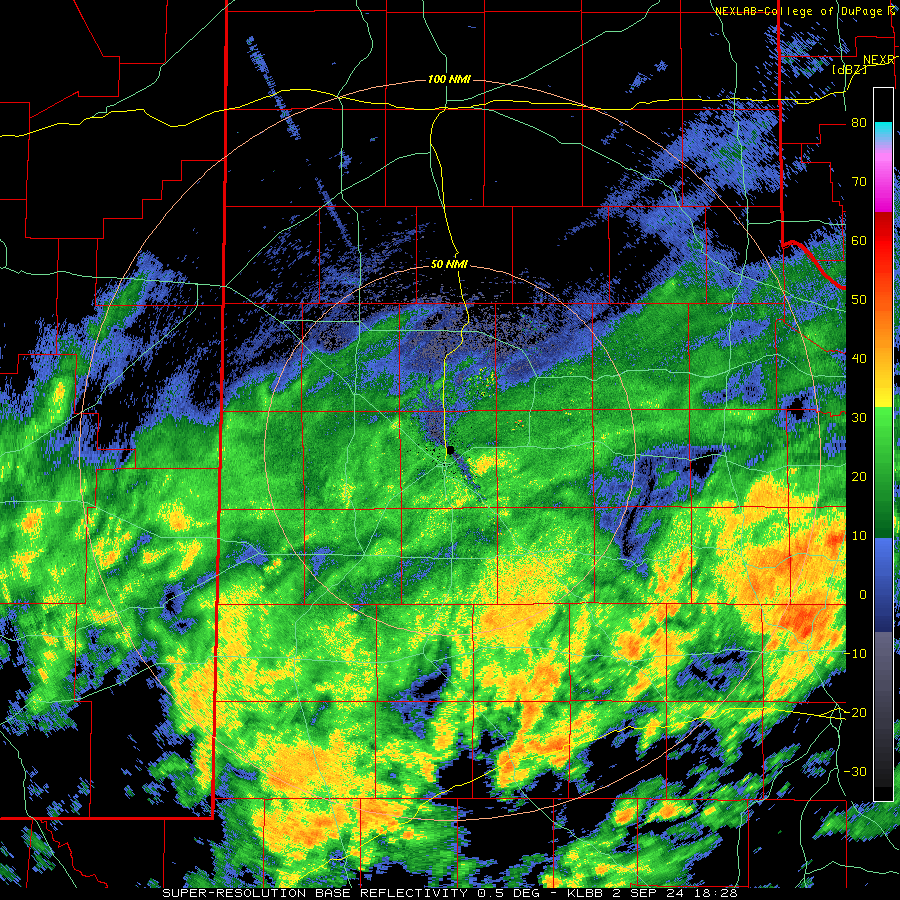
| Regional radar animation valid from 9:25 pm on Saturday to 7:25 am on Tuesday (31 August - 3 September 2024). Additional Lubbock WSR-88D radar animations can be found at: 7:10 am to 9:30 am on Monday (2 September); 10:10 am to 8:53 pm on Monday (2 September); and 1:28 pm on Monday to 8:02 am on Tuesday (2-3 September). | |
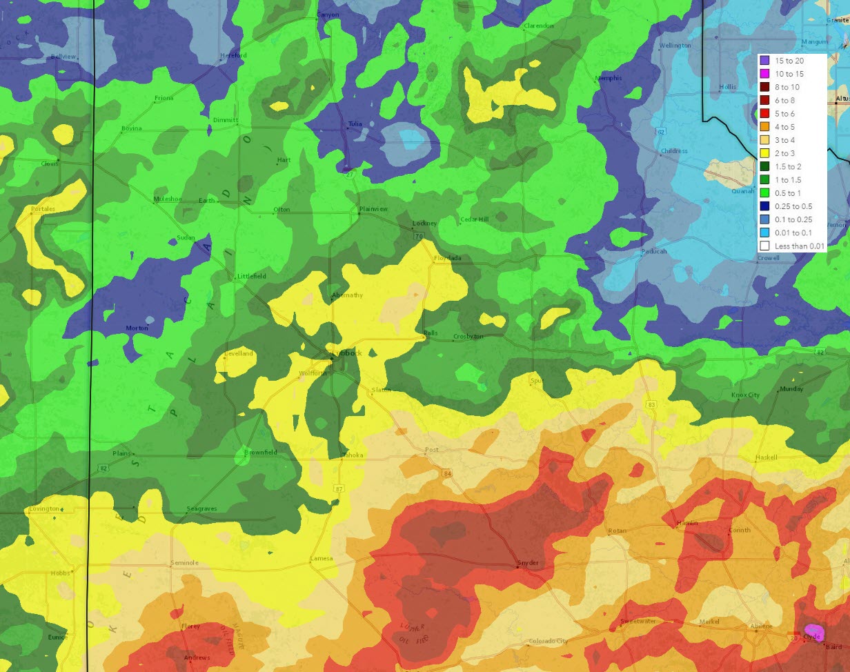
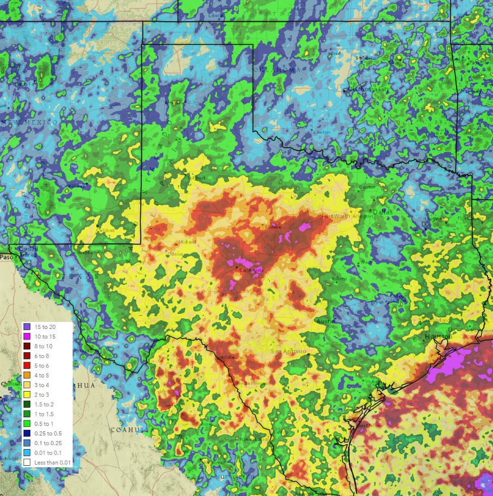
| The heaviest rain targeted the southern sections of the South and Rolling Plains, and point south and southeast from there, while lighter rain fell at many locations farther north. This rain continued through much Sunday and Monday, before finally diminishing and shifting southeastward on Tuesday. By the conclusion of the event, rain totals of 2 to 3+ inches were common from the central South Plains through the southern Rolling Plains. Jayton measured over 5 inches of rain, while Lake Alan Henry finished just short of 5 inches. Farther south, rain totals of 5 to 10+ inches targeted parts of the Concho Valley and Big Country, where significant flooding occurred. Farther north, from the southern Texas Panhandle into the northern Rolling Plains, rain totals were lighter, with less than a quarter inch falling around Childress and Paducah. | |
 |
|
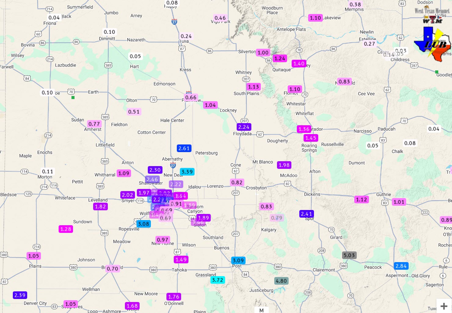
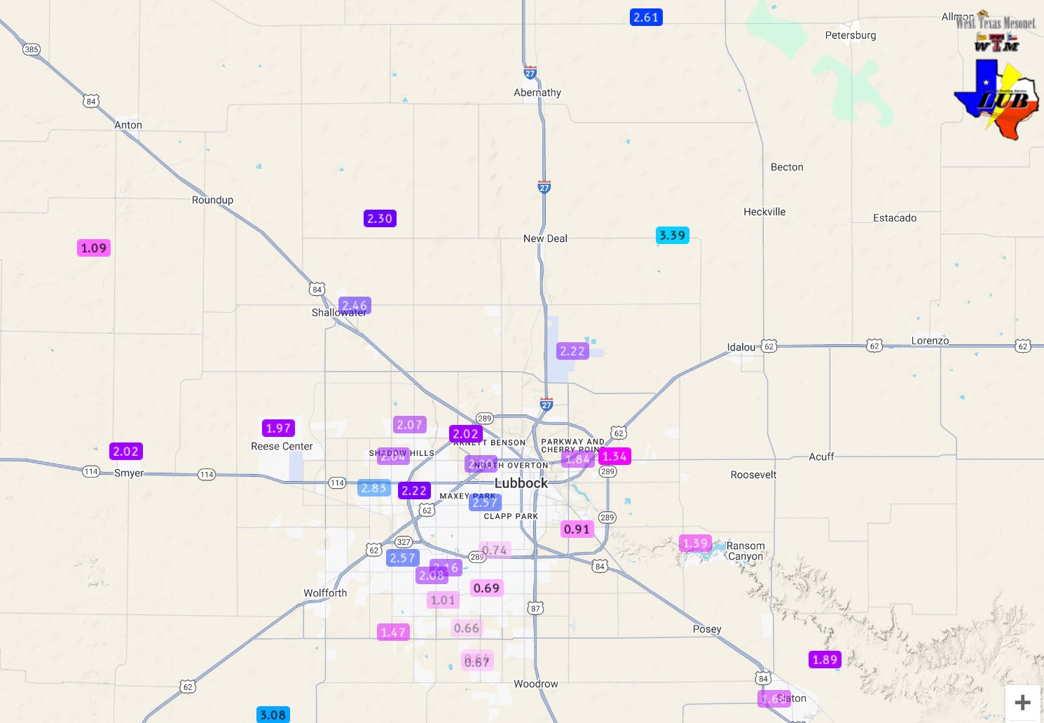
| 7-day radar-estimated and bias-corrected rainfall ending at 7 am on Thursday (5 September 2024). An expanded view, including all of Texas, can be FOUND HERE. Measured rain totals over this same period, courtesy of the NWS and WTM, can be VIEWED HERE, with a close up of the Lubbock area HERE. | |
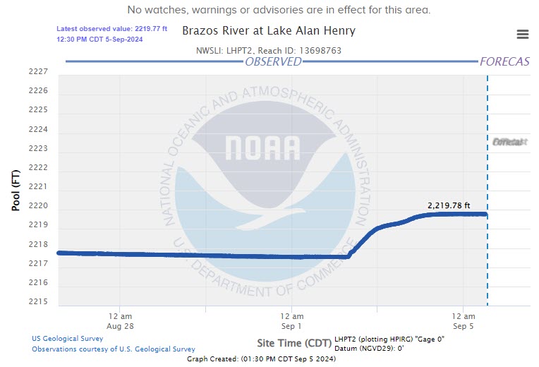
| Where the heavy rain fell, and creeks and rivers surged, the runoff led to notable rises of several reservoirs. The most impressive rises affected lakes south and east of the South Plains region, but Lake Alan Henry rose over 2 feet, nearly filling as we head into fall. | |
 |
|
| Trace of the elevation of Lake Alan Henry through Thursday morning (5 September 2024). The lake is considered full at 2020 feet. | |
|
Officially, the Lubbock Airport recorded 1.99 inches between August 30th and September 4th, with 1.79 inches falling on September 2nd. Childress wasn't as lucky, only measuring 0.12 inches over this stretch. The storm reports collected over this period can be found below: |
|
Preliminary Local Storm Report...Summary
National Weather Service Lubbock TX
1050 PM CDT Fri Aug 30 2024

..TIME...   ...EVENT...      ...CITY LOCATION...     ...LAT.LON...
..DATE...   ....MAG....      ..COUNTY LOCATION..ST.. ...SOURCE....
            ..REMARKS..

0415 PM     Tstm Wnd Gst     1 N O`Donnell           32.98N 101.83W
08/30/2024  M62 MPH          Lynn               TX   Mesonet

            Severe gusts began at 408 PM and continued
            through 415 PM.

0458 PM     Flood            6 NNE O`Donnell         33.06N 101.81W
08/30/2024                   Lynn               TX   NWS Employee

            Overflowing low-lying areas and drainage
            ditches resulted in water over the roadway
            on US-87 between Tahoka and ODonnell.

0556 PM     Flood            2 NNE O`Donnell         32.99N 101.82W
08/30/2024                   Lynn               TX   Emergency Mngr

            EM confirms continuation of ongoing flooding
            in southern Lynn County near ODonnell.

