| Cold Rain Ends Record Dry Stretch 16-17 February 2018 |
 |
| 24 hour measured rain totals end at 7 am on Saturday, 17 February 2018. A separate plot showing all of the rainfall reports from the West Texas Mesonet can be VIEWED HERE. |
| Mid-February brought a welcome and rare sight to the region in the form of rain falling from the sky. Following a cold front early on Friday, February 16th, clouds filled in. Several light showers formed over the South Plains during the day, with the Lubbock Airport officially recorded 0.01" early in the afternoon. This light but measurable rain officially ended the record 99 day stretch without precipitation in Lubbock. This initial wave of showers was spotty and very light, with many spots only receiving a trace. |
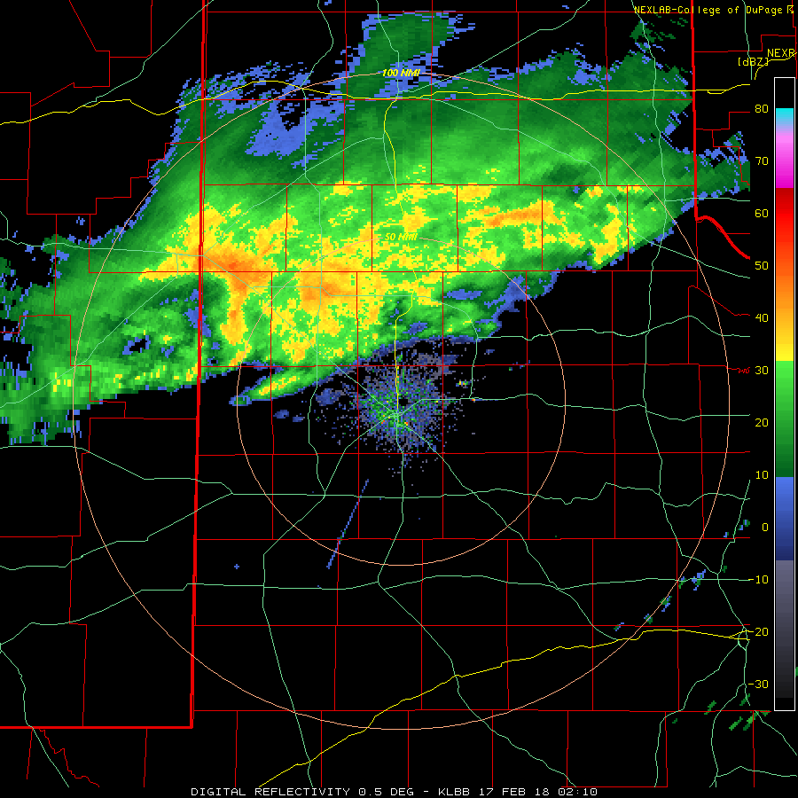 |
| Lubbock radar animation valid from 8:10 pm on Friday 16 February to 12:29 am on Saturday 14 February 2018. |
| Much more widespread light to moderate rain then developed during the evening and overnight hours as Pacific moisture combined with increased and deeper lift. The rain was initially concentrated over the southern Texas Panhandle into the northern South Plains, but did eventually expand to much of the South Plains and Rolling Plains. Where the rain was heaviest and lasted the longest, 1/3" to 1/2" plus fell in a swath from Muleshoe through Plainview and Memphis. The Silverton West Texas Mesonet was the big winner, recording 0.92 inches. To the north of the heaviest band of rain, rain totals quickly dropped to nothing, while lighter amounts were more widespread south of the band. Thankfully it stayed just warm enough, in the middle 30s to lower 40s, to keep all the precipitation a cold rain. |
 |
| Regional radar animation valid from 5:58 pm to 7:08 pm on Friday, 16 February 2018. Additional regional radar animations can be found at: 4:48 pm to 5:58 pm on Friday, 16 February and 10:50 pm on the 16th to 12:08 am on the 17th. |
| The rain wasn't confined to the South Plains region, but was fairly expansive from southern New Mexico and Far West Texas into parts of Oklahoma. This system provided much needed moisture for a good chunk of the region, though unfortunately locations from Amarillo northward missed out on rain during this event. |
 |
| Radar-estimated and bias-corrected 7-day rainfall ending at 6 am on 20 February 2018. |
| Officially, Lubbock recorded 0.18" through the course of the rain event, with most the city measuring between one and two tenths of an inch. The rain quickly came to an end early Saturday morning as the upper level storm system shifted off to the east. |

