
An upper-level storm system passing over the high plains to our north brought strong winds, blowing dust, and a few wildfires to our forecast area on Sunday, January 21st, 2018. Despite temperatures dropping behind a cold front sweeping across West Texas, the very dry air coupled with the strong winds created conditions favorable for a few fire starts. Fortunately, none of the fires caused major damage, as they burned through dry grasses.
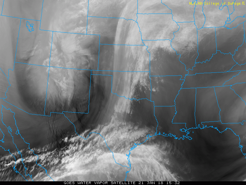
As the loop of satellite imagery below shows, an upper-level storm system was crossing the Rocky Mountains on the 21st and emerging over the high plains. As is did, a band of strong winds aloft passed over West Texas, while a cold front also raced across the area. Snow fell in the mountains of Colorado and northern New Mexico, and the storm system also brought blizzard conditions to northeast Colorado and parts of Nebraska and Kansas. Finally, the storm system spawned severe thunderstorm across East Texas, eastern Oklahoma, and parts of Missouri, Arkansas and Louisiana.
 |
|
A loop of satellite images from 21 January 2018.
|
West to northwest winds increased Sunday morning, becoming gusty by midday and continuing through much of the afternoon. Sustained wind speeds were generally in the 25 to 35 mph range, with gusts well into the 40s and lower 50s. The strongest winds passed across the southern South Plains and the northern Permian Basin. In these areas, the wind gusts peaked into the middle to upper 50s. The map below shows some of the peak wind gusts across the region as measured by the West Texas Mesonet.
 |
|
Peak wind gusts (mph) reported by the West Texas Mesonet (www.mesonet.ttu.edu) on Sunday, 21 January 2018. Click on the image for a larger version.
|
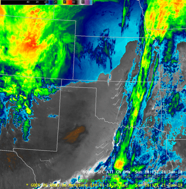
Unfortunately, the strong winds generated a swath of blowing dust that developed across the southern South Plains just after noon, spreading into the Rolling Plains through the afternoon hours. The satellite image below shows bands of thick blowing dust aligned with the low-level wind direction to the south and east of Lubbock.

Approximately three hours later, the NOAA MODIS Aqua satellite captured the image below, showing the blowing dust expanding off the Caprock in the Rolling Plains. A smoke plume can also be seen to the southwest of Amarillo.

The satellite loop below highlights some of the interesting features with Sunday's storm system. Over West Texas, the blowing dust shows up as a tan to brown swath that eventually spreads into North Texas and southwest Oklahoma.

