Mid-June brought a variety of weather to the South Plains region of West Texas. After a cool start to June, temperatures began to heat up as a ridge of high pressure developed across the desert southwest. Several weak upper-level disturbances rounding the top and east sides of the ridge helped kick off a couple rounds of thunderstorms during the period. Two days saw quite a bit of thunderstorm activity, Monday, June 12 and Thursday, June 15.
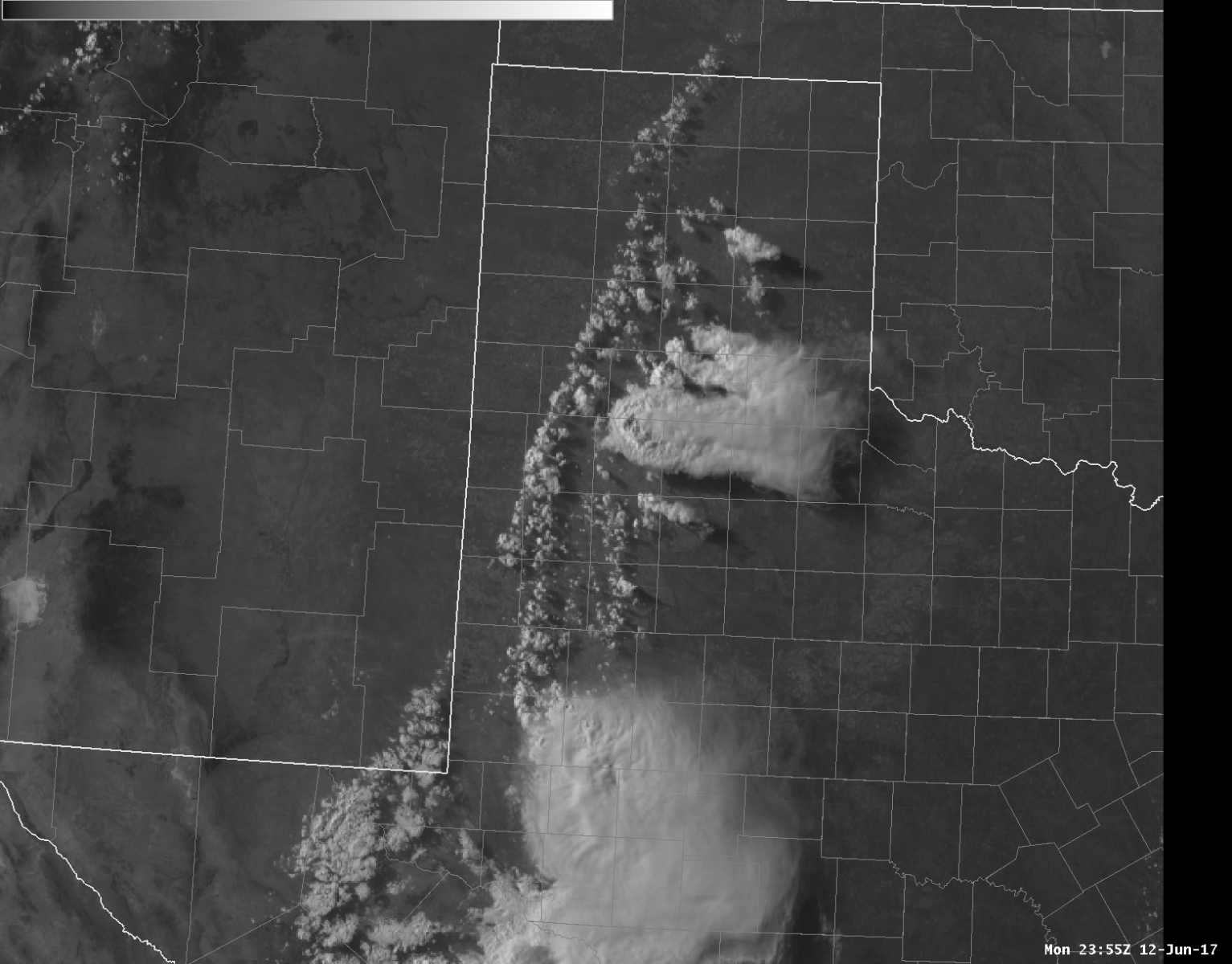
The image below shows a satellite image from late in the day Monday showing several storms developing east of a dryline running N-NE to S-SW from the central Texas Panhandle into the western Permian Basin. One of these storms dropped very large hail up to baseball size in Plainview, unfortunately causing some property damage.
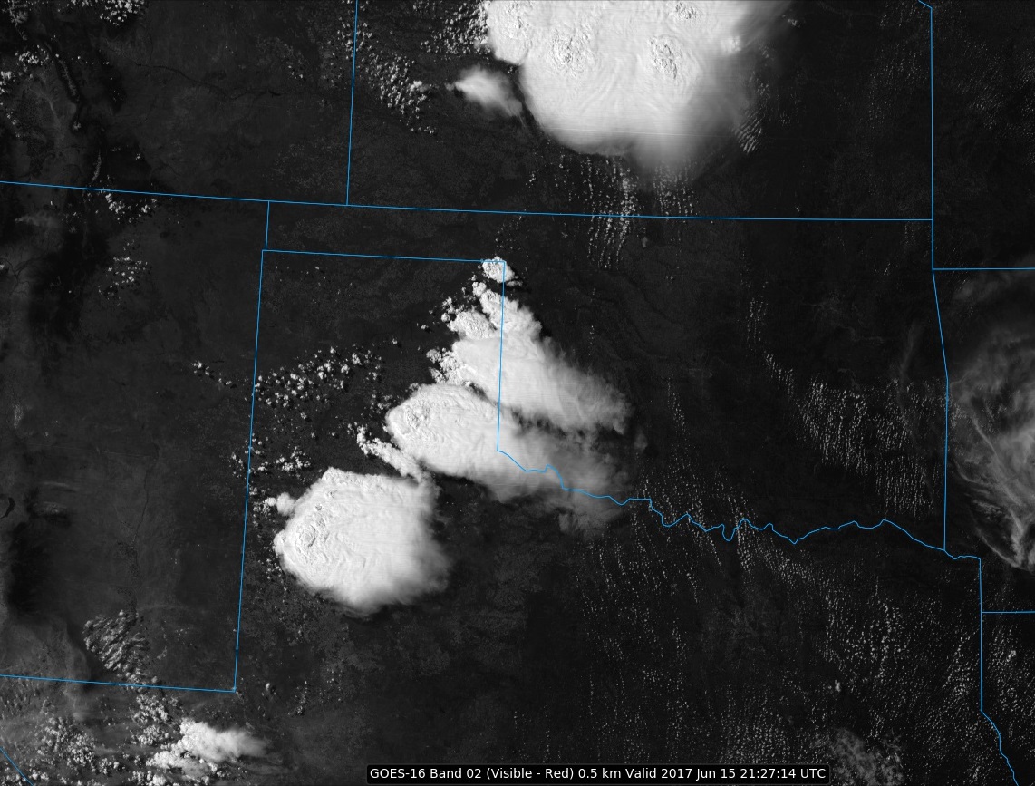
On Thursday the 15th, the dryline bent back farther west in the Texas South Plains, so several storms developed to the west of Interstate 27. The satellite image below in a snapshot of thunderstorm development late Thursday afternoon.
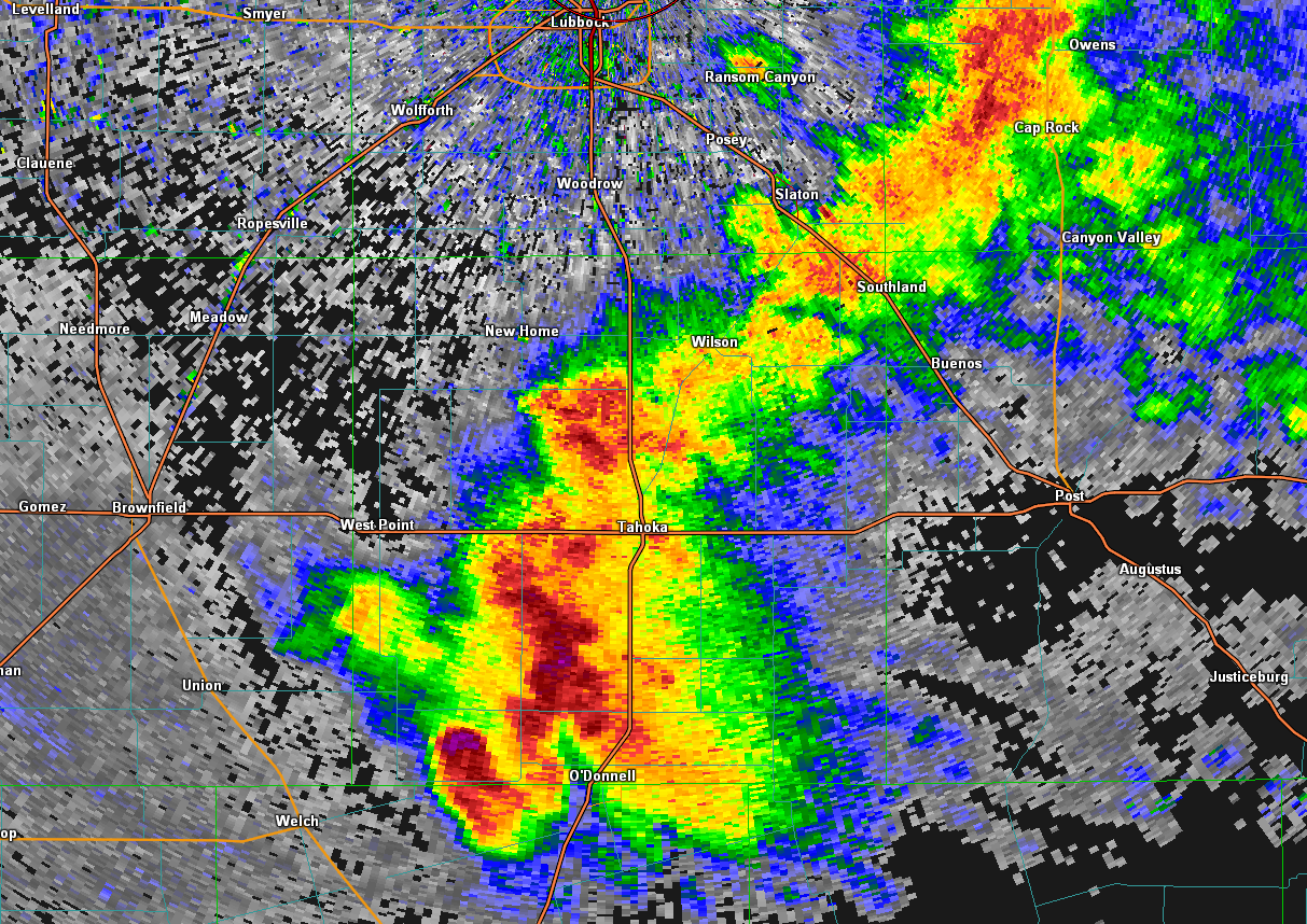
The atmosphere on Thursday was very unstable east of the dryline and a few of the storms quickly became severe. One storm to the west of Lubbock produced large hail and very heavy rainfall as it moved across Hockley County, It also produced wind gusts of 65 to 70 mph as it moved across the Levelland area. The storm then took a right turn and moved south-southeast across much of western Lynn County. The storm continued to produce large hail and severe wind gusts, with the West Texas Mesonet station near O'Donnell recording an 81 mph gust at 6:10 pm. The radar image below shows this storm as it approached O'Donnell.
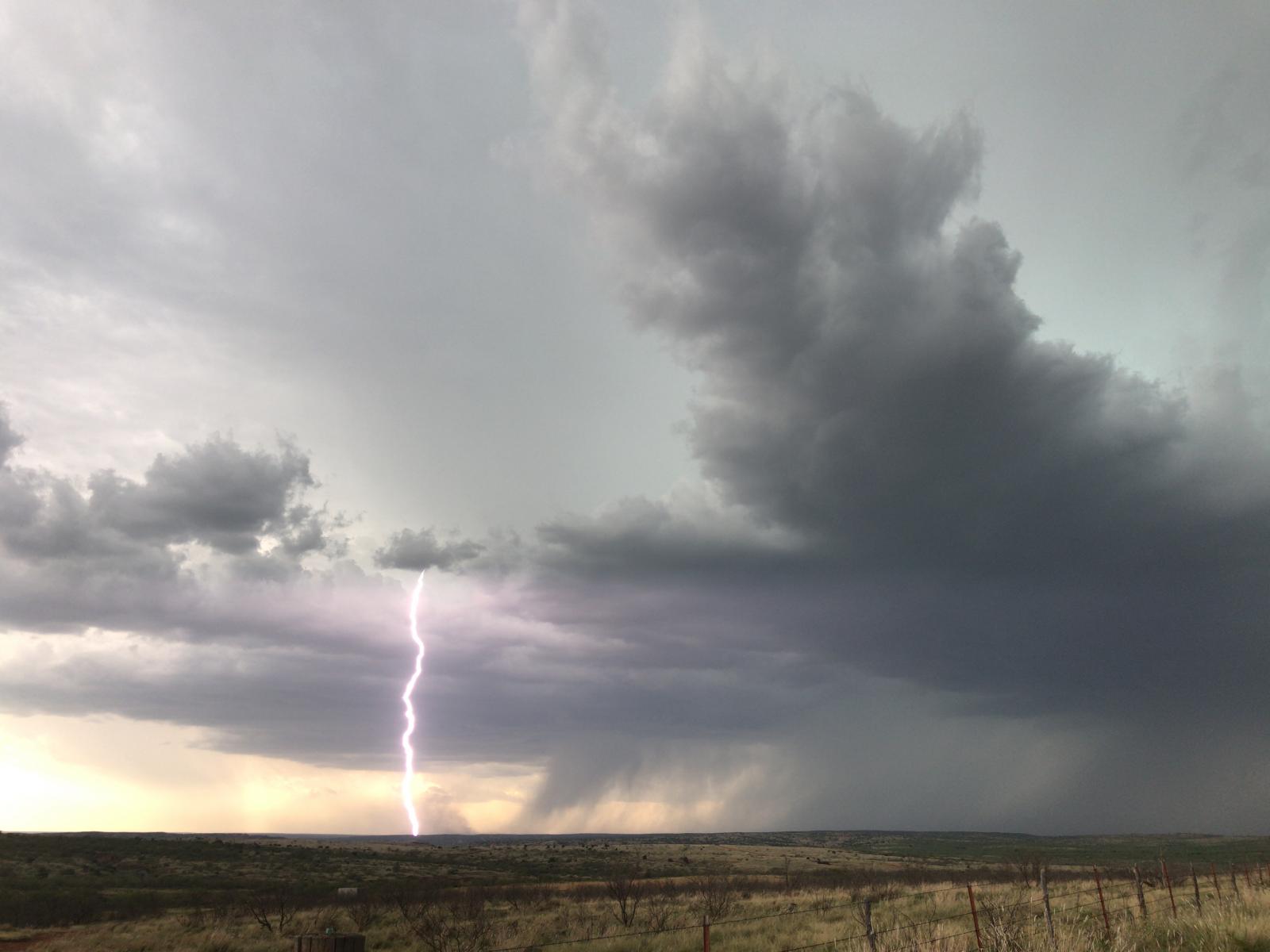
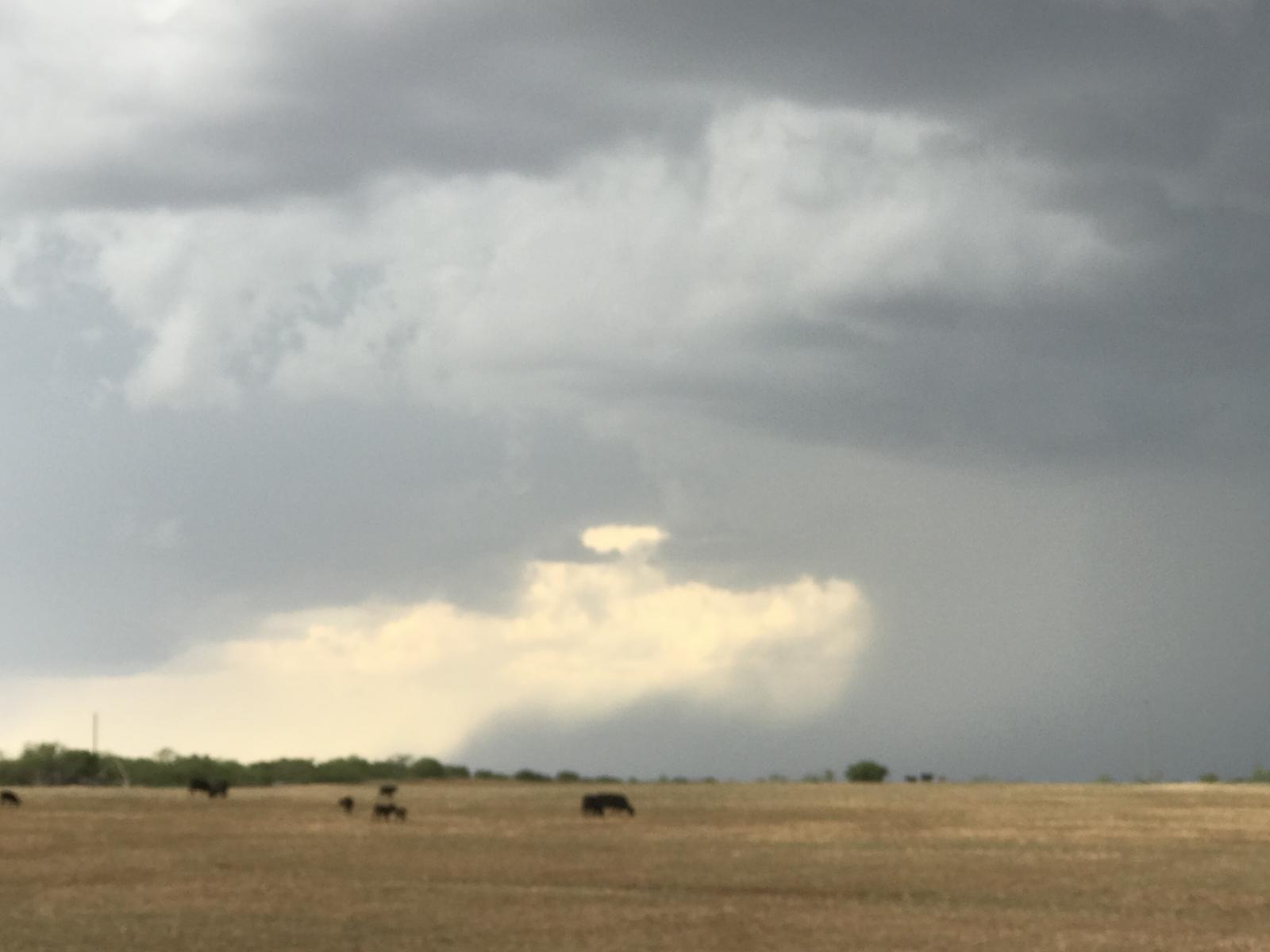
There were also severe thunderstorms around the Caprock Canyons area of the southeast Texas Panhandle. The photograph below captured a strong thunderstorm downdraft from one of the storms. These storms eventually moved across the Childress area producing wind gusts up to about 65 mph.
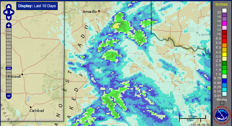
Pockets of heavy rain accompanied the thunderstorms. Unfortunately, the rainfall was pretty spotty overall. In the map below, several areas stand out across the southeast Texas Panhandle and eastern portions of Swisher and Hale Counties. Also, a narrow swath of heavy rain cam be seen from Hockey into southern Lynn County associated with the severe storm on the 15th.
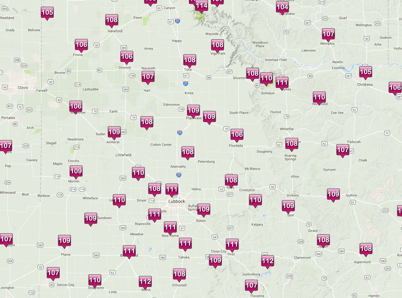
Unfortunately, the region had to endure an extended stretch of hot temperatures. The hot weather culminated on Friday, when temperatures soared well above 100 degrees at most locations. As can be seen in the map below, many locations were above 110 degrees. The hottest temperatures were on the Caprock, and along the canyons. The West Texas Mesonet station on the floor of Palo Duro Canyon reported the hottest temperature, 114 degrees!
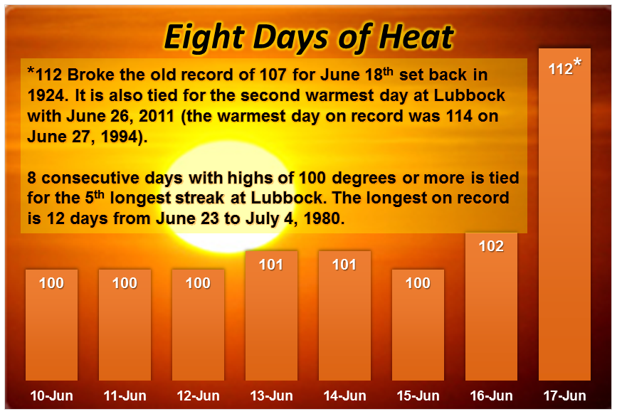
The chart below shows the high temperatures at Lubbock during this period. Only one record high was broken, on Friday the 17th.
PRELIMINARY LOCAL STORM REPORT...SUMMARY
NATIONAL WEATHER SERVICE LUBBOCK TX
1122 PM CDT MON JUN 12 2017

..TIME...   ...EVENT...      ...CITY LOCATION...     ...LAT.LON...
..DATE...   ....MAG....      ..COUNTY LOCATION..ST.. ...SOURCE....
            ..REMARKS..

0708 PM     HAIL             PLAINVIEW               34.19N 101.72W
06/12/2017  M2.00 INCH       HALE               TX   TRAINED SPOTTER

            TIME ESTIMATED FROM RADAR.

0708 PM     HAIL             1 SW PLAINVIEW          34.18N 101.74W
06/12/2017  E2.75 INCH       HALE               TX   PUBLIC

            TIME ESTIMATED. MANY VEHICLES DAMAGED.

0708 PM     HAIL             3 NW PLAINVIEW          34.22N 101.76W
06/12/2017  E3.00 INCH       HALE               TX   PUBLIC

            TIME ESTIMATED FROM RADAR.

0711 PM     HAIL             PLAINVIEW               34.19N 101.72W
06/12/2017  E1.00 INCH       HALE               TX   LAW ENFORCEMENT

0830 PM     HAIL             9 NW PETERSBURG         33.98N 101.70W
06/12/2017  E3.00 INCH       HALE               TX   STORM CHASER

0943 PM     HAIL             7 SW FLOYDADA           33.91N 101.42W
06/12/2017  E2.00 INCH       FLOYD              TX   TRAINED SPOTTER

            FALLING AT THIS TIME. MOSTLY GOLF BALL SIZE.

0950 PM     TSTM WND GST     3 WSW AIKEN             34.13N 101.57W
06/12/2017  M62 MPH          HALE               TX   MESONET

            SUSTAINED 53 MPH. EARLIER GUST TO 58 MPH AT 948 PM.
            MEASURED BY THE WEST TEXAS MESONET.

0955 PM     TSTM WND GST     2 NNE FLOYDADA          34.00N 101.33W
06/12/2017  M62 MPH          FLOYD              TX   MESONET

            MEASURED BY THE WEST TEXAS MESONET.

