
A slow-moving storm system will continue to bring thunderstorms, heavy rain and flooding potential from Southeast Florida, into the Southern to Central Appalachians and the Mid-Atlantic regions today into Wednesday. Gusty winds and dry fuels will support widespread critical fire weather in the northern Plains into the Upper Midwest and the Southwest. Read More >
Lower Mississippi RFC
River Forecast Center
Back to Mississippi River Page | Full NWPS | Missouri | Illinois | Ohio | Arkansas | Upper Mississippi | Lower Mississippi
New LaGrange, IL, to Hardin, IL
Pittsburgh, PA, to Hannibal Dam, Allegheny and Monongahela Rivers
Van Buren, AR, to Pendleton, AR
Grand Rapids, MN, to Fort Ripley, MN
St. Cloud, MN, to Red Wing, MN
Lake City, MN, to Guttenburg (L&D 10), IA
Dubuque (L&D 11), IA, to Gregory Landing, MO
Smithland, IL, to New Orleans, LA


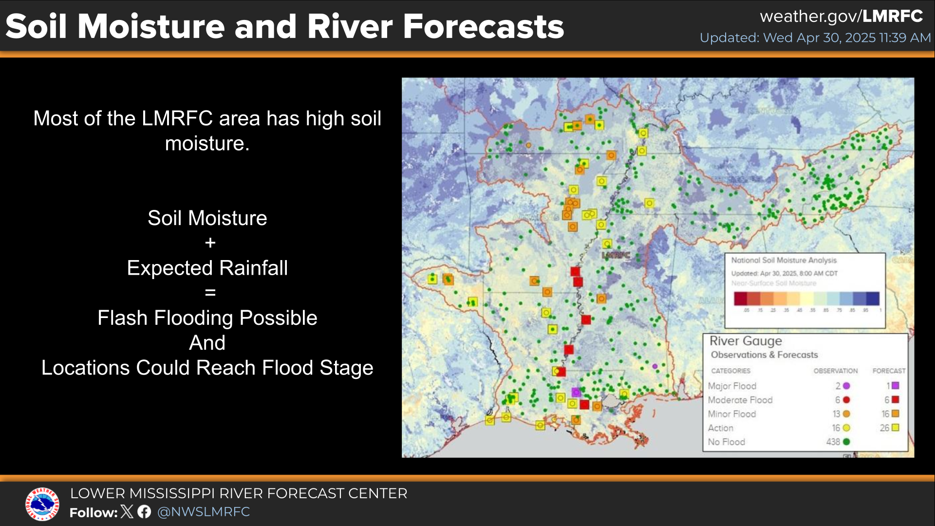 Weather Story