Louisville, KY
Weather Forecast Office
August was a quiet and somewhat cool month. It was the first cooler than normal month since May 2016 at Louisville and Frankfort. The coolest day was the 5th when daily average temperatures were around 10 degrees below normal and the mercury dipped well into the 50s.
There was almost no severe weather during the month. A few trees were blown down on the 1st, 2nd, 6th, and 22nd. Otisco, Indiana reported quarter sized hail on the 1st. A line of storms trained over Louisville on the 17th and dropped record rains on Louisville International Airport.
Fortunately, conditions were great for the solar eclipse on the 21st. Although it was a very warm, muggy day, there were only scattered clouds in the sky.
Tropical Depression Harvey approached from the southwest on the last day of the month and brought record rainfall to Bowling Green.
| Average Temperature | Departure from Normal | Rain | Departure from Normal | |
| Bowling Green | 75.9° | -1.6° | 5.36" | +2.03" |
| Frankfort | 73.5° | -1.7° | 2.63" | -0.73" |
| Lexington | 73.0° | -2.3° | 5.07" | +1.82" |
| Louisville Bowman | 75.1° | -2.4° | 3.42" | +0.11" |
| Louisville International | 76.9° | -1.5° | 4.20" | +0.87" |
Records
17th: Record rainfall of 2.56" at Louisville
31st: Record rainfall of 1.83" at Bowling Green
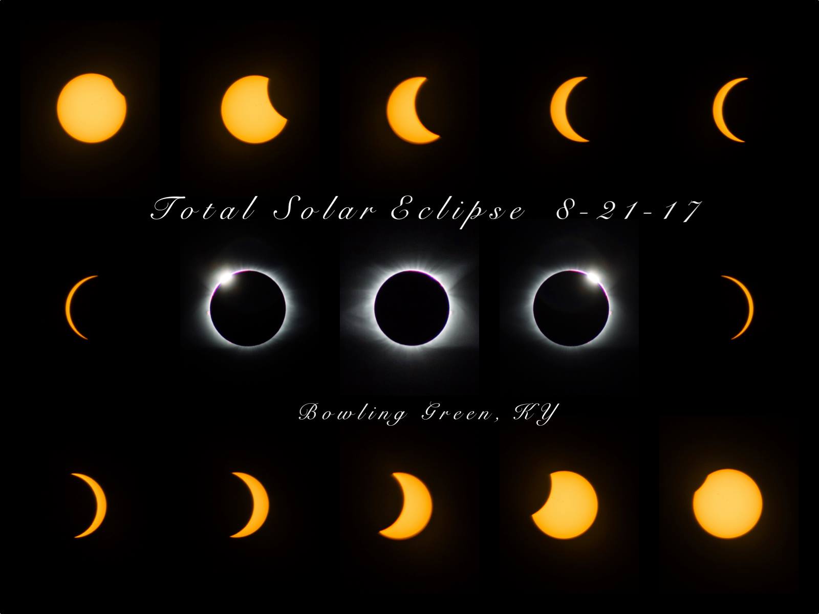
NWS Louisville forecaster Dan McKemy compiled these images he took of the eclipse from the south side of Bowling Green in totality for 1 min. 32 sec.
Current Hazards
Hazardous Weather Outlook
Storm Prediction Center
Submit a Storm Report
Advisory/Warning Criteria
Radar
Fort Knox
Evansville
Fort Campbell
Nashville
Jackson
Wilmington
Latest Forecasts
El Nino and La Nina
Climate Prediction
Central U.S. Weather Stories
1-Stop Winter Forecast
Aviation
Spot Request
Air Quality
Fire Weather
Recreation Forecasts
1-Stop Drought
Event Ready
1-Stop Severe Forecast
Past Weather
Climate Graphs
1-Stop Climate
CoCoRaHS
Local Climate Pages
Tornado History
Past Derby/Oaks/Thunder Weather
Football Weather
Local Information
About the NWS
Forecast Discussion
Items of Interest
Spotter Training
Regional Weather Map
Decision Support Page
Text Products
Science and Technology
Outreach
LMK Warning Area
About Our Office
Station History
Hazardous Weather Outlook
Local Climate Page
Tornado Machine Plans
Weather Enterprise Resources
US Dept of Commerce
National Oceanic and Atmospheric Administration
National Weather Service
Louisville, KY
6201 Theiler Lane
Louisville, KY 40229-1476
502-969-8842
Comments? Questions? Please Contact Us.


 Weather Story
 Weather Map
 Local Radar