Overview
|
Active weather affected the Ohio Valley on July 3-4, 2024, with flash flooding over southern Indiana on the evening of the 3rd, and two brief tornadoes on the afternoon of the 4th. |
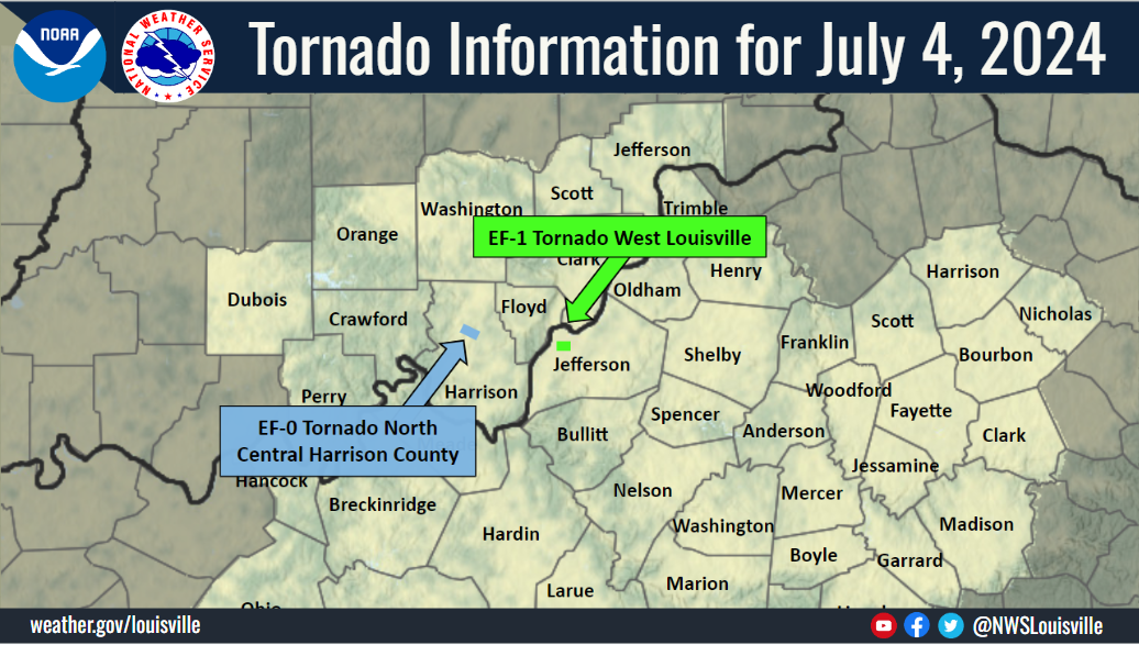 Damage Survey from July 4, 2024 |
Tornadoes:
|
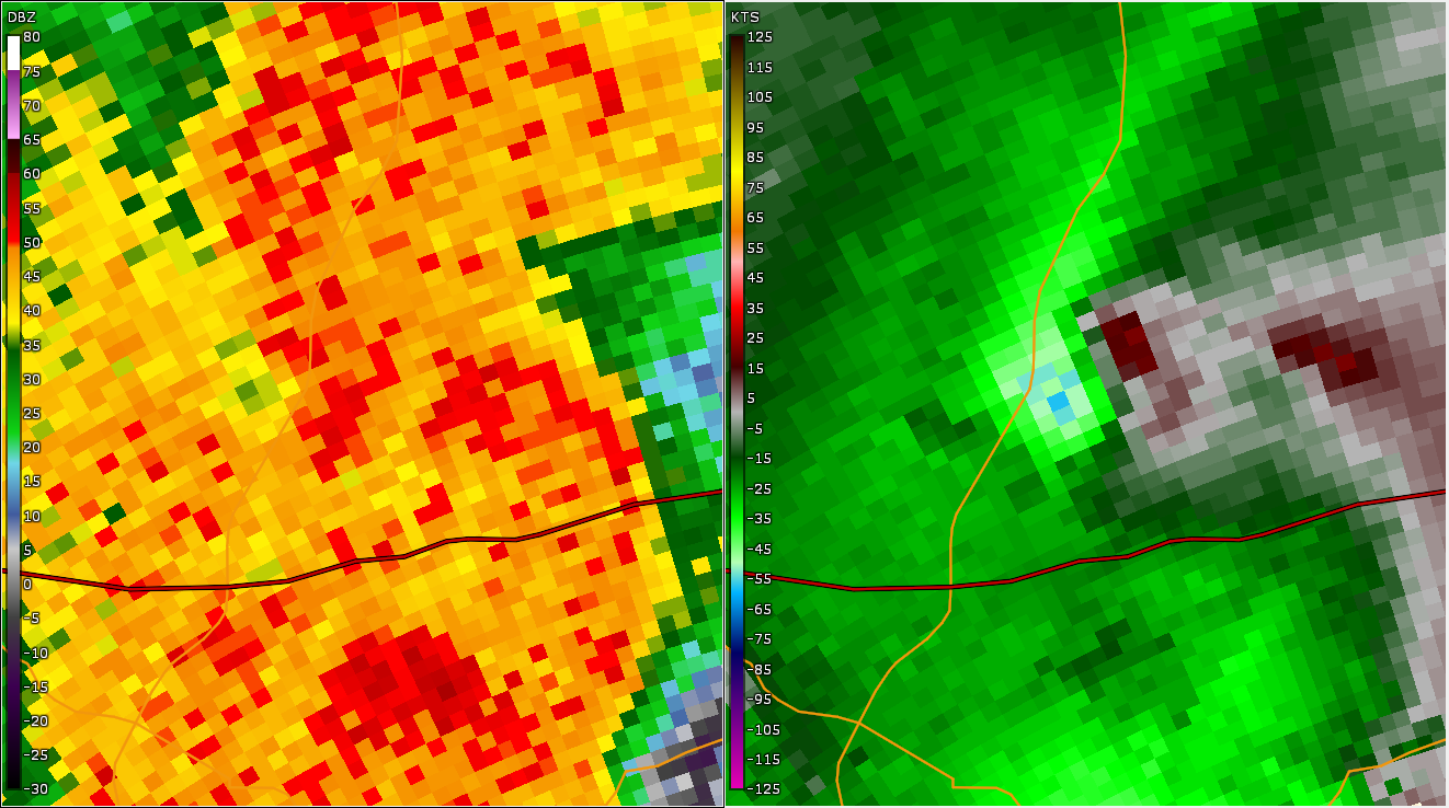
Tornado - near Crandall, IN
|
||||||||||||||||
|
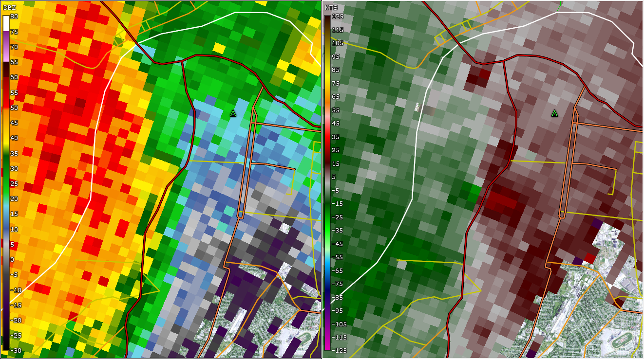
Tornado - Louisville, KY
|
||||||||||||||||
The Enhanced Fujita (EF) Scale classifies tornadoes into the following categories:
| EF0 Weak 65-85 mph |
EF1 Moderate 86-110 mph |
EF2 Significant 111-135 mph |
EF3 Severe 136-165 mph |
EF4 Extreme 166-200 mph |
EF5 Catastrophic 200+ mph |
 |
|||||
Radar
 |
 |
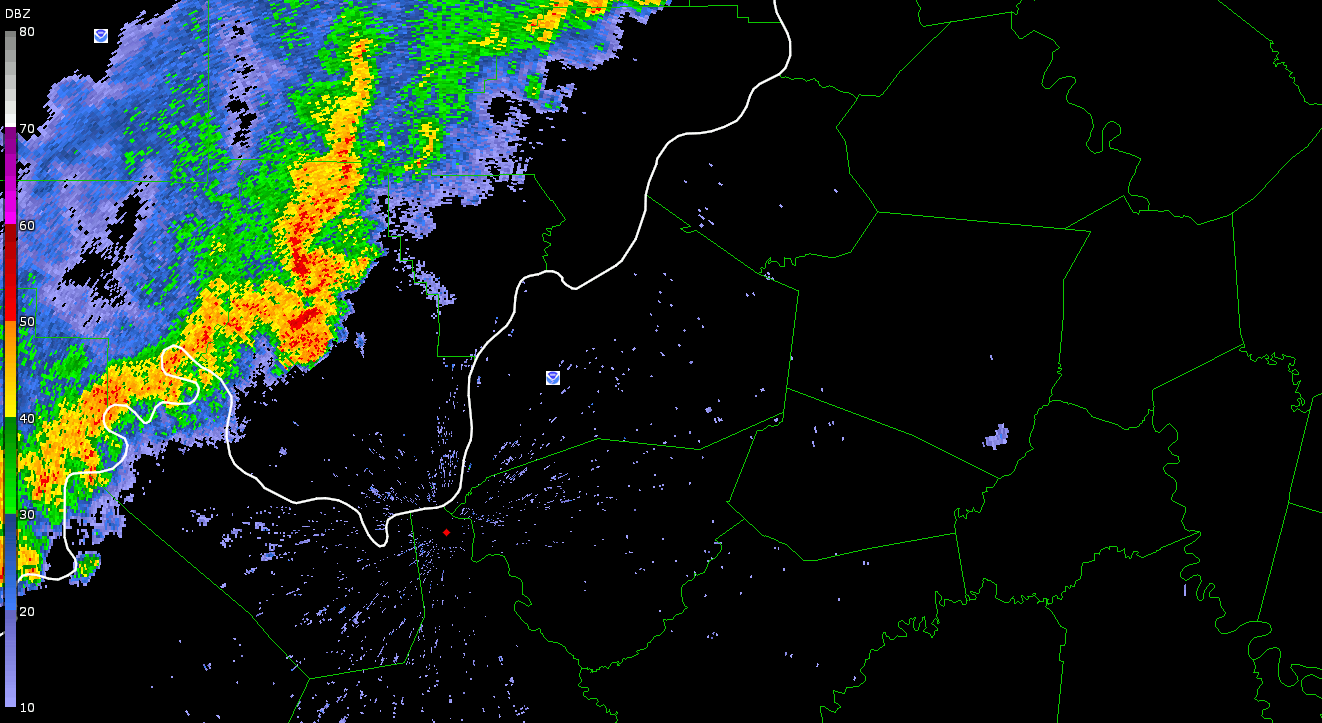 |
| Harrison County Radar Image | Louisville Radar Image | Radar Loop from July 4 |
Storm Reports
Preliminary Local Storm Report...Summary
National Weather Service Louisville KY
556 PM EDT Fri Jul 5 2024

..TIME...   ...EVENT...      ...CITY LOCATION...     ...LAT.LON...
..DATE...   ....MAG....      ..COUNTY LOCATION..ST.. ...SOURCE....
            ..REMARKS..

0915 PM     Flash Flood      1 E Shively             38.20N 85.80W
07/03/2024                   Jefferson          KY   911 Call Center

            Request for barricades to block off 7th and
            Berry and 7th and Noble.

0126 PM     Tstm Wnd Dmg     3 WSW Louisville        38.23N 85.80W
07/04/2024                   Jefferson          KY   Emergency Mngr

            Trees down and power poles snapped.

0127 PM     Tornado          3 WSW Louisville        38.23N 85.80W
07/04/2024                   Jefferson          KY   NWS Storm Survey

            NWS Storm Survey found a brief EF-1 tornado
            touched down and lasted about a half mile on
            the ground as it traveled east and east
            southeast. The tornado was wide at onset,
            170 yards and narrowed along its path.

0103 PM     Tstm Wnd Dmg     1 E Corydon             38.21N 86.11W
07/04/2024                   Harrison           IN   Emergency Mngr

            Trees down on a house.

0105 PM     Tornado          3 WSW Crandall          38.27N 86.11W
07/04/2024                   Harrison           IN   NWS Storm Survey

            A brief EF-0 tornado touched down along
            Highway 135 between Sky Aire Road and
            Highway 335. The tornado damaged trees and
            minor structures there, before continuing
            ESE toward Tee Road. There more minor
            structural and tree damage occurred. One
            vehicle was smashed by a falling tree. Peak
            winds were estimated at 85 mph and the max
            path width was 125 yards.

0555 PM     Flash Flood      1 NNE Jasper            38.40N 86.93W
07/03/2024                   Dubois             IN   Emergency Mngr

            Report of another vehicle submerged in water
            at 16th and Mill St.

0616 PM     Flash Flood      3 N Jasper              38.43N 86.94W
07/03/2024                   Dubois             IN   911 Call Center

            Responders called to Knoll Ridge apartment
            in Jasper for people stuck in a home due to
            flooding.

0630 PM     Rain             Jasper                  38.39N 86.93W
07/03/2024  M4.50 Inch       Dubois             IN   Public

            A cluster of rain gages around Jasper
            measured between 4 and 5 inches of rainfall
            in a little over an hours time.

0900 PM     Flash Flood      Huntingburg             38.30N 86.96W
07/03/2024                   Dubois             IN   911 Call Center

            Reports of multiple roads flooded in
            Huntingburg.
Rain Reports
-RainfallAnalysisPublic.png)
Environment
 |
 |
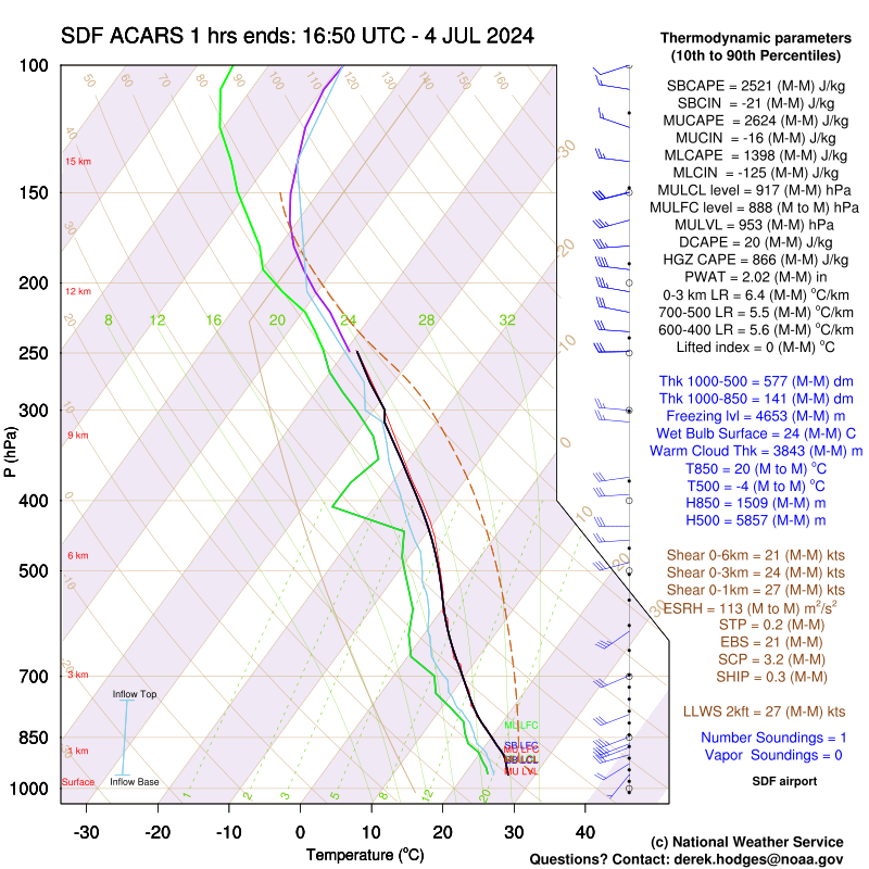 |
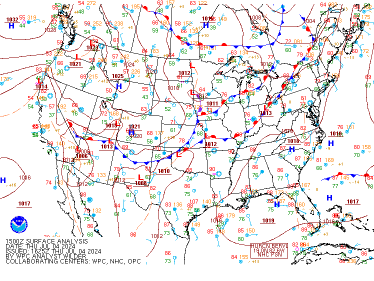
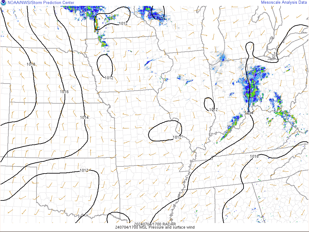
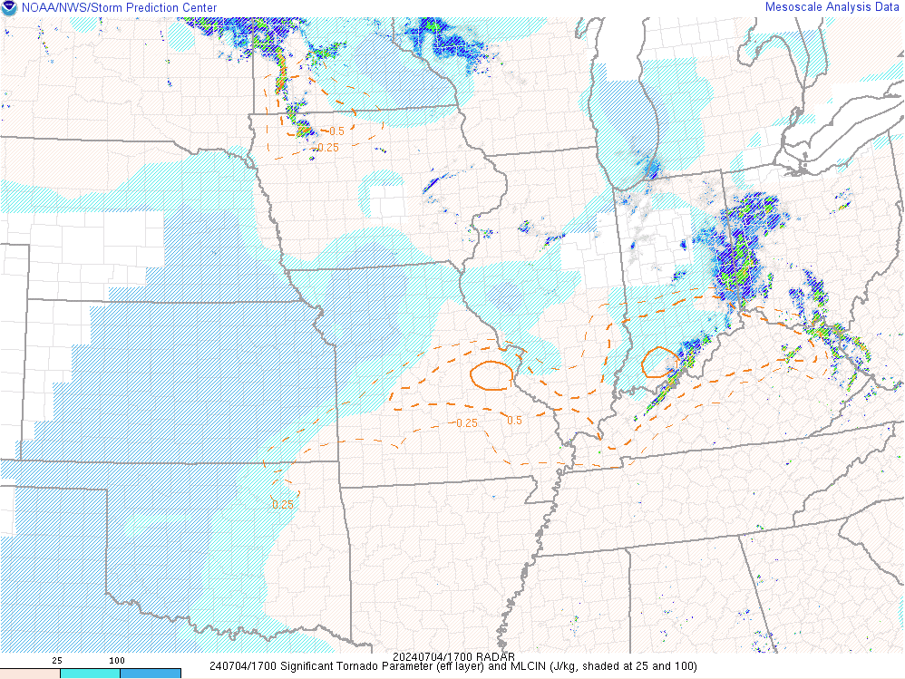
| Figure 1: 15Z Surface Analysis | Figure 2: 17Z Mean Sea Level Pressure | Figure 3: 17Z Sounding |
 |
 |
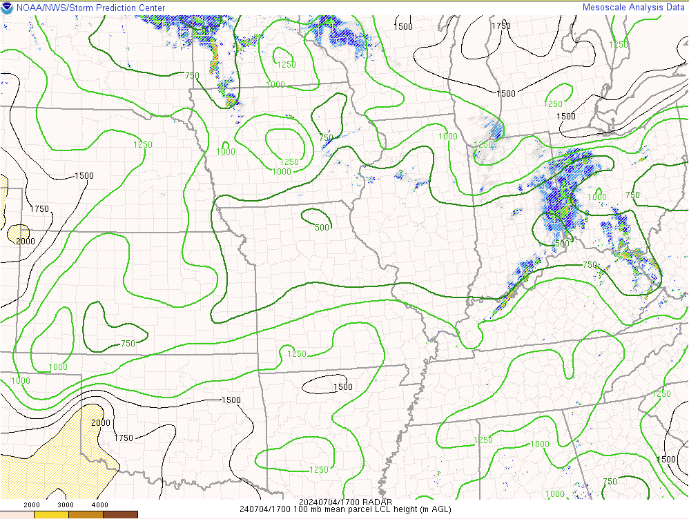 |
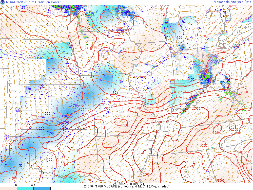
| Figure 4: 17Z Effective STP | Figure 5: 17Z MLCAPE | Figure 6: 17Z LCL |
 |
 |
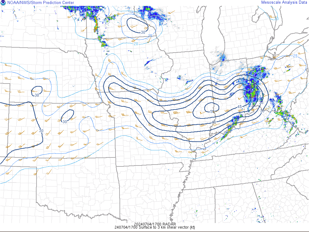 |
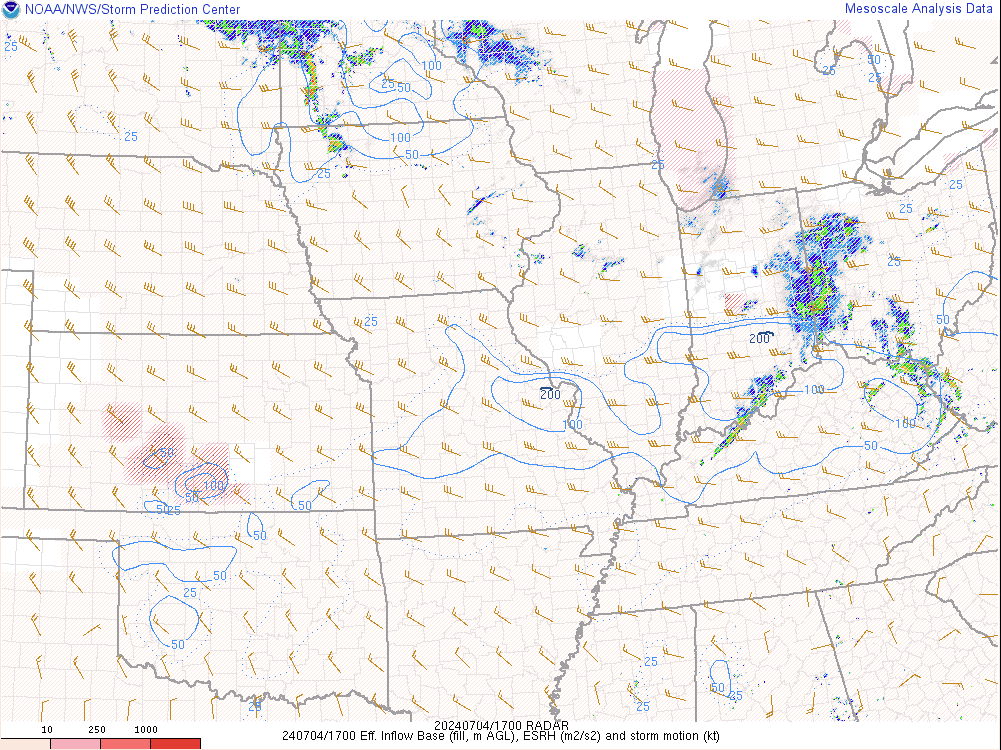
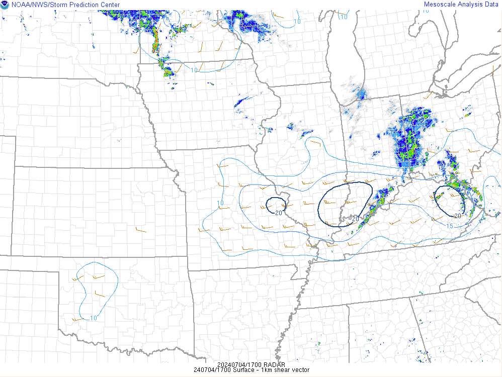
| Figure 7: 17Z ESRH | Figure 8: 17Z 0-1km Shear | Figure 9: 17Z 0-3km Shear |
 |
Media use of NWS Web News Stories is encouraged! Please acknowledge the NWS as the source of any news information accessed from this site. |
|


 Weather Story
 Weather Map
 Local Radar