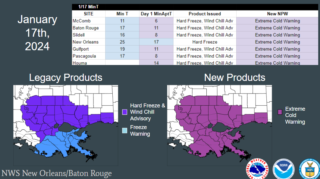
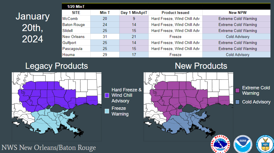
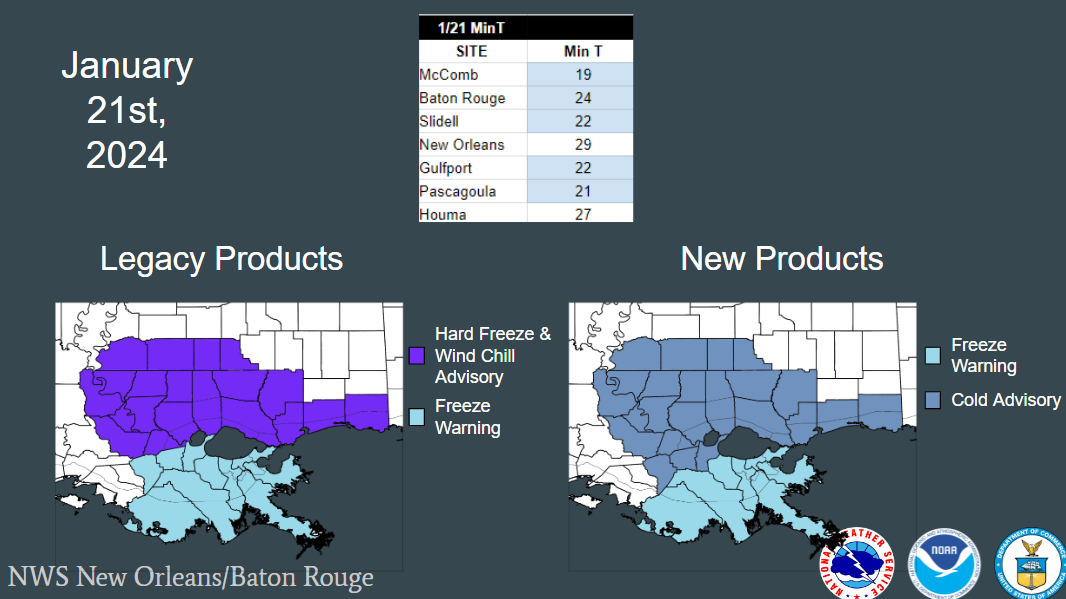
1 - Removing the Hard Freeze Warning Product.
2 - Changing Wind Chill Advisory, Watch and Warning to Extreme Cold
3 - Changing the thresholds/criteria that we use to issue these products.
See below for a National fact sheet on this simplification.
Hazard Simplification Fact Sheet

NOTE- These are NOT the colors of the products on the Watch/Warning/Advisory map. They are simply picked to show the various tiers of thresholds easily.
A Cold Weather Advisory would be issued when Temperatures OR Wind Chills are expected to fall below 25 degrees F.
An Extreme Cold Warning would be issue when Temperatures OR Wind Chills are expected to fall below 15 degrees F.
A Freeze Warning will be issued every time the temperature is 32 or below. We will not overlap a Freeze Warning and Cold Advisory.
A Cold Weather Advisory would be issued when Temperatures OR Wind Chills are expected to fall below 20 degrees F.
An Extreme Cold Warning would be issue when Temperatures OR Wind Chills are expected to fall below 10 degrees F.
A Freeze Warning will only be issued for the first two freezes of the season, or after an unseasonably warm spell.
Here are examples of what a cold event may look like with the new products compared to our legacy products.
For any questions, comments, concerns or feedback, please contact our office:
sr-lix.webmaster@noaa.gov

