
Event Summary
Gusty southerly winds blew for several days ahead of the cold front that pushed across the Arklamiss region during the afternoon and evening of April 18, 2013. The persistent feed of moist air from the Gulf produced a warm and humid air mass that resulted in afternoon temperatures well above normal, topping out in the 80s across the forecast area Thursday afternoon. Warmer air aloft produced an atmospheric cap that prohibited thunderstorm development well ahead of the front. As a result, a squall line of severe convection developed in the vicinity of the cold front and moved across the Delta region. Much of the damage associated with the squall line was produced by two intense severe storms. The first storm moved across Ashley and Chicot Counties in southeast Arkansas during mid afternoon before tracking across Washington County in northwest Mississippi. The first storm produced an EF-1 tornado near Crossett, AR. The second storm moved across northeast Louisiana into the Mississippi Delta region, producing an EF-1 tornado near Sondheimer, Louisiana and another tornado in Nitta Yuma, Mississippi. In addition to tornadoes, severe storms along the squall line downed trees and power lines and produced golf ball sized hail.
The squall line began to weaken as it continued across the Mississippi Delta, pulling away from the associated low pressure system and moving into a region where the air mass was more stable. Storms that remained in the remnants of the line progressed to the east, briefly strengthening as they crossed northeast Mississippi. Sporadic down burst winds continued, bringing down trees and power lines near Yazoo City and at Sturgis in Oktibbeha County.
Tornado Track Map

Click on map above to see entire event tracks and damage point notation. Individual track maps also available on individual tornado pages.
Survey Information - Click on the location in the table for additional maps and details
| Location | Start/ End Time |
Event Type/ Max Winds |
Fatalities/ Injuries |
Path Length | Path Width |
| Ashley County 6 S Crossett to 4 SE Crossett |
3:08 pm - 3:14 pm |
EF-1 Tornado 90 mph |
none | 4.0 miles | 150 yards |
| Chicot County 4 SE Eudora |
4:38 pm - 4:39 pm |
EF-0 Tornado 75 mph |
none | 0.4 miles | 50 yards |
| Issaquena County 3 NNW Mayersville to 4 NNE Mayersville |
5:03 pm - 5:05 pm |
EF-1 Tornado 90 mph |
none | 2 miles | 50 yards |
| Washington County 3 SW Tribbett |
5:09 pm - 5:10 pm |
EF-0 Tornado 75mph |
none | 0.4 miles | 50 yards |
| East Carroll Parish 2 NW Sondheimer to 2 NNE Sondheimer |
5:19 pm - 5:23 pm |
EF-1 Tornado 95 mph |
none | 2.5 miles | 75 yards |
| Sharkey County 1 WNW Nitta Yuma to 1 NE Nitta Yuma |
5:21 pm - 5:23 pm |
EF-0 Tornado 75 mph |
none | 1.5 miles | 50 yards |
| Madison Parish 5 N Tallulah |
5:23 pm - 5:24 pm |
EF-0 Tornado 75 mph |
none | 0.4 miles | 50 yards |
| Sharkey County 3 ESE Delta City |
5:29 pm - 5:30 pm |
EF-0 Tornado 75 mph |
none | 0.2 miles | 25 yards |
Local Storm Reports
Click on the map below for additional details.


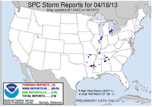
National Storm Reports
Rainfall Totals


 Follow us on YouTube