|
Aerial Damage Photos | Ground Damage Photos |
|
|
|
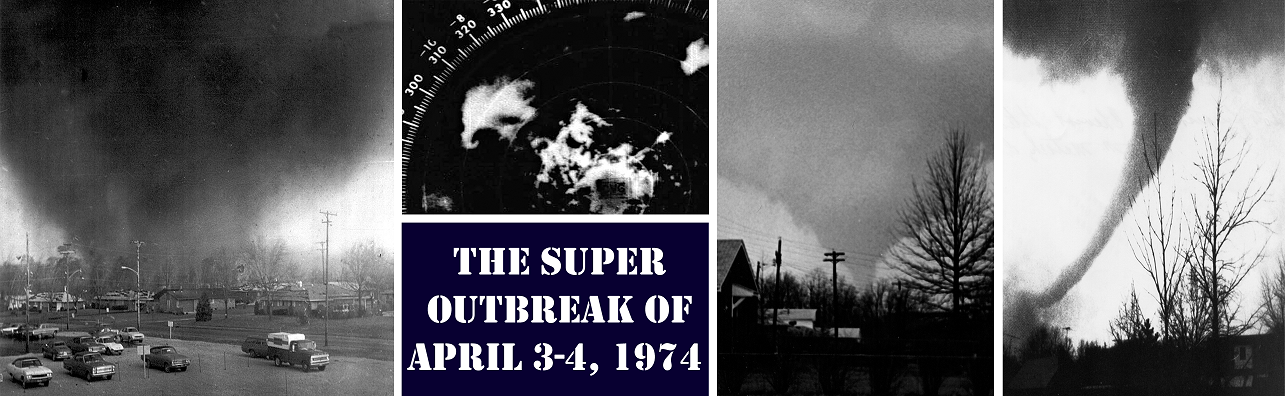
Note: the following text is from the NWS Storm Data publication for April 1974 (Volume 16 / Number 4). Greene County segment (link): This devastating tornado first touched down 5 miles southwest of Xenia between Bellbrook and Xenia, then quickly moved north-eastward through Xenia destroying or damaging about one-half of the entire city (population of 25,000). Public reports two or possibly three separate funnels. The tornado remained on the ground for 16 miles lifting just north of Cedarville. The Arrow Head sub-development was leveled. A total of about 300 homes were destroyed and 2100 others damaged. Most of the downtown business section was destroyed or heavily damaged, and two nearby colleges received almost total destruction to many of their campus buildings. The Xenia High School was destroyed. An entire furniture manufacturing company, most of a foundry and machine company were laid to ruin. The telephone company estimated total damage to its equipment of about $2 million dollars and the Dayton Power and Light Company reported approximately $1.4 million dollars in damage. The path of destruction varied from one-quarter to one-half mile wide. Reports of heavy rain and golf ball sized hail accompanied the tornado. Clark County segment (link): A tornado touched down near Cortsville and continued on the ground to the vicinity of South Charleston. Several farm buildings, homes, and mobile houses were damage or destroyed, and a few trees uprooted. Note from NWS Wilmington OH: while the above descriptions in the 1974 Storm Data publication indicate that the tornado lifted and touched down again near Cedarville / Cortsville, it is believed that this should be considered a continuation of the same tornado. |
|
This track map was created from an analysis of aerial photos of damage from the Xenia F5 tornado. The map should be considered approximate. Please note that this track map only includes the segment of the tornado's track near Xenia and Wilberforce. This map does not accurately depict the actual start and end points of the tornado. Here is a direct link to the KMZ version of the track. |

