Rip currents are the deadliest and most common hazard people face at the beaches of North and South Carolina, as well as along most of the coastlines of the world. The United States Lifesaving Association (USLA) estimates rip currents are responsible for about 100 drownings each year in the United States and over 80% of lifeguard rescues. Between 2000 and 2023, there were 184 rip current drownings (~8 per year) reported in North and South Carolina. This number far exceeds any other weather-related fatalities during that time frame, making rip currents the #1 weather related killer in the coastal Carolinas. With millions of people visiting the beaches of North and South Carolina each year, it is very important rip current awareness and education continues to be promoted to help keep the public safe.
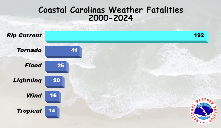
Fatalities by weather type across all NC & SC counties served by coastal Carolinas NWS forecast offices (CHS, ILM, MHX, AKQ)
Note: These totals include fatalities from counties that are not along the immediate coastline
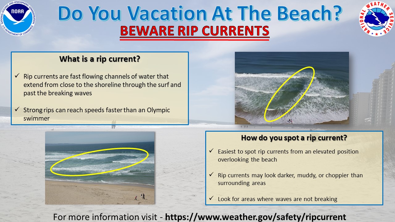
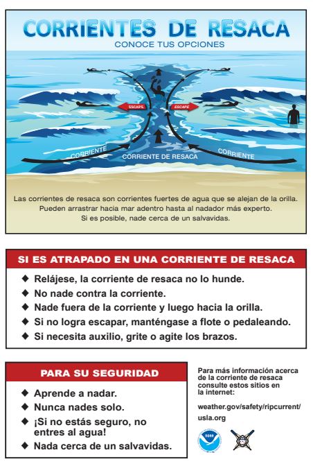
Rip currents are strong, channelized currents of water that flow back into the ocean from the shoreline. They typically form at breaks in the sandbars, and near structures such as jetties and piers. Rip currents are commonly found at any beach where there are breaking waves, including Great Lakes beaches.
Rip currents are dangerous and life-threatening for several reasons:
Rip currents form as incoming waves push water up the slope of the beach. To remain in balance, excess water building in the surf zone seeks the path of least resistance as a rip current through the surf zone.
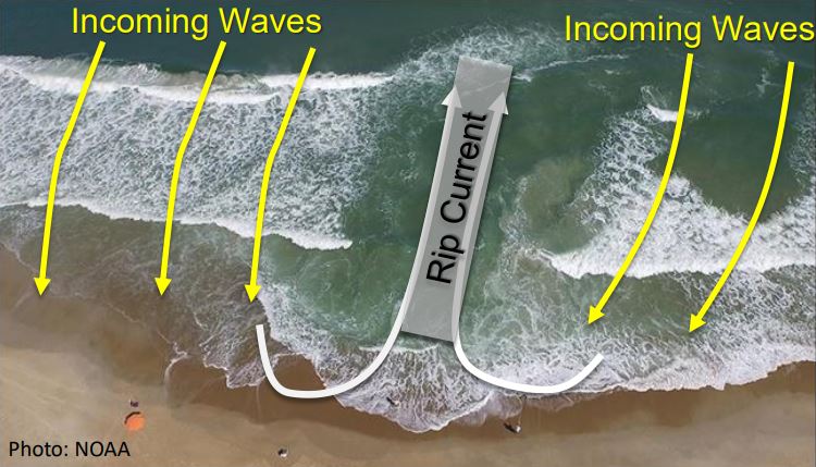
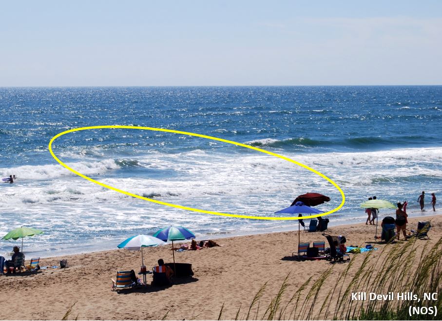
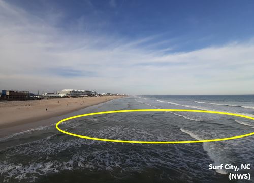
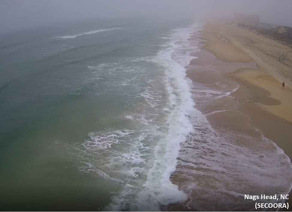
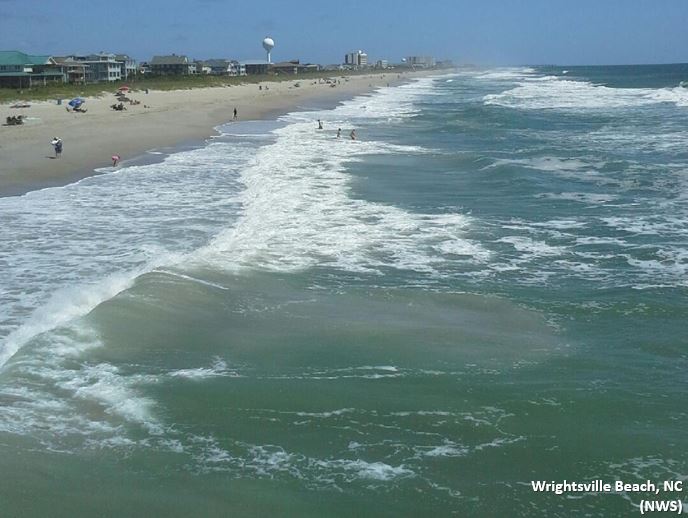
Spotting a rip current can be tricky, especially at eye level standing on the beach. It is easier to spot rip currents from an elevated position overlooking the beach (e.g., parking lot, beach access, or headland). Watch the water for several minutes as ocean conditions, including rip current characteristics, can change. You can also ask a lifeguard if there any rip currents in the area.
Look for these clues when trying to spot a rip current:
Check out the video above, taken by an NWS employee, on spotting a rip current while in the water (courtesy of NWS Morehead City)
There are several different types of rip currents, characterized by how and where they develop along with how long they persist. Below are the rip current types typically found in our area:
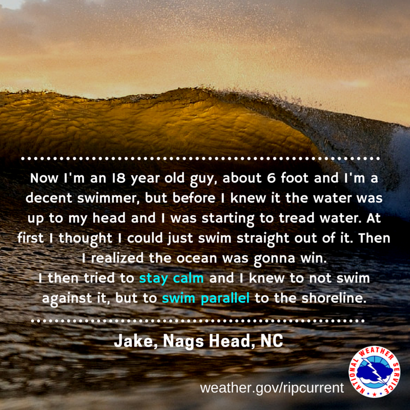
It is not always obvious if you are caught in a rip current. One sign you may be in a rip - as you try to swim towards shore you are not making any progress and are becoming tired. With stronger rips, you may feel that you are being pulled away from the beach. Know Your Options if you are caught in a rip current.
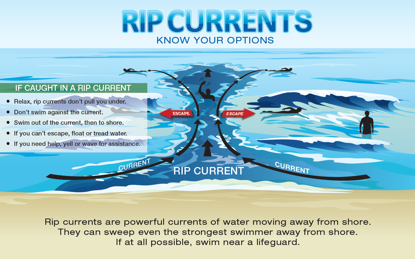
If you are caught in a rip current:
Below is a drone video taken by Wrightsville Beach Ocean Rescue of three people caught in a rip current and subsequently rescued by a lifeguard. Discoloration of the water can be seen showing the location of the rip current. Three people are being moved away from shore by the current, attempt to swim against the current without luck, and begin to tread water to stay afloat. A lifeguard enters the water towards the end of the video and has the swimmers grab a flotation device before moving them sideways out of the current in order to swim back to shore.
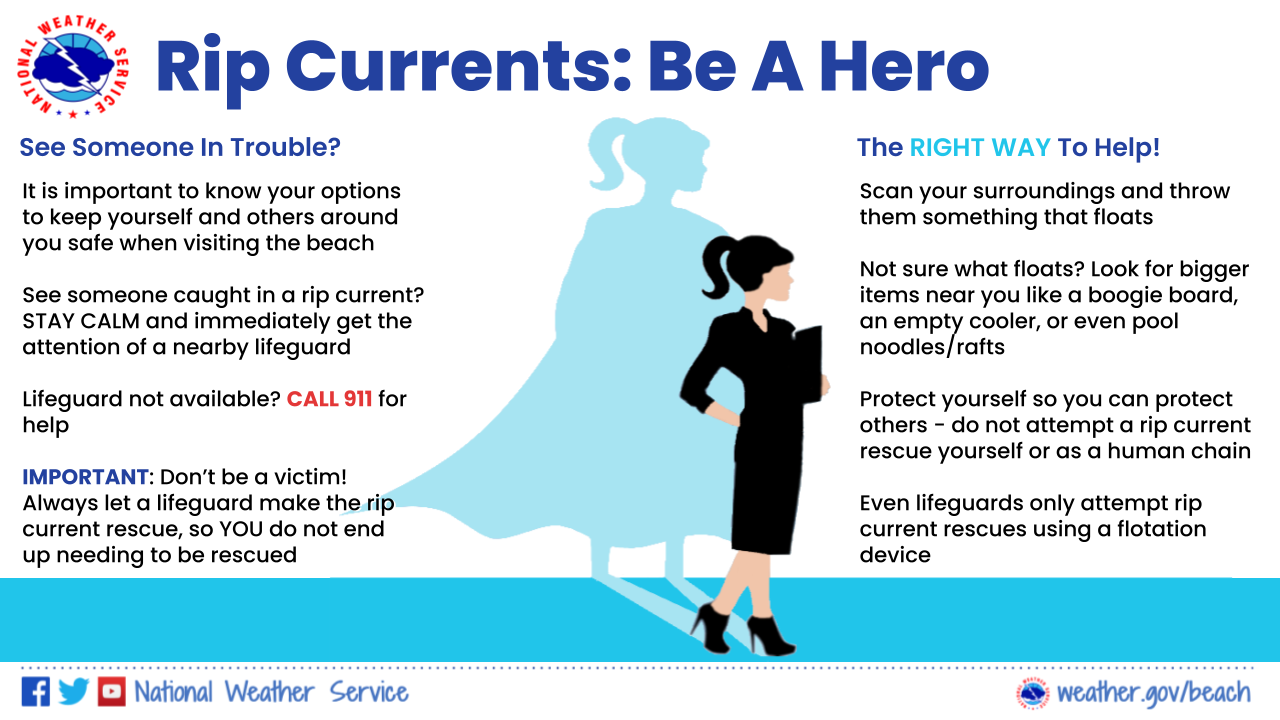
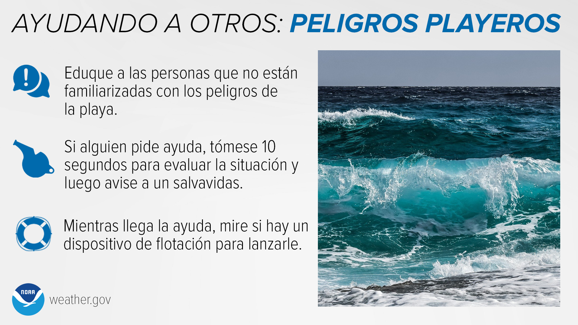
Too often, those that get into trouble in rip currents are bystanders who drown attempting to help someone caught in a rip. Roughly 28% of rip current drownings in the Carolinas (since 2011) were bystanders. Check out this video from NOAA's Ocean Today Wave Safe series: Protect Yourself to Save Others. Know Your Options if you see someone in trouble in the water:
The National Weather Service has recorded information on rip current drownings in North and South Carolina since 2000. Insights and statistics from this information are used to improve rip current outreach and develop more targeted messaging. (Note: These numbers are solely drownings confirmed to be rip current related. The actual numbers are likely higher.)
North and South Carolina rip current fatality statistics (2000-2023):
A coastal hazard with far inland implications...
The last two statistics show the need to educate not just the beach communities about rip currents, but the public in general regardless of where they live (even if they live in a landlocked state). If someone vacations at the beach, they need to be aware of the danger of rip currents. Check out the map below to see the spread of hometowns across the East Coast, as well as to the west and international.

Top 10 Hometown States of Carolinas Rip Current Fatalities: 2000-2023
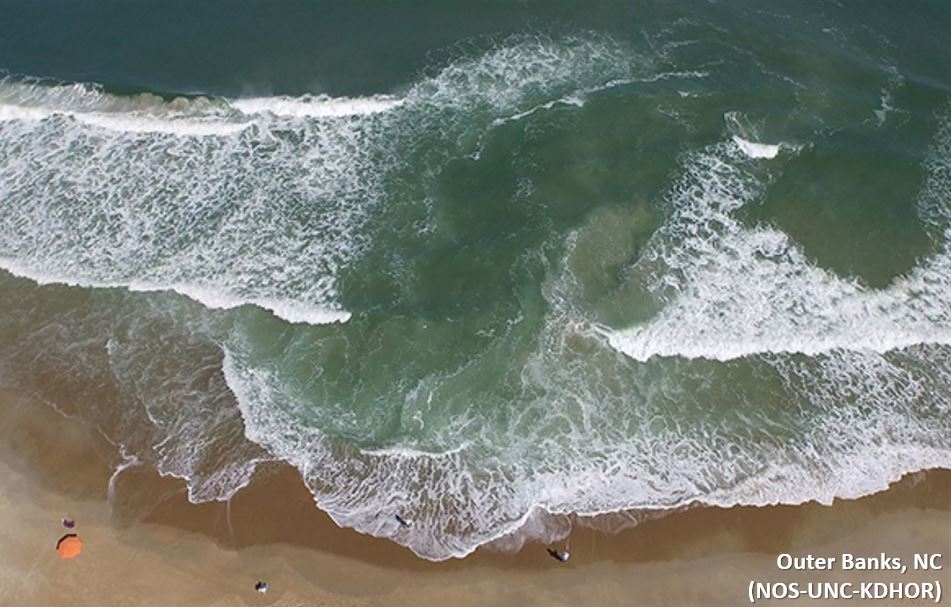
Scientists from the UNC Coastal Studies Institute and Kill Devil Hills Ocean Rescue used fluorescent dye to track a rip current in the surf zone. Video taken in the Outer Banks of North Carolina.
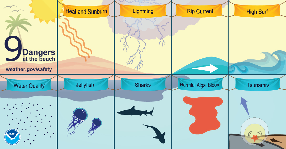
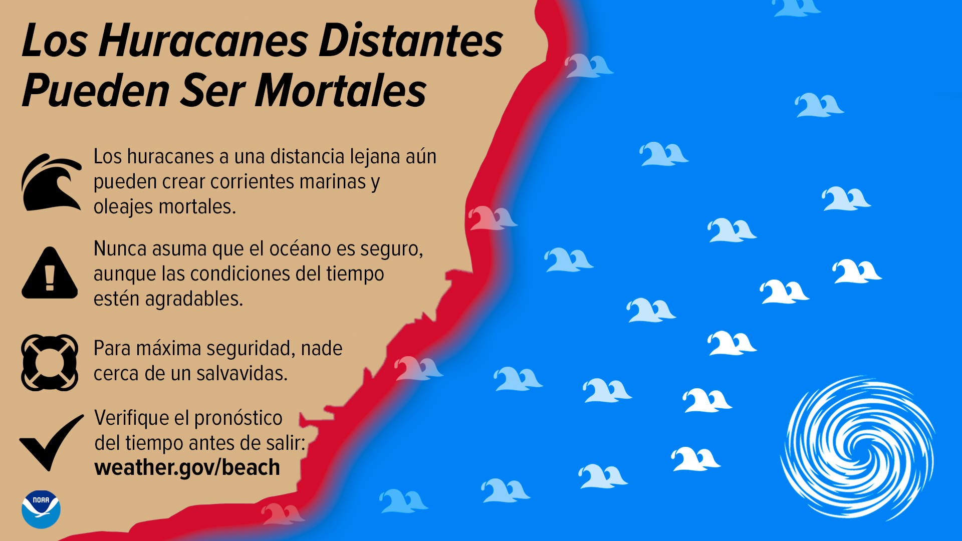
Tropical cyclones produce a wide range of hazards: storm surge, heavy rain & inland flooding, high winds, rough surf, and tornadoes. Nearly 90% of all tropical cyclone related deaths are water related (surge, rain, surf, and marine). Unfortunately the rough surf hazard can easily be overlooked or underestimated, especially with distant cyclones that may be hundreds or thousands of miles away. Long period swells from distant storms can lead to strong rip currents forming along exposed beaches. Large waves from nearby storms can create rough surf and rip currents. Nice weather may be occurring locally, increasing the chance of high beach populations at risk. Therefore it is important to stay aware of the tropics, along with weather and beach forecasts, throughout the hurricane season.
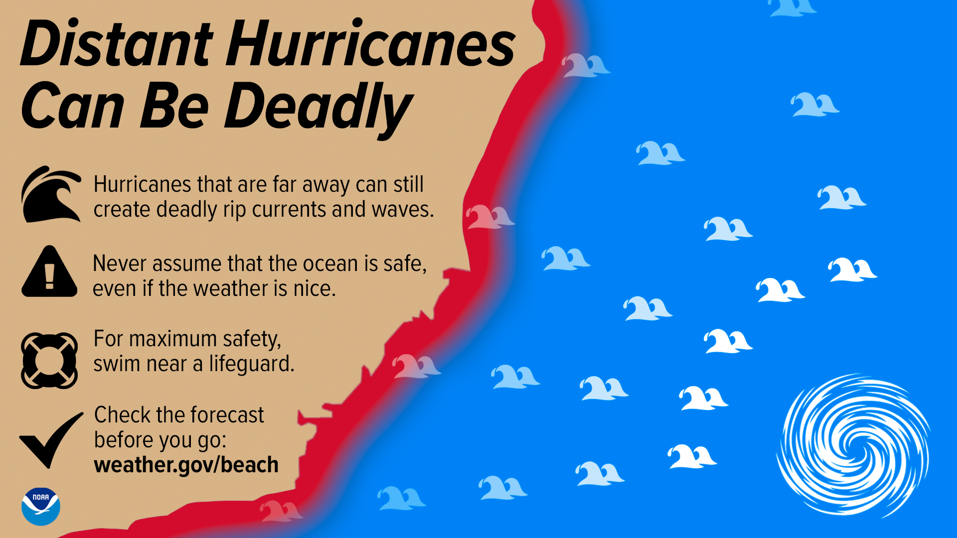
(Spanish version of infographic)
It is estimated 6% of fatalities from Atlantic tropical cyclones are surf related, including rip currents and high surf. Between 2000 and 2021, there were approximately 143 surf fatalities caused by Atlantic tropical cyclones in the continental U.S. - 100 of which were due to rip currents. Over half of these fatalities occurred when the tropical cyclone had no impacts at the fatality location other than rough surf and marine conditions (i.e., the storm stayed out to sea or made landfall elsewhere in the Atlantic).
On a local level, 10% of rip current fatalities in the Carolinas between 2000 and 2022 have been due to swells from tropical cyclones. At Wrightsville Beach, NC, there is a peak in strong rip currents reported in the month of September correlated to the peak in Atlantic hurricane season (based on observations collected from Wrightsville Beach Ocean Rescue since 2004).
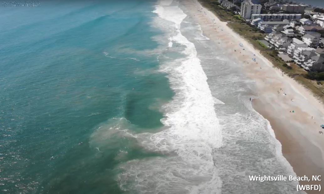
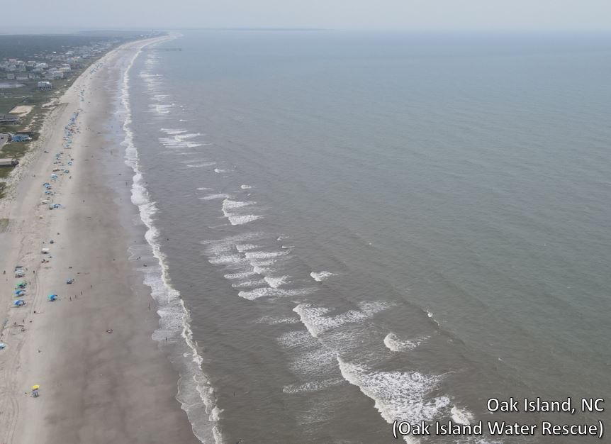
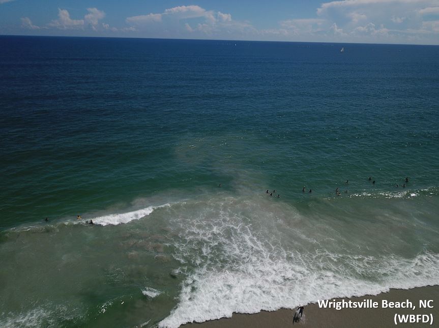
Aerial view of rip currents due to swells from distant Hurricane Fiona (over 500 miles away) - September 2022
How many rip currents can you spot? (Hint: look for where dark colored sediment is being pulled out beyond the waves)
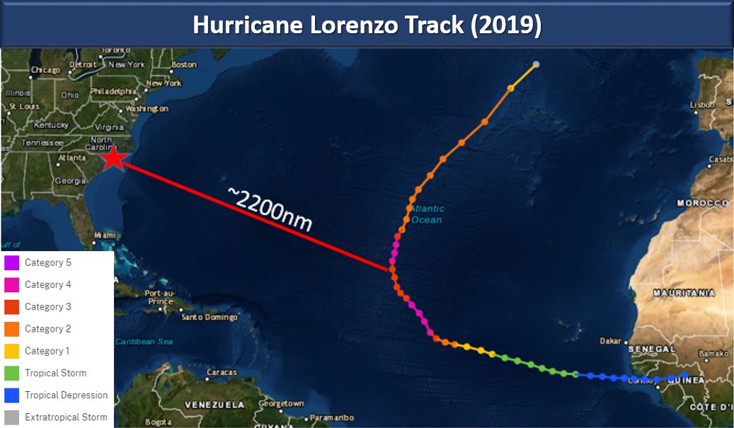
In 2019, Hurricane Lorenzo was a tropical cyclone in the eastern Atlantic from September 22nd - October 4th. Lorenzo was a powerful major hurricane for days and was the northern most category 5 storm on record in the Atlantic. From September 26 - 30, Lorenzo was a category 2 hurricane or stronger and was either moving right at the U.S. or moving slowly. This generated long period swells that traversed the Atlantic, taking four days for the swells to reach the East Coast. As a result, a deadly rip current outbreak occurred along the U.S. East Coast, despite Hurricane Lorenzo getting no closer than ~1,700 nautical miles from the coast. Strong rip currents and hazardous surf conditions were reported up and down the coastline. Eight lives were lost in total, six of which were rip current related, between September 30th and October 3rd. Four of these fatalities occurred in North Carolina. Lorenzo led to the most U.S. surf fatalities from an Atlantic tropical cyclone since Hurricane Gabrielle in 1989. For additional information, check out our StoryMap for Hurricane Lorenzo.
Know Before You Go! One of the best ways to be prepared for rip currents and other beach hazards is to know what you could be swimming into at the beach.
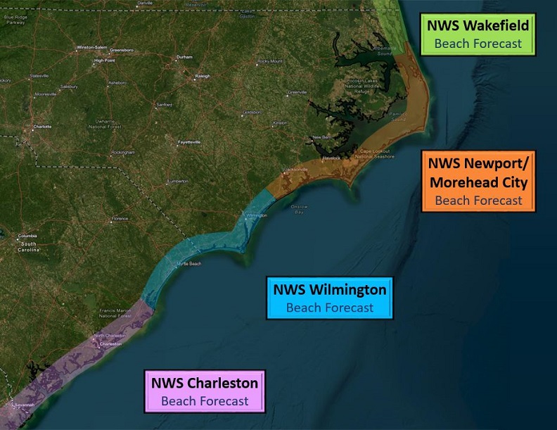
Southeast Beach Forecast Page: www.weather.gov/beach/southeast
NWS Charleston, SC (typical beach season March 15 - Oct 31): www.weather.gov/beach/chs
NWS Wilmington, NC (typical beach season April 1 - Oct 31): www.weather.gov/beach/ilm
NWS Newport/Morehead City, NC (typical beach season mid April - Oct 31): www.weather.gov/beach/mhx
NWS Wakefield, VA (typical beach season May 15 - Oct 1): www.weather.gov/beach/akq
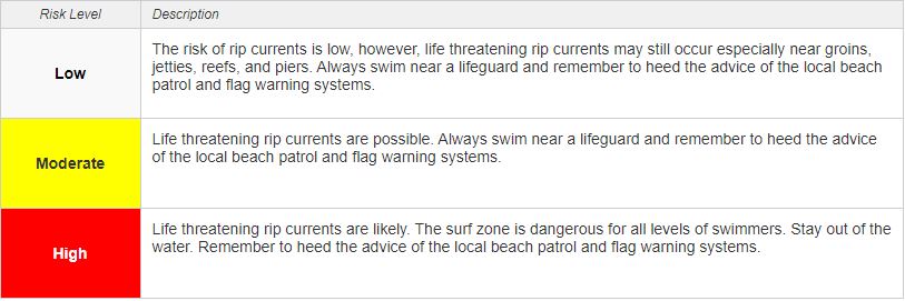
Did you know that NWS coastal offices, including the Great Lakes, issue Surf Zone Forecasts (SRF) during local beach seasons? The primary purpose of this forecast product is to alert partners and public of potential hazards swimmers and beachgoers may encounter at local beaches. The SRF contains the beach forecast for the next two days with some offices including an extended forecast, or outlook, section for a heads up. Hazards in the Surf Zone Forecast include rip current risk, surf heights, UV index, thunderstorm potential and other potential hazards such as longshore currents.
NOAA launched the first national rip current probabilistic forecast model in 2021. This model predicts the probabilities of hazardous rip currents occurring along U.S. beaches using output from the NWS's nearshore wave model on different forecasted wave groups, including wave height and direction, as well as predicted tide levels. Values are calculated from 0-100%, hourly through 6 days. This model is aided and refined by lifeguard reports submitted by our local beach partners. The model is used by NWS coastal offices as a tool to help forecast rip current risk. Note: the output from the model does not correspond to the rip current risk forecasted by NWS offices in the official SRF product, as other factors and known biases are taken into account during the forecast process.
NWPS Rip Current Model Output (click a circle along the coast for a localized time series, or click a box for an area animation): polar.ncep.noaa.gov/nwps/viewer.shtml
Press Release for NOAA's First Rip Current Forecast Model: oceanservice.noaa.gov/news/apr21/rip-current-forecast.html
Shorebreak occurs where you have a relatively sharply sloping beach so that incoming waves, rather than breaking gradually as they feel the bottom of the sea floor, break quickly and steeply onshore. The force of shorebreak waves can catch unsuspecting swimmers off guard driving them into the sand, causing neck and back injuries, and in some cases even drowning. Shorebreak is common along the Outer Banks of North Carolina, and the hazard typically increases as wave height increases. You must stay situationally aware at all times and never turn your back on the ocean. Check out the PSA videos below from Dare County, NC on the dangers of shorebreak.
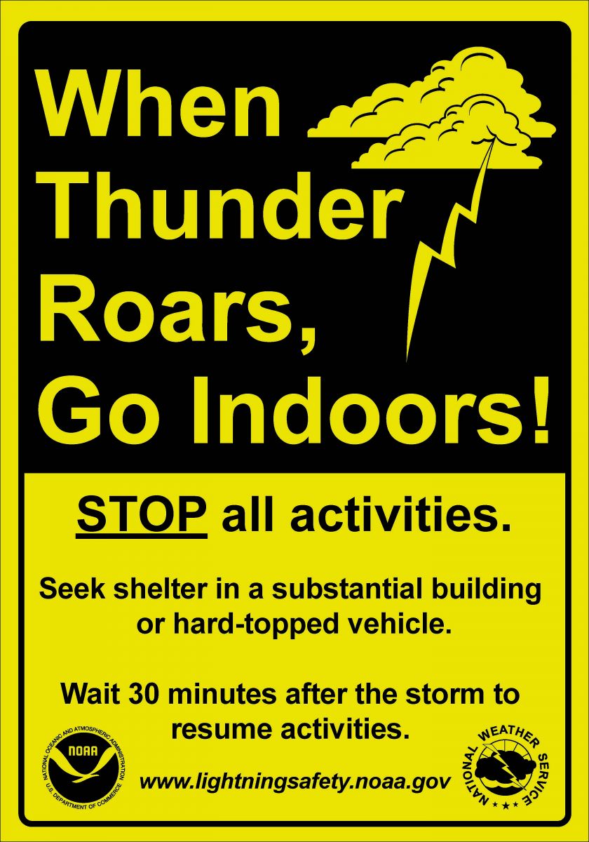
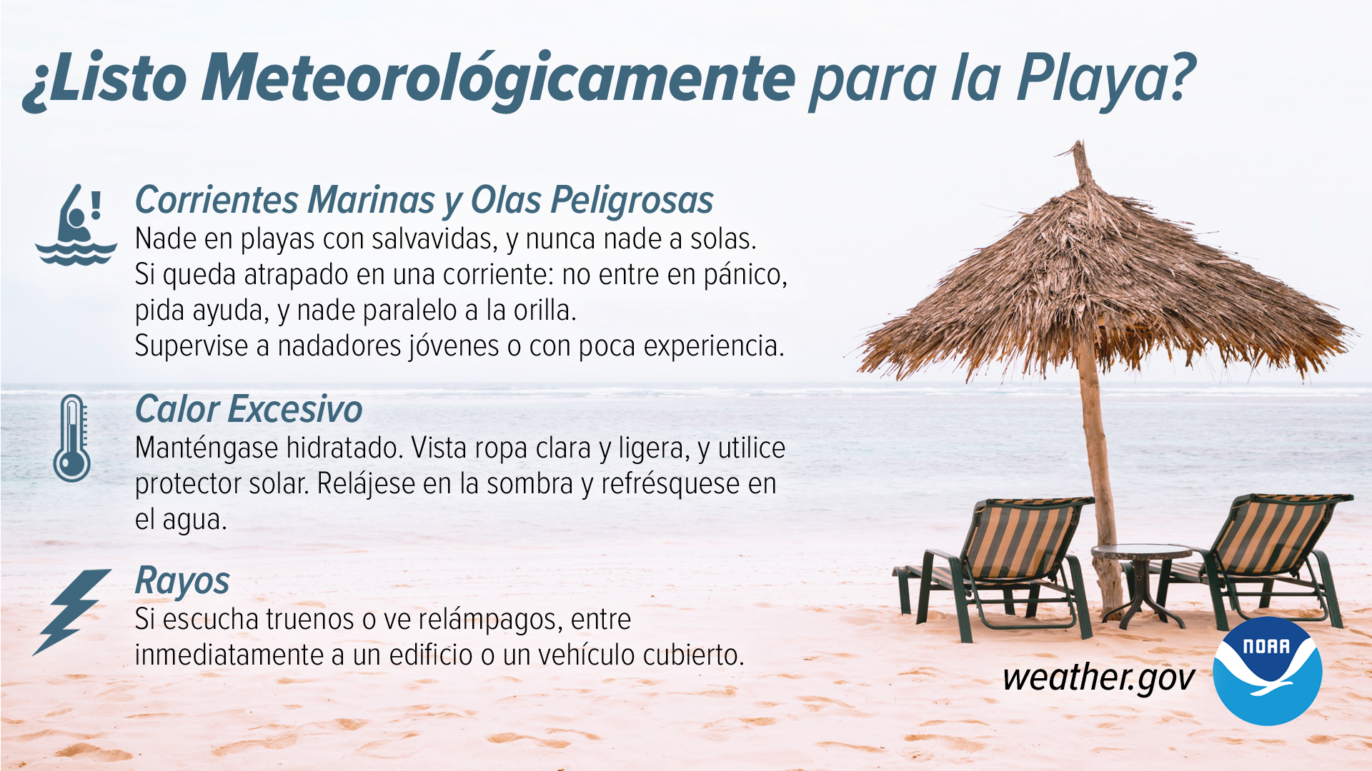
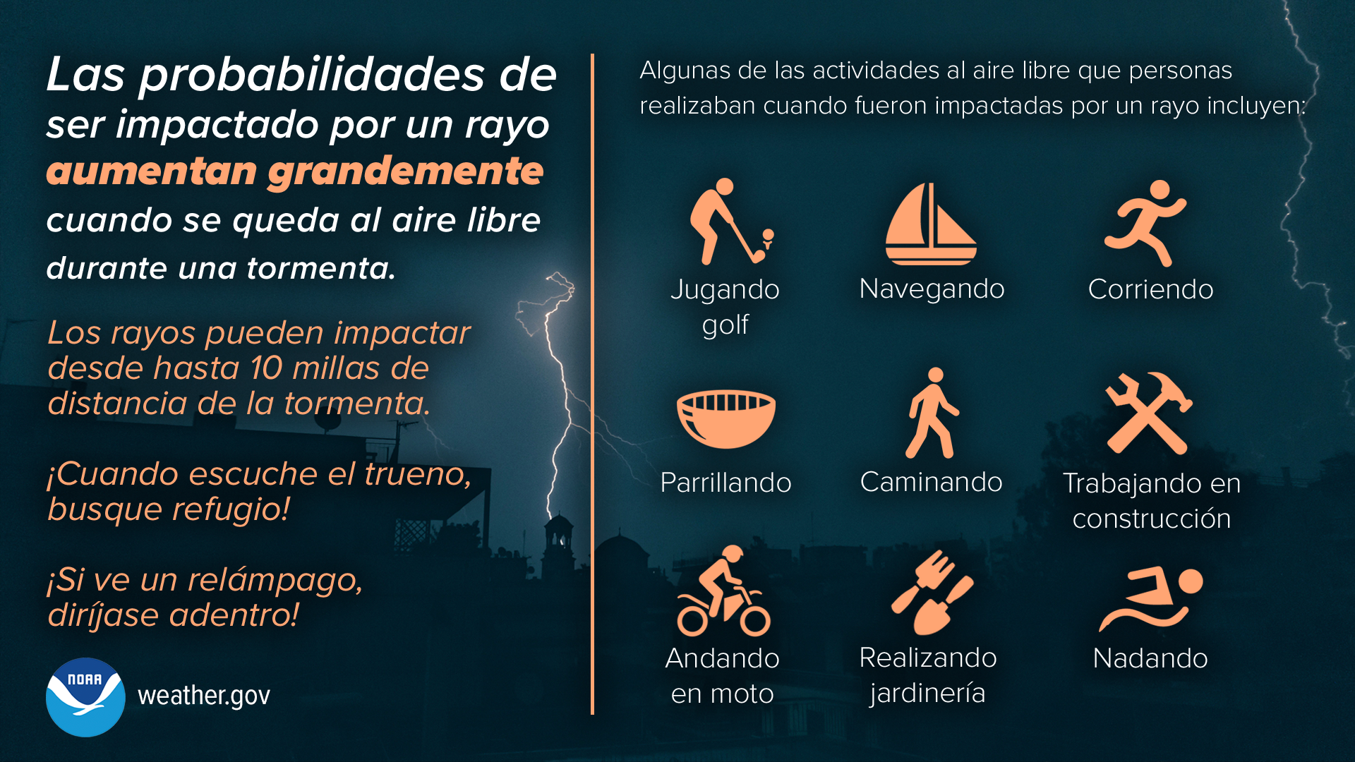
If you are on the beach or in the ocean and hear thunder or see lightning, immediately seek shelter in a substantial building (i.e., not under a beach picnic shelter) or a metal topped car. Lightning can strike far away from the thunderstorm and if you can hear thunder or see lightning, you are close enough for lightning to strike you. Lightning strikes the tallest object in the area and if you are standing on the beach you become the tallest object.
Heat is one of the leading weather-related killers in the United States. Heat can be very taxing on the body and heat-related illnesses, such as heat exhaustion and heat stroke, can occur within even a short period of exposure. Everyone can be vulnerable to heat, but some more so than others (such as young children, older adults, and pregnant women). Stay safe in the sun when on the beach by using sunscreen, staying hydrated, and taking breaks in the shade.
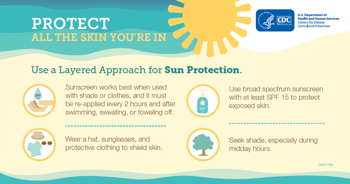
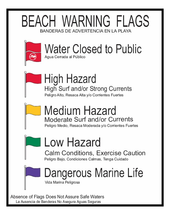
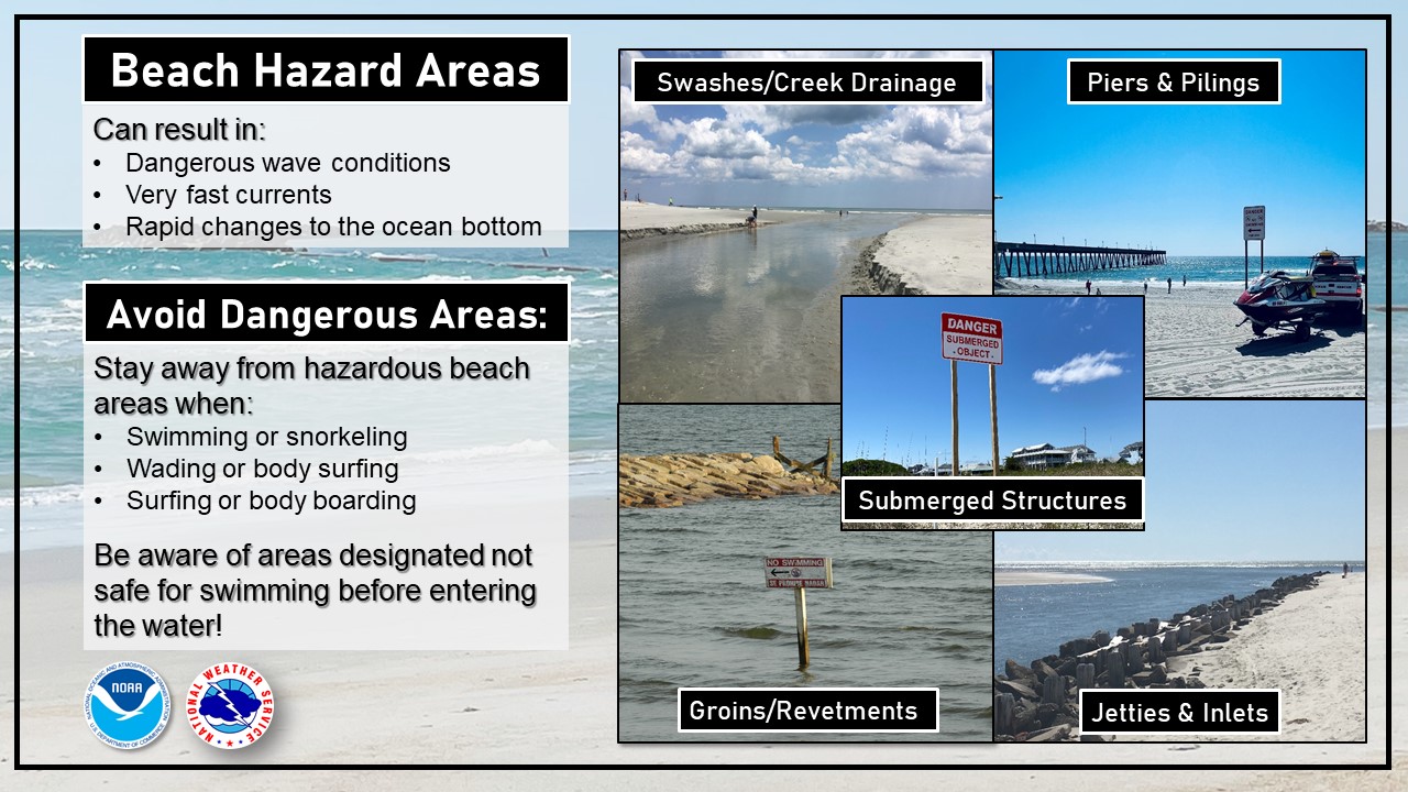
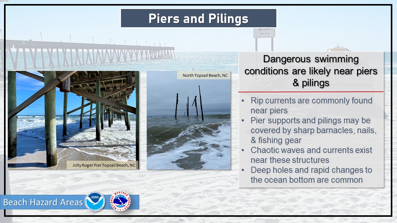
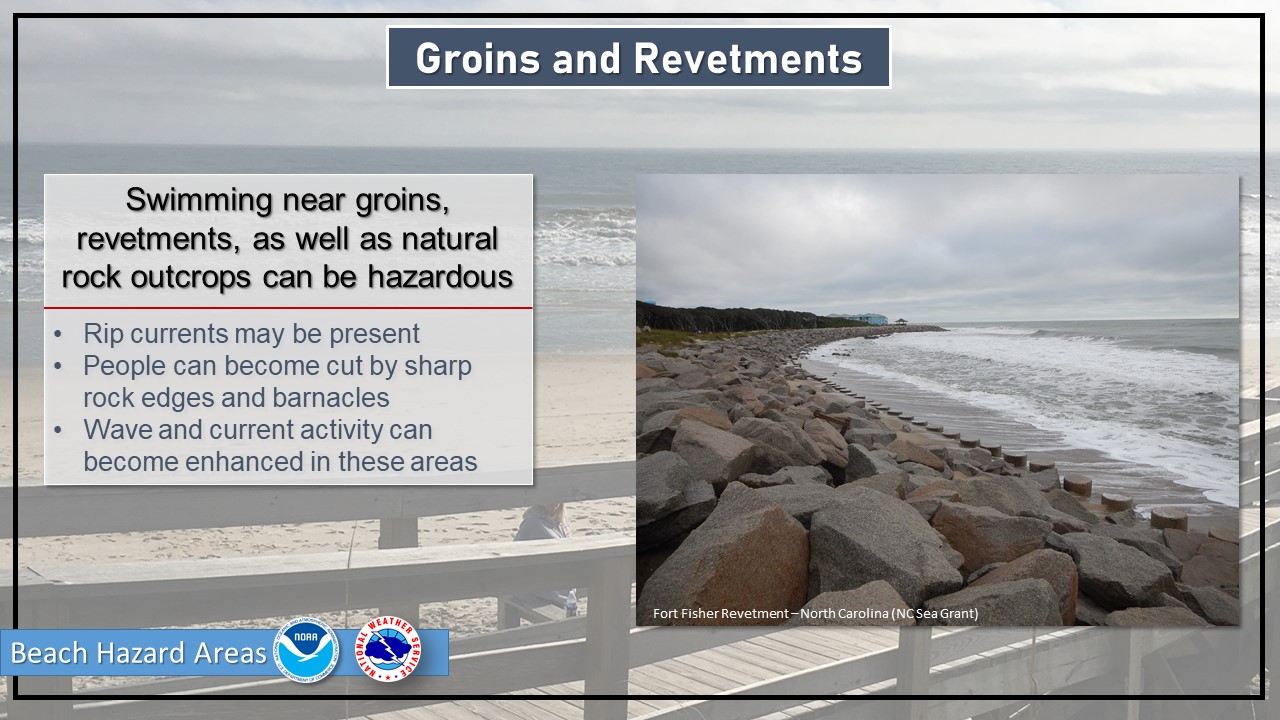
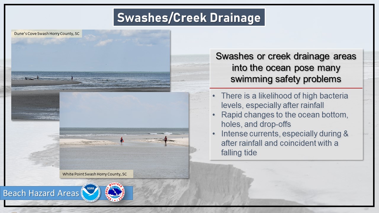
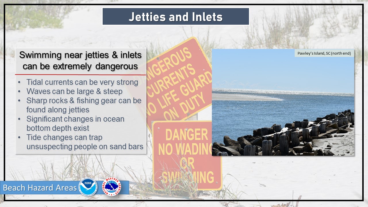
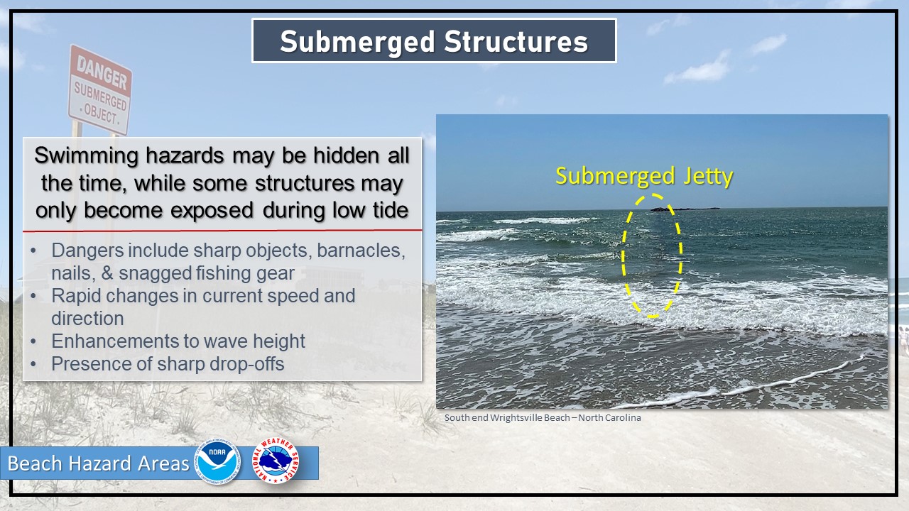
In addition to common surf hazards, there are certain areas along the coast that are hazardous to be near in the water. These dangers become amplified during certain weather and wave conditions. Check out the graphics below on various hazardous swimming areas found in the Carolinas. Read more at: www.weather.gov/ilm/beachhazardareas.
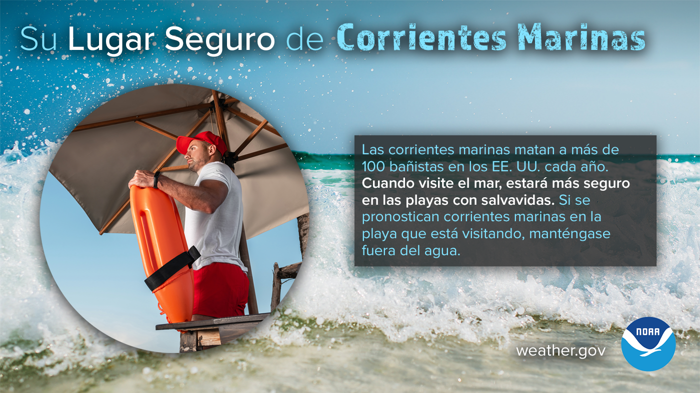
Swim near a lifeguard. The chances of drowning at a beach with lifeguards are 1 in 19 million.
Never swim alone. Always swim with a buddy so that if one swimmer has a problem, the other can provide assistance and call for help.
Know how to swim before venturing into the ocean. Swimming in a pool is not the same as swimming at a surf beach with crashing waves, winds, and dangerous currents.
Know before you go. Check the local surf forecast before going to the beach.
If in doubt, don't go out!
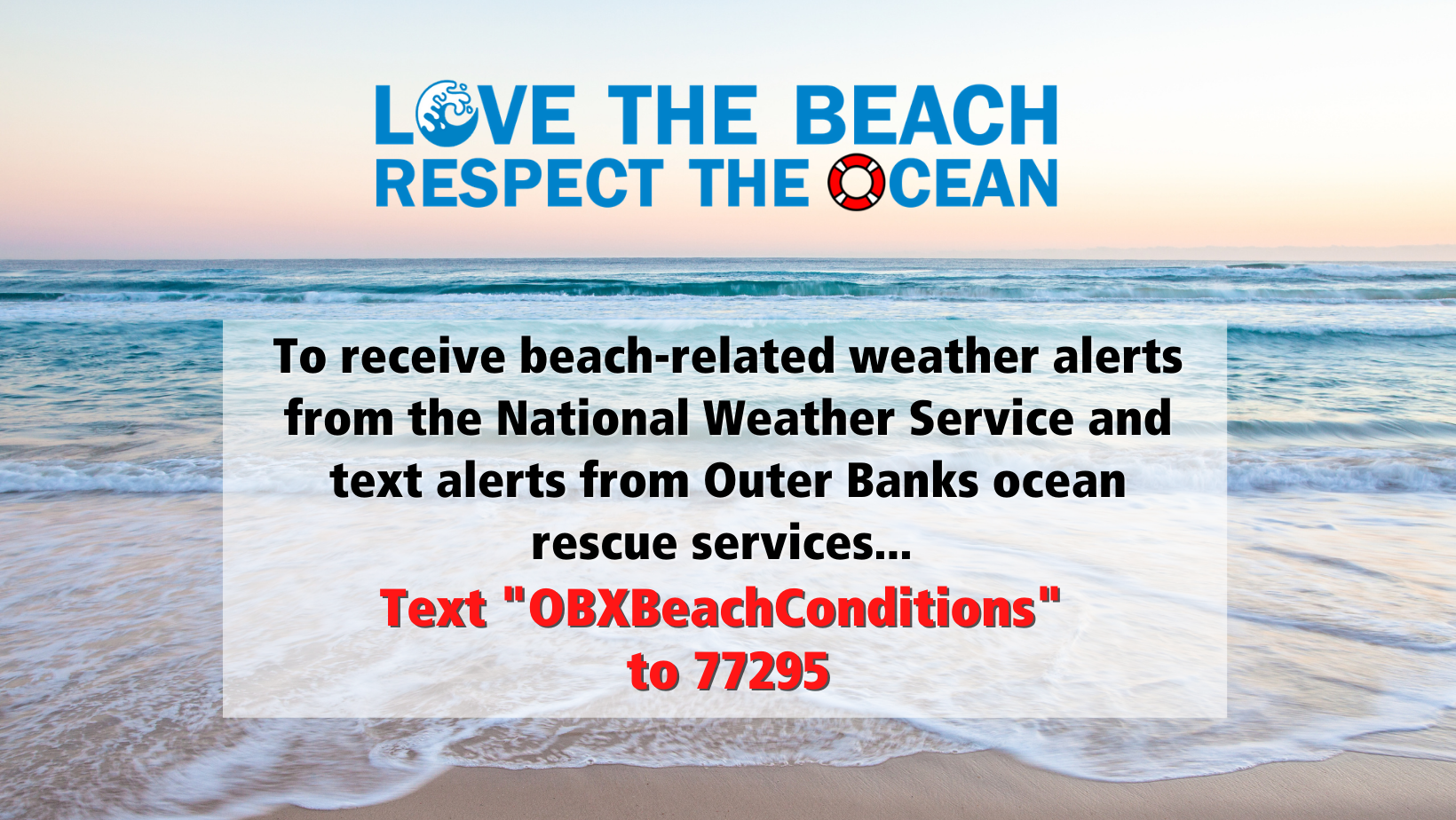
In an effort to provide beachgoers with information on how to enjoy the Outer Banks' beautiful barrier island beaches safely, Dare County Emergency Management created the "Love the Beach, Respect the Ocean" campaign. This effort has led to numerous safety videos and graphics to inform the public of potential hazards at the beaches. Dare County also offers a text message service, where you can sign up for text alerts on beach conditions for the Outer Banks beaches by texting "OBXBeachConditions" to 77295. For additional information on Love the Beach, Respect the Ocean, visit www.lovethebeachrespecttheocean.com.
For additional information, reach out to your local National Weather Service Forecast Office:
For questions regarding this webpage, contact Victoria Oliva.


 Coastal Flood
  Follow us on YouTube