The largest snowstorm in history for the Southeast U.S. coast occurred just before Christmas 1989. This storm broke all-time snowfall records in Wilmington (15.3 inches), Cape Hatteras (13.3 inches), Charleston (8 inches), and Savannah (3.6 inches). Measurable snow fell as far south as Jacksonville and Tallahassee, Florida, and snow flurries were reported in Tampa and near Sarasota.
In addition to record amounts of snow unprecedentedly cold temperatures accompanied the storm. All-time record lows were smashed across coastal North Carolina with temperatures falling to -4 in New Bern and to 0 in Wilmington. Arctic air flooded south into Florida as well with record lows observed all across the peninsula. Even Key West, FL reached 44 degrees tying the coldest December temperature ever seen in that nearly-tropical location. The Florida citrus industry suffered severe injury with newspaper reports indicating "nearly total destruction of commercial citrus growing north of Interstate 4..."
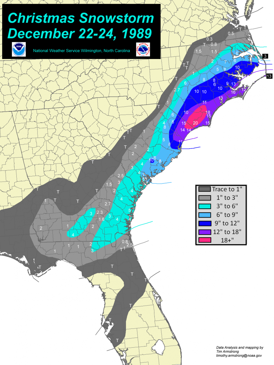
Click the map for a larger version with totals from Virginia through Florida, December 22-24, 1989. Data from NWS & FAA stations and NWS cooperative observers.
|
North Carolina |
|
South Carolina |
|
Georgia |
|
Florida |
|
|||
|
|
|
|
|
|
|
|
|
|||
|
Longwood |
19.5" |
Loris, 2 S |
14.5" |
Cairo |
6" |
Live Oak |
3" |
|||
|
Wilmington, 7 N |
17.5" |
Myrtle Beach |
14" |
Sapelo Island |
4.7" |
Mayport |
2.9" |
|||
|
Hofmann Forest |
16.5" |
Conway |
13.5" |
Fort Stewart |
4.3" |
Jacksonville Beach |
2.5" |
|||
|
Cherry Point MCAS |
16" |
Brookgreen Gardens |
11.3" |
Quitman, 2 NW |
4" |
Jasper |
2" |
|||
|
Wilmington airport |
15.3" |
Givhans Ferry, 2 ESE |
10.1" |
Brunswick airport |
4" |
Jacksonville NAS |
1" |
|||
|
Southport, 5 N |
15" |
Charleston airport |
8" |
Atkinson, 2 W |
4" |
Monticello |
1" |
|||
|
Cape Hatteras airport |
13.3" |
Marion |
8" |
Savannah airport |
3.6" |
Tallahassee airport |
1" |
|||
|
Bayboro, 3 E |
13" |
Andrews |
8" |
Douglas |
3.3" |
Madison |
1" |
|||
|
New River MCAS |
12.7" |
Lake City |
7.5" |
Brooklet, 1 W |
3" |
Jacksonville airport |
0.8" |
|||
|
Cedar Island |
12" |
Beaufort MCAS |
6.5" |
Patterson |
3" |
Myakka River St. Park |
T |
|||
|
Willard, 4 SW |
11" |
Dillon |
6" |
Surrency |
2.7" |
Daytona Beach airport |
T |
|||
|
Belhaven, 3 NE |
10.3" |
Summerville, 4 W |
5.8" |
Claxton |
2.5" |
Crescent City |
T |
|||
|
Whiteville, 7 NW |
10.2" |
Beaufort |
5" |
Newington |
2.5" |
Gainesville airport |
T |
|||
|
Trenton |
10.2" |
Kingstree |
4.8" |
Alma Bacon airport |
2.3" |
Tampa airport |
T |
|||
|
Clinton, 2 NE |
10" |
Florence airport |
4.3" |
Glennville |
2" |
Clermont |
T |
|||
|
Warsaw, 5 E |
10" |
Walterboro, 1 SW |
4.2" |
Homerville |
2" |
Whiting Field NAS |
T |
|||
|
New Bern airport |
8.8" |
Yemassee |
3.6" |
Colquitt, 2 W |
2" |
Apalachicola airport |
T |
|||
|
Washington, 4 W |
8" |
Effingham |
3" |
Waycross airport |
1.6" |
Pensacola airport |
T |
|||
|
Goldsboro, S. J. AFB |
8" |
Hampton, 1 S |
3" |
Metter |
1.5" |
Crestview airport |
T |
|||
|
Kinston airport |
8" |
Bamberg |
2" |
Preston |
1" |
Pensacola NAS |
T |
|||
|
Williamston, 1 E |
6.5" |
Holly Hill |
2" |
Moultrie, 2 ESE |
1" |
|||||
|
Plymouth, 5 E |
6" |
Orangeburg |
2" |
Valdosta, 3 E |
0.8" |
Virginia |
|
|||
|
Edenton |
6" |
Wedgefield |
1" |
Abbeville |
T |
|
|
|||
|
Kinston |
6" |
Columbia, USC |
T |
Americus, 3 SW |
T |
Back Bay NWR |
1" |
|||
|
Dunn, 4 NW |
6" |
Columbia airport |
T |
Ailey |
T |
Suffolk, Lake Kilby |
0.5" |
|||
|
Greenville |
5" |
Pee Dee |
T |
Montezuma |
T |
Emporia, 1 WNW |
0.3" |
|||
|
Manteo airport |
3" |
Cheraw |
T |
Columbus airport |
T |
Oceana NAS |
T |
|||
|
Fayetteville, Pope AFB |
2.7" |
Springfield |
T |
Gibson |
T |
Norfolk airport |
T |
|||
|
Tarboro, 1 S |
2" |
Pelion, 4 NW |
T |
Norfolk NAS |
T |
|||||
|
Scotland Neck |
1.5" |
|||||||||
|
Smithfield |
1" |
|||||||||
|
Laurinburg |
1" |
|||||||||
|
Jackson |
0.8" |
|||||||||
|
Roanoke Rapids |
T |
|||||||||
|
Raleigh, NCSU |
T |
|||||||||
|
Sanford, 8 NE |
T |
|||||||||
|
Neuse, 2 NE |
T |
 The evolution of this historic event followed the general pattern for significant snow in the eastern Carolinas. The first hint of low pressure along the stalled arctic front showed up during the early morning hours of December 23rd on the Florida east coast. (Typically during a significant winter storm for the eastern Carolinas low pressure develops in the eastern Gulf of America and is already well-developed once it reaches the Atlantic) From the Florida east coast the low followed a typical path northeastward a few hundred miles off the Southeast coast of the United States. Due to the extremely cold air in place snow fell with air temperatures in the teens in Charleston, Myrtle Beach and Wilmington. How often could you warm the air by 10 to 15 degrees and still get snow here? Unfortunately two deaths were attributed to this storm in Camden County, NC, while another man died of a heart attack while shoveling snow in Wilmington.
Below are surface maps hand-analyzed every 12 hours using historic surface observations. Temperatures and dewpoints are shown in the upper-left and lower-left of each station plot. Weather and visibility (if applicable) is plotted in the center-left. Station pressure in millibars and tenths (last three digits only) is plotted in the upper-right. Wind direction is shown by the direction of the flag with the number of lines indicating wind speed; a half-line indicates 5 knots while a full line indicates 10 knots. Surface pressure is analyzed in black with fronts and troughs indicated.
7:00 AM EST December 22, 1989 (22 Dec 1200 UTC)
An arctic cold front moved through the Carolinas on December 21st and by the morning of the 22nd had pushed into central Florida. Very cold air had already spread across the Carolinas and the remainder of the Southeastern states ahead of a very strong 1055 millibar (31.15 inches Hg.) arctic high pressure centered over Nebraska. Temperatures across North and South Carolina were in the teens and 20s with single digits in the mountains and near the Virginia border.
In the upper levels of the atmosphere a broad trough covered the eastern half of North America. Cross-polar flow was established from Siberia across the Arctic Ocean into Canada and the eastern United States. Although temperatures were cold across the Carolinas and Georgia, the coldest temperatures relative to normal were still farther west across Texas and the Ozarks.
The upper level disturbance that would be responsible for developing the great snowstorm was centered near the Colorado/New Mexico border and moving southeastward toward Texas. Local forecasts for the next couple of days were for bitterly cold temperatures but no precipitation as arctic high pressure was expected to keep moisture out of the area.
7:00 PM EST December 22, 1989 (23 Dec 0000 UTC)
The upper level disturbance was moving into central Texas and was sharpening the upper level trough along the Gulf coast states. Humid southwest winds developed over the top of the arctic air across Florida, Georgia and coastal South Carolina. This flow of moisture led to an expanding area of rain across central Florida. Where the air was colder to the north, snow or mixed precipitation began to fall across northern Florida and parts of coastal Georgia and South Carolina. Rain changed over to sleet in Jacksonville, FL just after 6 p.m.; freezing rain began in St. Simon's Island, GA around 7 p.m.; and snow began to fall in Savannah and Charleston around 7 p.m.
A very chilly night was in store for the Carolinas with low temperatures mainly in the teens, with single digits in northwestern North Carolina. The Wilmington Star-News reported that Carolina Power & Light (the local electric utility) set a new record for peak usage at 8,100 megawatts. The Robesonian newspaper reported Public Service (now called PSNC Energy) had record-high demand on its natural gas system in the state as well. Some Wilmington residents lost water service due to frozen pipes.
7:00 AM EST December 23, 1989 (23 Dec 1200 UTC)
Low pressure developed along the arctic front along the Florida east coast. Counter-clockwise winds around the low pushed the arctic front south across Florida with cold temperatures surging southward across the entire peninsula. The flow of humid southwest winds increased above the arctic air as the upper level disturbance reached the lower Mississippi Valley. Light to moderate snow was expanding northward along the coast. Snow fell in Myrtle Beach and Wilmington most of the night; snow began in Cape Hatteras around midnight. Along the transition zone between rain and snow across central Florida a narrow zone of sleet and freezing rain continued. In Wilmington and Myrtle Beach 5 inches of snow had fallen by 7 a.m., with 3 inches at Hatteras, 2 inches in Charleston, and 1 inch in New Bern and Savannah. It has been noted that in most significant snowstorms for the eastern Carolinas the surface low tracks very near 32° north latitude, 75° west longitude, about 215 miles southeast of Cape Fear. The low missed this benchmark point to the south during the day but still dropped heavy snow locally due to its track almost northward along the Carolina coast.
Across Texas and Louisiana this was the coldest morning of the historic cold wave. In Houston the air temperature dropped to 7 degrees, setting a record low for the date. This was the only time since 1930 Houston has recorded a temperature in the single digits. New Orleans recorded a record-low temperature of 11 degrees, with 9 in nearby Slidell, and 5 in Shreveport.
7:00 PM EST December 23, 1989 (24 Dec 0000 UTC)
Low pressure continued to intensify along the arctic front a few hundred miles off the South Carolina coast. Moderate to occasionally heavy snow continued along the North and South Carolina coast with near-blizzard conditions across eastern North Carolina. Weather conditions at 7 p.m. at Cape Hatteras included moderate snow and blowing snow with a visibility of one-eighth of a mile and north winds sustained at 28 mph gusting to 39 mph. Arctic air continued to blast south behind the low across Florida with snow flurries reported in locations as far south as Tampa and Daytona Beach! At the Jacksonville, FL NWS office 0.8 inches of snow fell, the second highest storm total on record for this subtropical city. Just across town at the Jacksonville Naval Air Station 1 inch of snow fell, while at Jacksonville Beach 2.5 inches was recorded. The high temperature this day in Charleston was 20° F and in Savannah was only 22° F; those are the coldest high temperatures for any day during the 20th century and the coldest daily high ever recorded in Charleston.
The Wilmington Star-News reported 300 car accidents across the Cape Fear area and power outages had affected 3,000 people in New Hanover county alone. The Wilmington airport was closed, and hospitals in Wilmington were requesting anyone with four-wheel drive vehicles to volunteer to transport doctors and nurses to work. The snow depth in Wilmington and Hatteras reached 8 inches, 7 inches in Charleston, 5 inches in New Bern, and 3 inches in Savannah, with more to fall...
7:00 AM EST December 24, 1989 (24 Dec 1200 UTC)
The low had moved northeastward to a position a few hundred miles off the North Carolina coast. Snow piled up deeper and deeper across eastern North Carolina with 13 inches reported on the ground in Wilmington at 7 a.m. On the Outer Banks at Cape Hatteras enough warm air wrapped back around the northern semicircle of the storm to change precipitation over to a mix of rain and snow for about 12 hours, reducing storm-total snowfall amounts here. Life along the Carolina coast ground to a halt as extraordinary amounts of snow overwhelmed the modest amount of snow removal equipment. Snow depth at 7 a.m. was reported to be 14 inches at the Myrtle Beach airport, 8 inches in Charleston and 7 inches in New Bern.
This was the coldest morning of the cold wave across the interior Southeastern states. Temperatures in Talladega reached 1 degree, 4 in Birmingham, 6 in Atlanta, 9 in Crestview (Florida), 11 in Pensacola, and 13 in Tallahassee. It was absolutely brutal in the North Carolina mountains with -18 degrees recorded in Banner Elk, -7 on Grandfather Mountain, and -5 in Blowing Rock.
7:00 PM EST December 24, 1989 (25 Dec 0000 UTC)
Low pressure moved away from the North Carolina coast with dry and very cold arctic air spreading well offshore. With plenty of snow on the ground from northern Florida through the coastal Carolinas, clearing skies and subsiding winds allowed record-cold temperatures to develop later this night. In Wilmington the all-time record low was smashed by five degrees as the temperature dropped to 0 early Christmas morning. New Bern, NC also set a new all-time record low of -4 degrees. Other notable low temperatures reported on Christmas morning 1989 included -5 degrees at the New River MCAS near Jacksonville, -3 degrees in Southport, -3 degrees in Elizabethtown, -2 degrees in Whiteville, and 0 degrees in Marion, SC. The extremely cold temperatures froze and burst water pipes around the region. According to the Wilmington Star-News, a State of Emergency was declared in Wilmington as the municipal water system was stressed due to over 300 burst pipes draining the city's water reserves. The basement of the Cape Fear Hotel apartments became filled with 50,000 gallons to water due to burst pipes. The Robesonian Newspaper from Lumberton quoted an official with the NC Highway Patrol saying road conditions were extremely treacherous from south of Fayetteville (NC) through South Carolina, Georgia, to Jacksonville, Florida.
At the Wilmington airport 13 inches of snow remained on the ground on Christmas Day. (This is slightly less than what fell due to compaction of snow from to its own weight) This is the largest snow depth ever reported in Wilmington and made the Christmas of 1989 unforgettable for residents of the the coastal Southeast -- children and adults alike.
Local Stories & Photos
The Wilmington Star-News archives are publicly available through Google's newspaper archive project. Here are articles about the snowstorm than ran from December 23 through December 30, 1989.
|
Snow Falls on Southeastern N.C. December 23, 1989 |
December 24, 1989 |
Snow, record lows slam Florida December 24, 1989 |
Snowstorm cripples coast December 24, 1989 |
December 25, 1989 |
|
Snowfall brings a white Christmas December 25, 1989 |
Storm bashes beaches December 26, 1989 |
Sun, city crews tackle icy roads December 27, 1989 |
Low water leads to state of emergency December 28, 1989. |
Snow wasn't inconvenient for all December 28, 1989 |
|
Coast paralyzed after record-breaking snow December 26, 1989 |
December 30, 1989 |
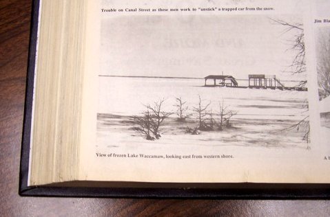
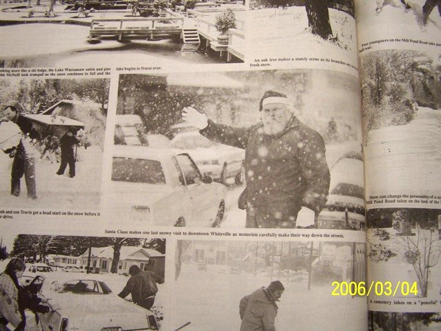
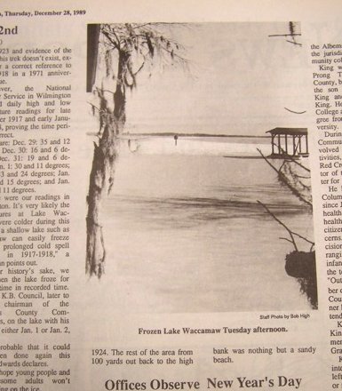
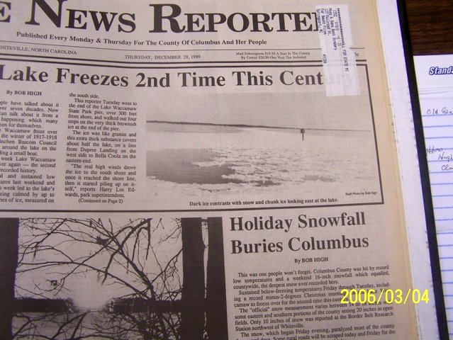
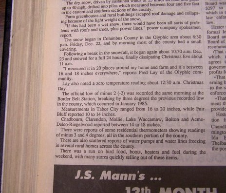
Bob High, a reporter and photographer for the News Reporter in Whiteville, NC informed us Lake Waccamaw froze over during the snowstorm, only the second time during the 20th century this occurred. Ice on the southern side of the Lake was 2 feet thick at least 100 yards from shore. North winds had driven ice southward across the lake, and new ice kept sliding under existing ice to build extensive sheets. Six miles south of Whiteville along NC Highway 130 in the Pleasant Plains community snow was measured 18 inches deep. The News Reporter noted that snow depth "in Tabor City ranged from 16 to 20 inches, while Fair Bluff reported 10 to 14 inches. Chadbourn, Clarendon, Mollie, Lake Waccamaw, Bolton and Acme-Delco-Riegelwood reported between 14 and 18 inches."
Mr. High also provided the following photos of the December 28, 1989 edition of the News Reporter.
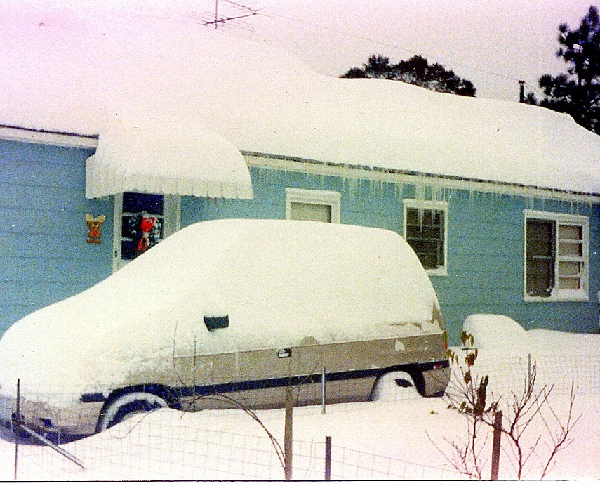
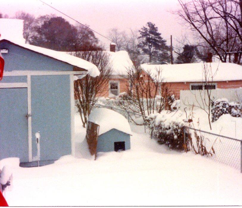
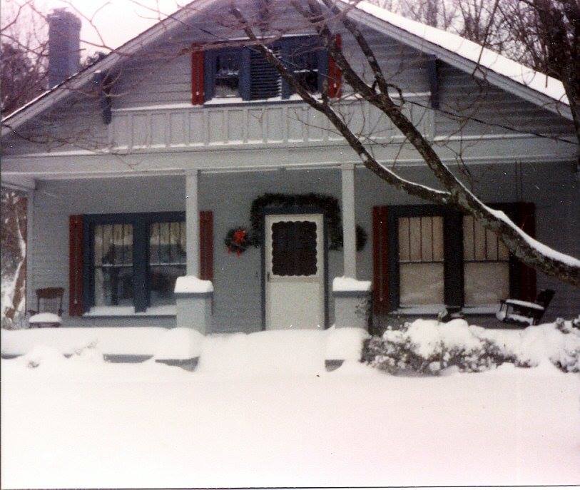
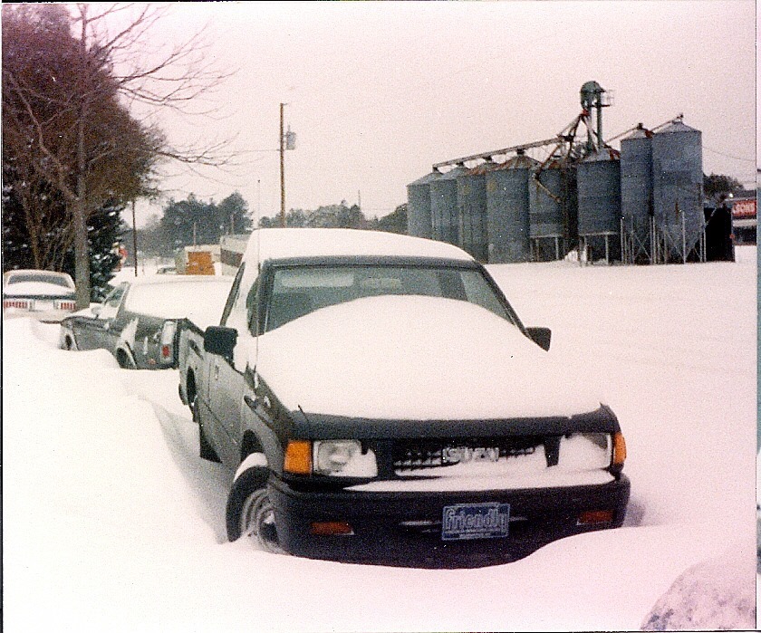
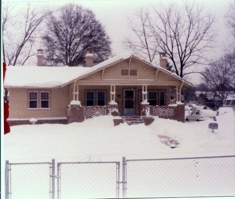
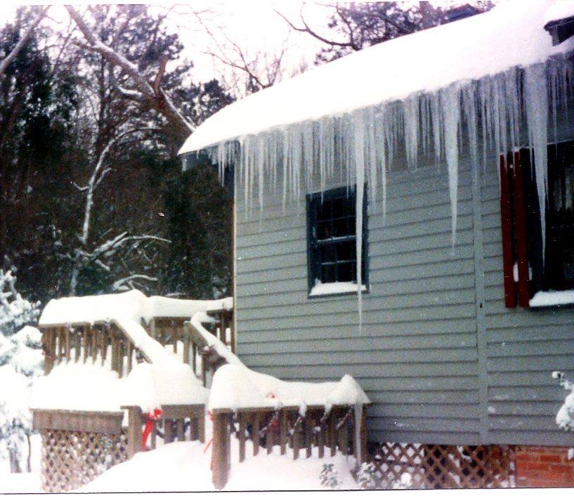
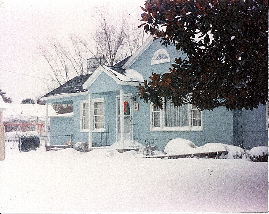
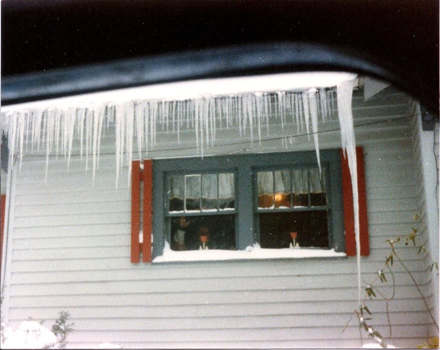
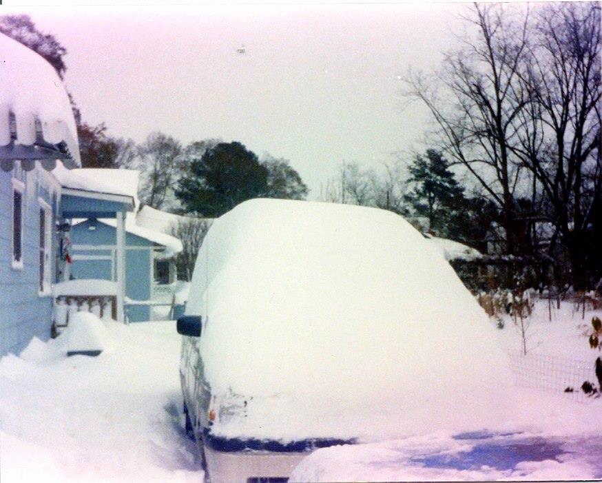
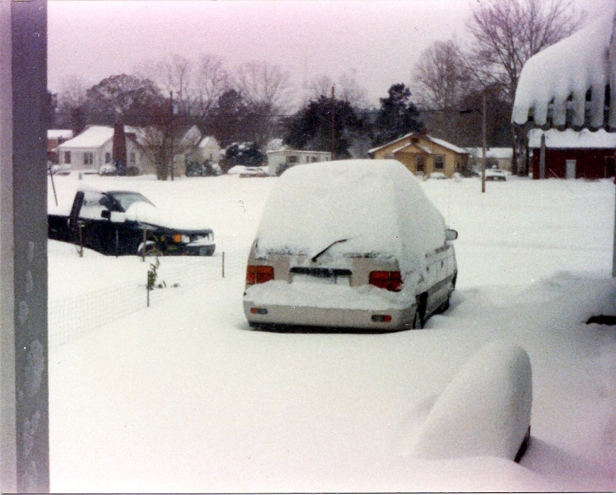
The following ten photos were provided by Rick Beacham of Burgaw, NC, and show the tremendous amount of snow that fell in Burgaw during this storm.
 |
 |
 |
 |
 |
 |
 |
 |
 |
 |
Stories submitted to us via social media:
Amanda Altman: I was 12 years old. We moved from upstate NY a year prior. I missed the snow so much and was ecstatic to have a white Christmas!
Cheryl Melton: It was 9 degrees an hour south of Houston. Pipes froze all over the city. We also had no electricity Christmas Eve Day. My parents braved the long drive back to their suburb north of Dallas and their brand new house fearing the same. Funny thing is THEY had power and no frozen pipes!
Tina Whitehurst: Hampstead NC. I was 16. Best Christmas ever!!
Linda Honour: It was difficult driving to the mall for last minute shopping, it was empty of shoppers.
Tara Williamson: Nakina NC had a white Christmas and I was a senior in high school!! Loved it and will never forget how happy and close our family was.
Ronnie Kirkland: Just moved here in September of that year from Boone, NC and thought I'd left all that kind of weather behind me!
Anne Jasper: I remember that storm very well. My then boyfriend, now husband had to shovel out drifts taller than our heads in Indian Beach, NC so that he could get his vehicle out to go to the airport the next day. New Bern airport was closed and he had to go all the way to Raleigh to fly to Texas. We got engaged during that storm.
Chris Steele: I was in Georgetown for that. Never forget it!!!
Jack Brady: Best Christmas ever! I'll never forget it.
Karen Tripp: I will never forget it! We were living in Jacksonville, NC and were planning to go home to SC to visit my parents for Christmas. We had planned to leave on Christmas Eve but as soon as I heard that, we left a day earlier! I meant I was going to be with my family ~ We get down there (not too far from Columbia, SC) and my husband looked out the next morning, and said, "Where's the snow?" It was later on that night that we heard on the news how much snow that we had gotten! Ha ~ I knew I was right!!! We stayed down there for several days and drove back to Jacksonville, only to have to shovel snow from the drive & walkways. My stepdaughter (from Hawaii) was living with us that year ~ Still got the pictures of her and her little sister (our baby was only 1 1/2 yrs @ the time). No, I don't think I will ever forget!
Sandra Stiles: It was absolutely beautiful. It was a powdery dry snow and you could latterly sweep it off of surfaces. We had a St Bernard and she would walk through it like a snow plow , pushing it aside with her chest with our smaller dog walking behind her.
Additional Links
December 23-24, 1989 Christmas Snowstorm summary from NWS Newport/Morehead City
Remembering Beaufort County's White Christmas '89 from the Island Packet and Beaufort Gazette
Your photos from the Lowcountry's White Christmas of 1989 from the Island Packet newspaper
White Christmas 1989 from News 14 Carolina's Weather Blog
1989's Big Snow: Atmosphere Academy (great video clips from Wilmington!) from WWAY TV
Slideshow of photos of the snow in Jacksonville, FL from the Florida Times-Union
Wilmington, NC Snowfall Database -- see how this storm stacked up against other historic snowfall events in Wilmington
Page Author: Tim Armstrong
Page created December 7, 2014
Last modified December 10, 2014


 Coastal Flood