James Caruso, NWS Wichita
Chris Jakub, NWS Wichita
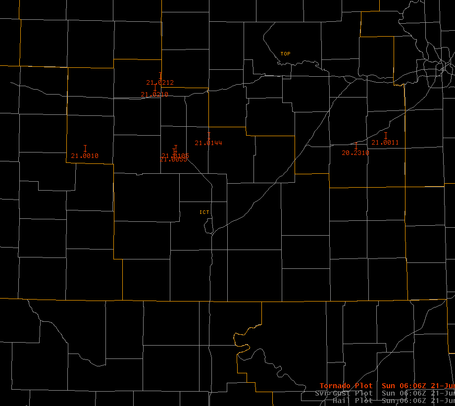
Between 6:00 pm and 9:15 pm cdt on Saturday, June 20th, 2009, as many as 8 tornadoes occurred in Central kansas (Figure 1). Six of those tornadoes occurred in the NWS Wichita CWA, with two occurring in the NWS Topeka CWA. Very minor damage was reported in Great Bend, and damage also occurred 7 miles west of Durham in Marion County. Other reports of severe wind gusts and thunderstorm wind damage accompanied the storms as they moved across Central kansas Saturday evening. The tornadic storms occurred within a subtropical moisture environment (with precipitable water values of around 2 inches), on the northwest periphery of a mid-upper level ridge centered over the Gulf Coast States. Subtropical environments can often be more subtle in terms of anticipating tornadoes compared to the more classic supercell environments with the "loaded gun" soundings.
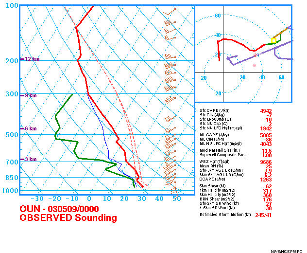
Figure 2 (below) depicts a surface map analysis at 2300 UTC, June 20th, 2009. A low pressure center was located just to the northwest of Elkhart, Kansas with a warm front draped eastward from the low across southern Kansas. Surface dewpoints in the lower to middle 70s were pooling just north of the retreating warm front with backed winds from the east-southeast across Central Kansas. Figures 3a and 3b (below) are the 00 UTC June 21st upper air soundings at Dodge City and Topeka, Kansas, respectively. Both soundings depict a very moist subtropical airmass with precipitable water values of greater than 2 inches and "skinny" CAPE profiles but strong deep-layer shear. 0-3 km CAPEs ranging from about 105 to 130 J/KG (conducive for low-level stretching) were observed on the soundings with LCL heights less than 600 m AGL.
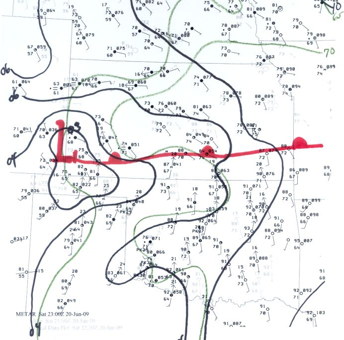 Figure 2 |
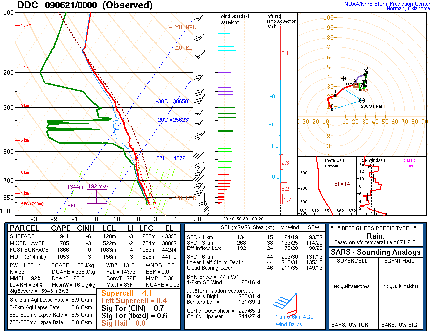 Figure 3a |
Figure 3b |
Figures 4a-c (below) are a composite overlay of water vapor imagery, 500 mb wind profilers (blue), GFS90 500 mb height contours and PV15 pressure, and 15 minute lightning data (white). Between 22:15 UTC on the 20th and 02:15 UTC on the 21st, a weak shortwave can be seen moving northeastward out of the Southern High Plains across Central Kansas, within the very moist subtropical plume on the northwest periphery of the upper high centered along the Gulf States. The profilers show 50-55kt southwesterly winds at 500 mb on the Haviland and Hillsboro wind profiler sites in Southwest and Central Kansas. With backed southeasterly winds of 5 to 10 kt at the surface to the north of the warm front across Central Kansas, the veering wind profile and increasing speeds with height created strong deep layer shear supportive of supercell thunderstorms.
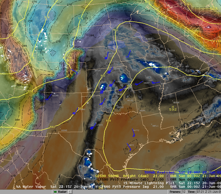 Figure 4a |
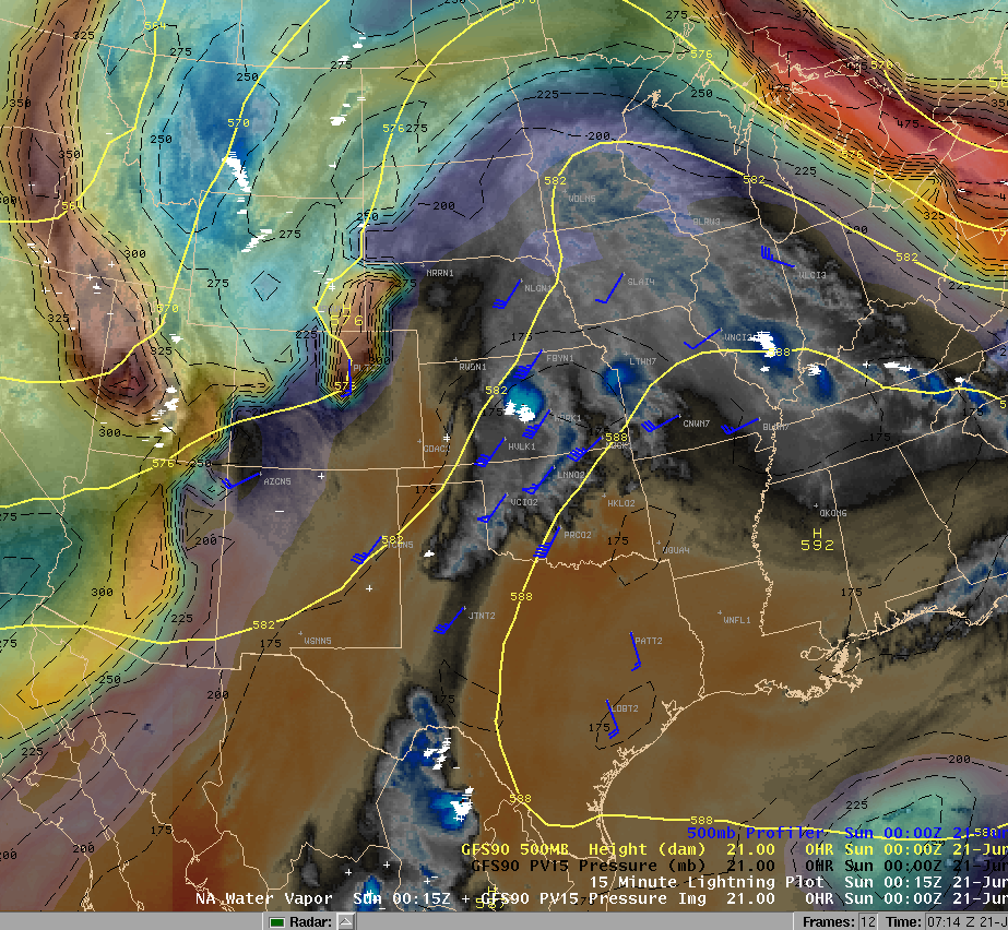 Figure 4b |
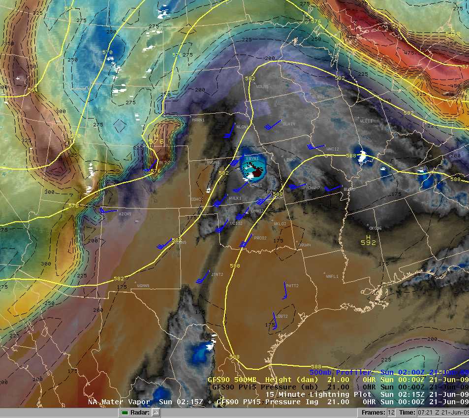 Figure 4c |
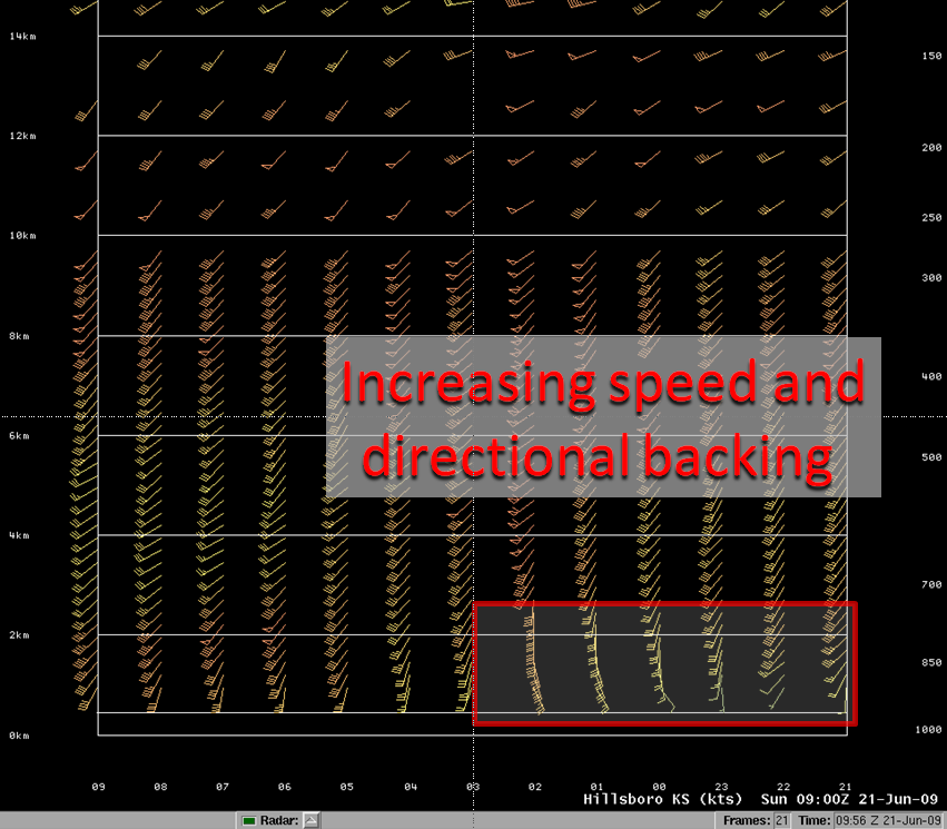
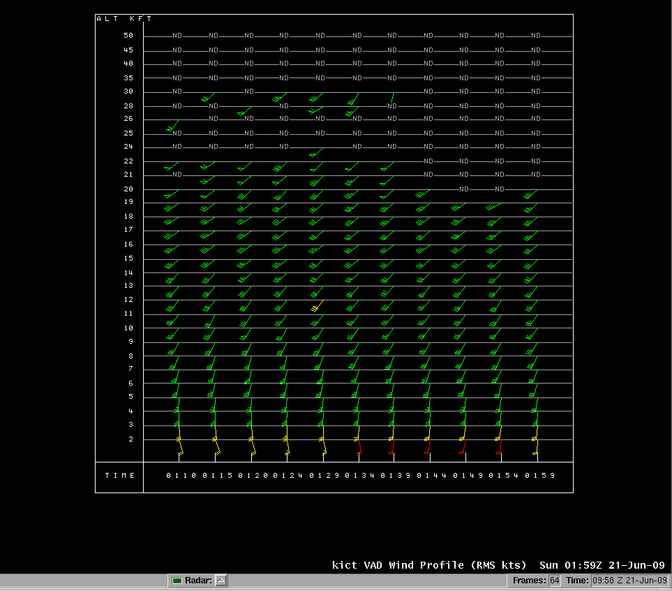
Wind data from Hillsboro profiler site and KICT VAD shows strong backing in the low levels across central Kansas during the early evening hours which made the environment favorable for mesocyclone development. Figure 5a shows the Hillsboro profiler data and Figure 5b shows KICT VAD wind data.
|
Figure 5a |
Figure 5b |
|---|
As pointed out earlier in the 00 UTC soundings at DDC and TOP, low-level CAPE was respectable from Southwest through Central Kansas. Figures 6a-c show a bullseye of 0-3 km MLCAPE centered across Central Kansas where the tornado touchdowns occurred. Values were as high as 200 J/KG at 00 and 01 UTC. In Figures 7a-c, LAPS data from AWIPS showed the LCL height below 500 meters AGL for surface-based parcels. The LCL height for 100 mb mixed-layer parcels via the SPC Mesoanalysis page (not shown here) were equally as impressive around 750 m AGL. The high values of low-level CAPE in conjunction with very low LCL heights would indicate that the environment was conducive for rapid parcel accelerations in the updrafts along with good vertical stretching potential.
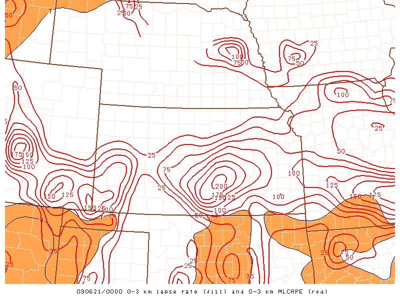 Figure 6a |
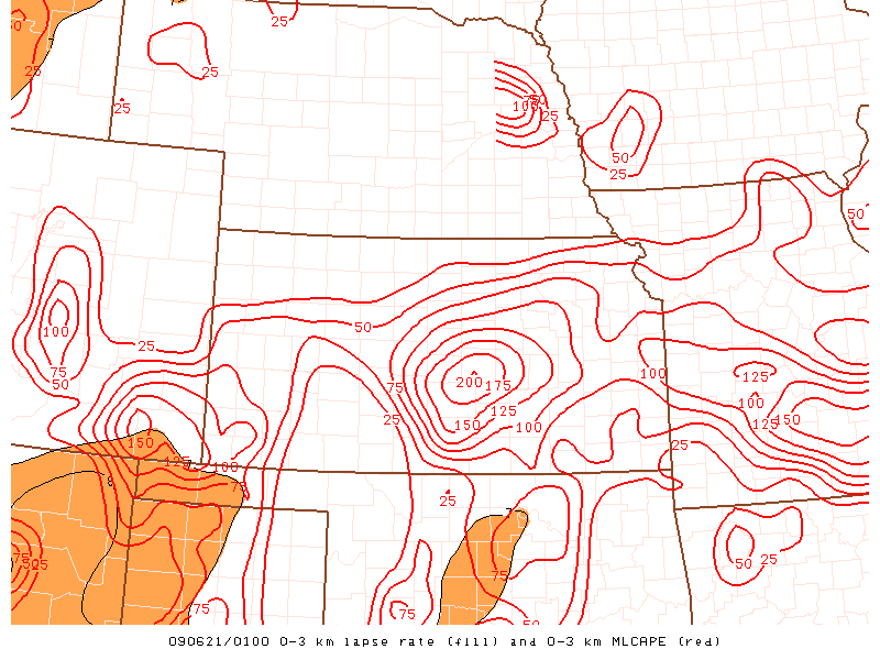 Figure 6b |
.gif) Figure 6c |
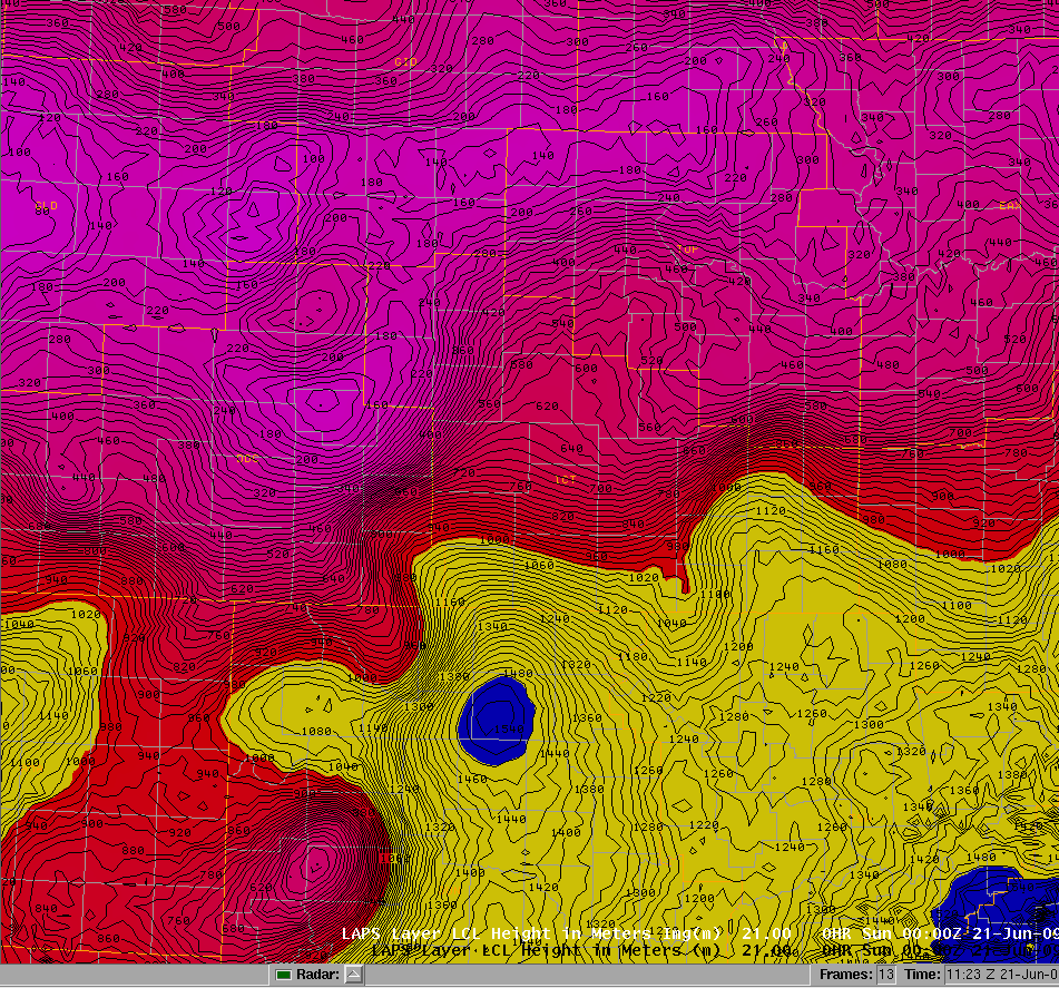 Figure 7a |
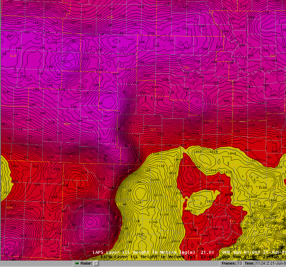 Figure 7b |
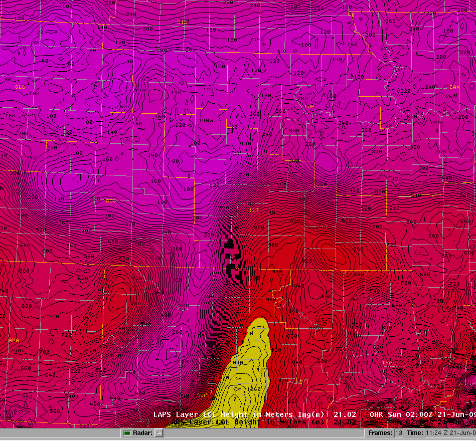 Figure 7c |
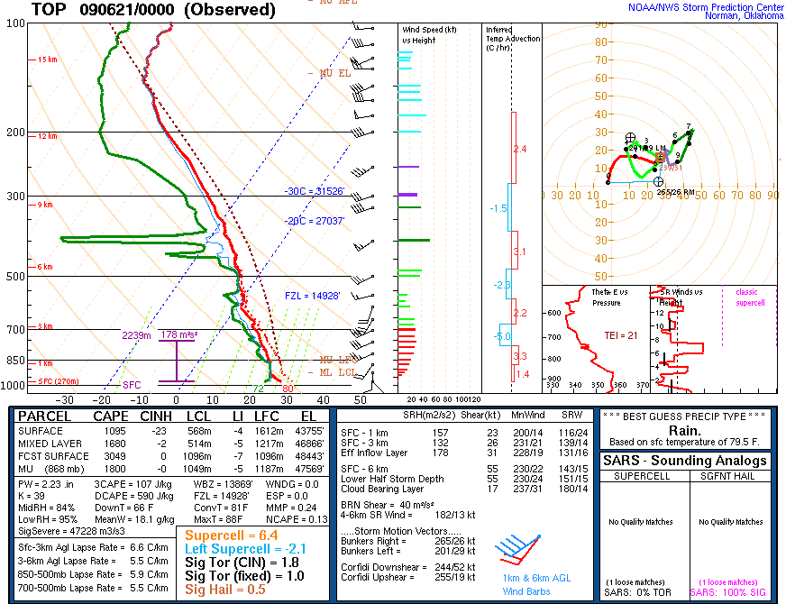
Figures 8a-c below show LAPS soundings in Barton, McPherson, and Marion Counties very close to the times of the reported tornadoes. The soundings confirm the very moist high precipitable water airmass, with strong 0-6 km shear, low LCL heights, and decent CAPE below 700 mb. While SRH values were on the lower side, there was some low-level turning of the winds. The strong low-level CAPE and low LCL heights likely resulted in stronger updraft accelerations and vertical stretching within the updrafts which was sufficient for tornadoes.
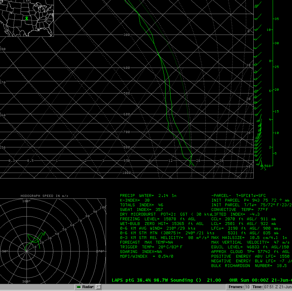 Figure 8a (Barton County 00 UTC) |
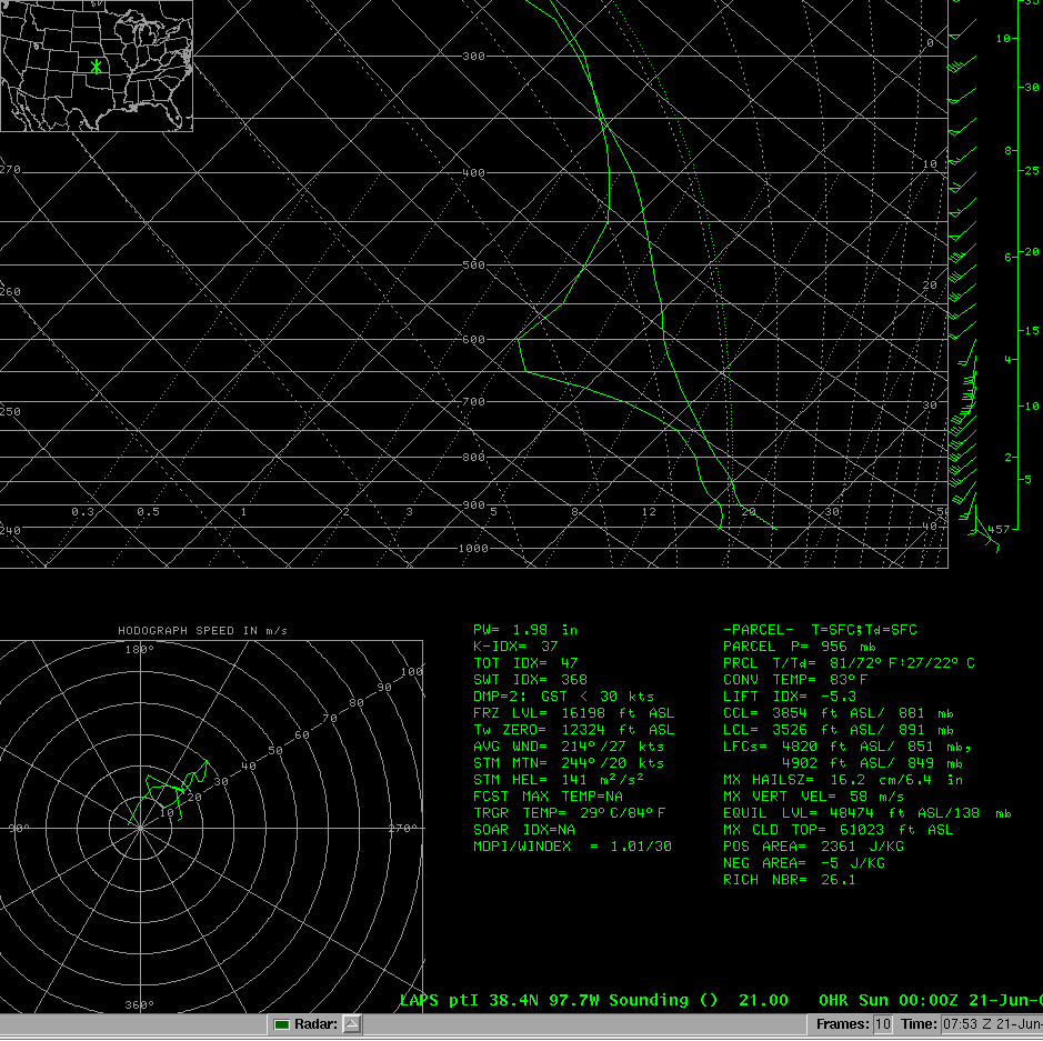 Figure 8b (McPherson County 00 UTC) |
 Figure 8c (Marion County 01 UTC) |
Figure 9 below shows the KICT WSR-88D radar imagery (via GR2Analyst) at 0050 UTC 21 Jun 2009 of a tornadic supercell moving through McPherson County. The left side of the image is the high resolution 0.5 degree base reflectivity while the right side of the image is the corresponding 0.5 degree SRM. A tornado was reported at 0055 UTC about 8 miles north of Inman which is in the vicinity of the highlighted rotation couplet and reflectivity notch on radar. A damage survey by the NWS in Wichita confirmed EF1 damage from this tornado which was on the ground for about 7 miles from about 9 miles west of McPherson to 2.5 miles northwest of McPherson. The path width was estimated at a few hundred feet. All of the other tornadoes that occurred across Central Kansas were rated EF0.
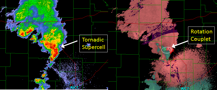
Figure 9
In summary, this informal case review demonstrates the importance of identifying the type of warning environment that is present for potential severe convection. This is necessary in identifying proper plausible outcomes. This was demonstrated in this case as tornadoes were observed in a subtropical environment characterized by subtropical moisture, including "skinny" CAPE sounding profiles.
By doing so, assessing weak shortwaves or MCVs which can enhance deep layer shear, surface boundaries which can enhance low level shear and helicity, LCL heights, and sizeable low-level CAPE which can enhance the vertical streching and updraft acceleration, can be done more effectively as was the result in this case.


 Follow us on YouTube