Powerful supercell thunderstorms erupted along a cold front across Central Kansas during the early evening hours of Wednesday June 11th. These storms quickly became severe as they tracked east producing several tornadoes along with extremely large hail.
Tornadoes with damage were first reported across the Northeast portion of Barton County, around 8 miles north-northwest of Claflin around 640 pm. Initial reports are that there was roof damage along with damage to rural homes and outbuildings. This same storm tracked through Ellsworth County causing damage to trees and power poles.
 Radar image of this storm as it affected Northeast Barton County. |
 Map of tornado touchdowns across Barton County on June 11th. |
|
 Tornado about 2-3 miles southeast of Wilson(Ellsworth County) at around 7 pm. Picture courtesy of Henry Diehl. |
||
A few hours later another intense thunderstorm developed and tracked through Saline County around 9:40 pm producing a tornado. This tornado moved east-northeast with a path length of about 14 miles and a maximum intensity of EF-3.
|
Map showing the tornado path through Saline County. |
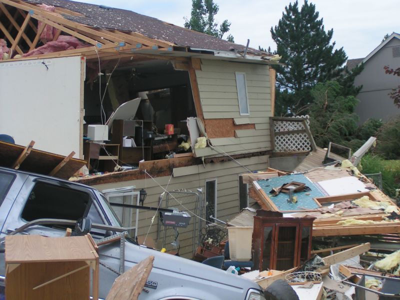
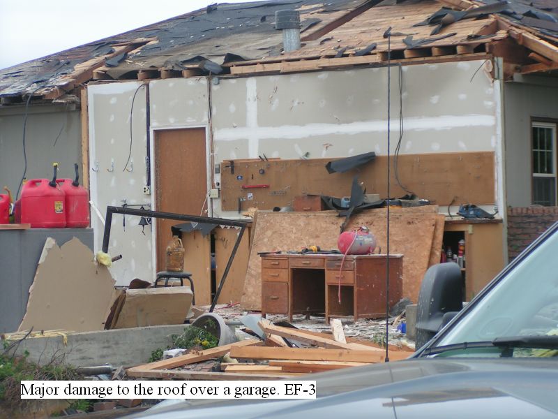
The tornado fist touched down just west of I-135 and just south of the Salina Airport. It then traveled along the southeast outskirts of Salina where it damaged several homes, outbuildings, trees and power lines. EF-3 damage was noted near the intersection of East Shilling Road and South Holmes Road.
| Tornado damage near the intersection of East Shilling Road and South Holmes Road. | ||||
 |
 |
 |
||
 |
 |
 |
||
The tornado continued east of Salina with some EF-2 damage near East Crawford Street and South Whitmore Road. The tornado continued northeast before crossing into Dickinson County, just south of Solomon.
 Tornado damage to a roof of a double wide mobile home. |
 Roof damage to a metal barn around 5 miles east of Salina. |
 Roof damage to a metal barn around 5 miles east of Salina. |
|
|
Damage to an earthen home around 5 miles east of Salina. |
 Damage to a machine shed 5 miles east of Salina. |
||
|
Radar image of the storm that produced tornado damage to the south side of Salina at around 9:40 pm on Wednesday June 11th. |
|||
Fortunately there were no reports of injuries. Along with tornadoes, these powerful storms also produced extremely large hail, some to the size of softballs.
|
Map showing where severe weather occurred during this event. |


