June 17th, 2011 Severe Weather Event
|
A very warm, moist and unstable airmass was present across much of central and eastern Kansas Friday afternoon. High temperatures reached well into the upper 80s and 90s, and dewpoints surged into the low to mid 70s indicating a very moist boundary layer. Moderately strong upper level winds were in place across Kansas which enhanced storm organization and severity. A stationary front extended from northeast Kansas across south central Kansas. During the evening, clusters of severe thunderstorms erupted over central and south central Kansas near this front. These storms initially developed over McPherson county, quickly becoming severe. The storm over McPherson began dropping golfball sized hail. This storm evolved into a damaging wind threat, as a strong corridor of winds moved south from the city of McPherson along interstate I-135. At times the radar velocity signature indicated that 70 to 80 mph were likely with some periods of upwards to 100 mph possible. Again, like the previous day, this storm collapsed and a gust front surged out ahead. Fifty to 60 mph winds were reported south into Harvey and Reno Counties as this gust front moved south. Thunderstorms continued to develop from Reno to Marion county where large hail and damaging winds continued. A storm developed over Marion county, again having a radar signature that indicated extreme wind gusts. The winds from these storms moved south and east into Chase and eventually Bulter and Lyon counties overnight. These storms were very electric with very frequent lightning activity that many people in south central Kansas witnessed. Overnight another round of thunderstorms that developed in western Kansas moved into central Kansas again producing strong winds up to 70 mph and large hail. |
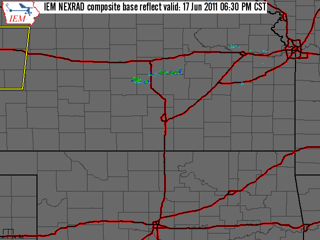
Radar
|
Radar loop starting around 6:30 pm on June 17th and ending around 4 am on June 18th. |
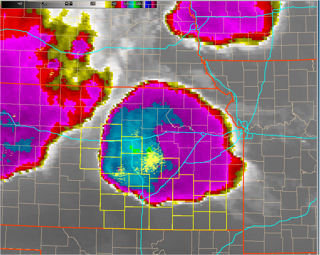
Infrared satellite imagery combined with lightning strikes showing the intense supercell storm over Central Kansas. |
Pictures
.png)
Picture taken by Jim Caruso looking north towards the McPherson supercell. |
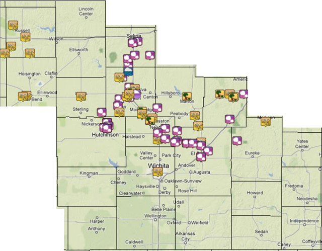
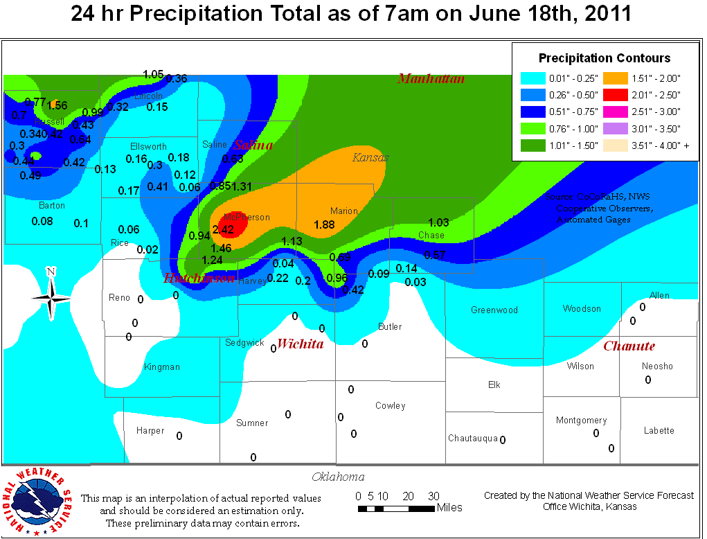
Storm Reports & Precip Map
|
|
|