
High winds and very dry conditions will bring extremely critical fire weather over a large part of New Mexico today. Red Flag and High Wind Warnings have been issued. Isolated to scattered severe thunderstorms may produce large to very large hail and localized damaging winds late this afternoon into evening from the eastern Central Plains to the Upper Midwest. Read More >
The newest addition to the Great Lakes Portal is a page dedicated to the swimming hazards on the Great Lakes. www.weather.gov/greatlakes/beachhazards
The Great Lakes Beach Hazards page was created to be a one-stop-shop for water safety partners and beachgoers that includes Great Lakes-specific beach forecasts and statements, statistics on current-related incidents, and beach safety information. A brief page tutorial follows:
Instructions for using the page can be found below.
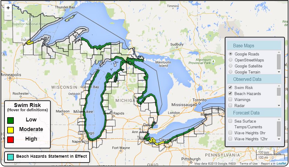
All of the information needed regarding the forecast swim risk on the Great Lakes can be found in the map portion of the page.
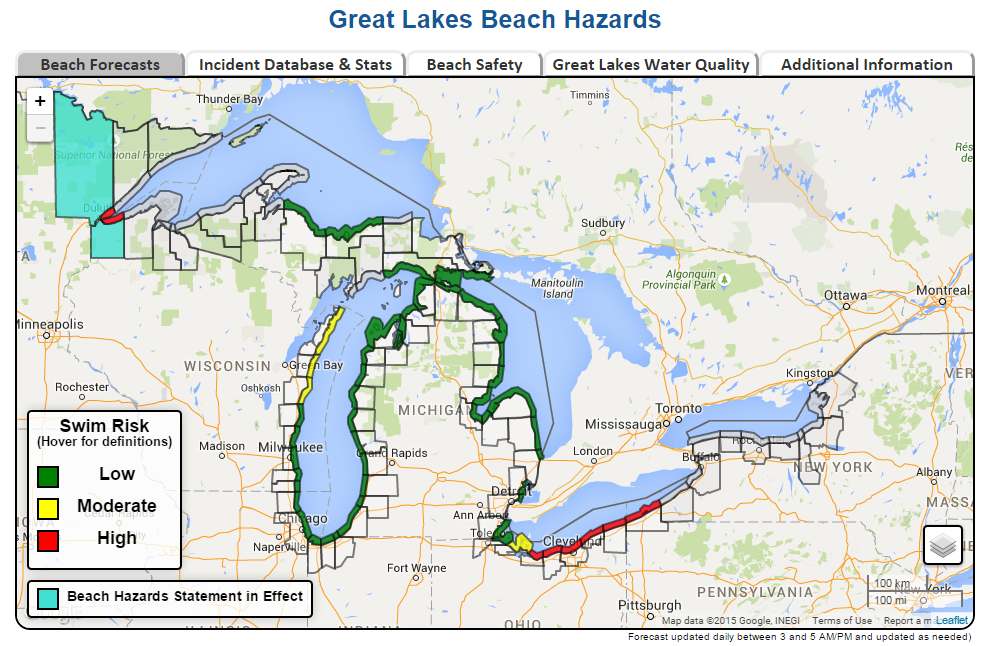
When the cursor hovers over the legend 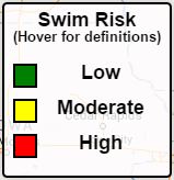 The swim risk definitions appear to the right.
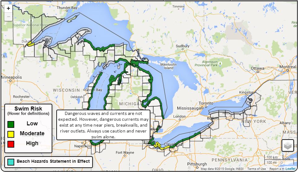
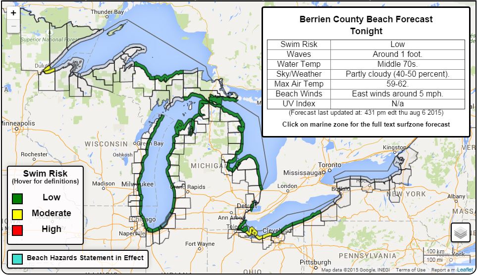
When the cursor hovers over a specific swim zone on the Great Lakes, a table pops up with the swimming conditions. When the zone is clicked, the text surfzone forecast will open in a new window.
When the cursor hovers over this button,  there are several overlays available including wave heights, winds, temperatures, and more.
In addition to the forecast information available on the homepage, the Great Lakes Current Incident database can be reached by clicking the
 tab. The Great Lakes Current Incident Database is a record of current-related incidents on the Great Lakes from 2002-present.
The below map is what appears when this tab is clicked. To search the database, click on the link below the map in the gray box. Questions about this data should be relayed to megan.dodson@noaa.gov. The map is updated after each swim season (around October 1st), but statistics in the database are updated as incidents occur.
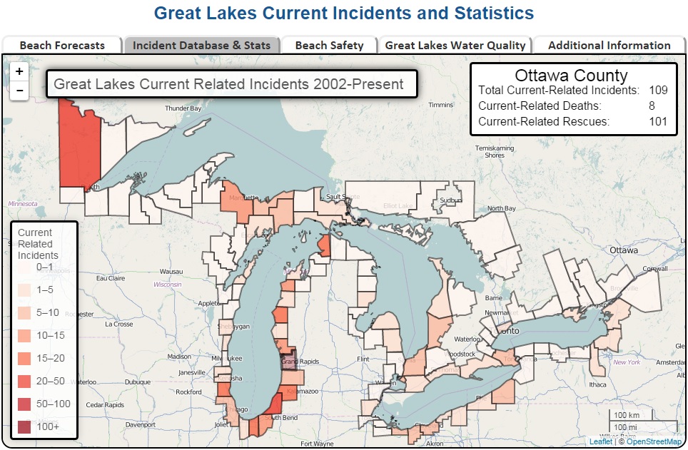
When the cursor hovers over a county, the number of total current-related incidents (combined deaths and rescues) in that county will appear in a table. Summarized data for each swim season will be available soon, with updates made annually after each swim season.
Learn more about the different beach hazards swimmers face on the Great Lakes, by clicking on the Beach Safety Tab. The Beach Safety Tab provides information about dangerous currents and waves, the UV Index, and more. Information from "About Waves & Currents" is shown below:

Additional information regarding beach safety is available from national pages and our water safety partners, under the Additional information Tab.
Learn about conditions that impact water quality on the Great Lakes, like Harmful Algal Blooms, under the Great Lakes Water Quality tab.
This page is built for YOU, the customer! If you have any feedback related to the page, please email evan.bentley@noaa.gov or megan.dodson@noaa.gov. Thank you for visiting our page!

