
Gusty winds are expected from portions of the Mid-Atlantic into the Northeast through the night following the system that brought rain to the area. An atmospheric river will move into the Northwest late today into Saturday bringing moderate to heavy rainfall, mountain snow, windy conditions, and high surf to the area over the weekend. Read More >
Overview:
|
A powerful low pressure system passed through the Central Plains between Sunday, Jan. 21st and Monday, Jan. 22, 2018. This resulted in a fairly classic winter storm for much of the NWS Hastings coverage area, along with at least a few hours of near-blizzard to blizzard conditions, thanks to sustained northwest winds commonly 30-40 MPH and gusting to 50+ MPH, resulting in visibility commonly 1/2 to 1/4 mile or less. For places such as the Tri Cities, these were the first legitimate blizzard/white-out conditions in nearly two years, since the Groundhog Day storm of early-Feb. 2016. For the majority of the area, the overall-worst conditions occurred sometime between 4AM-4PM on the 22nd, resulting in treacherous travel due to blowing and drifting snow, sporadic power outages and a few road closures. Snow eventually departed the far eastern fringes of the local area along Highway 81 by around 6 PM. Although snow totals fell short of forecasted expectations in the Tri Cities (especially at Kearney and Hastings), Grand Island still established new daily precipitation and snowfall records for Jan. 22. The new snow record of 7.4"easily beat the previous mark of 3.0" set in 1915, and the new precipitation record of 0.86" crushed the previous mark of 0.35" from 1982. |
 NWS Radar loop from 10:30 PM on Jan. 21 through 6 PM on Jan. 22. The NWS Hastings coverage area is within the orange outlined area labeled "GID" and Interstate highways are the red lines. |
Snowfall Map/Table and Wind Gust Table (Jan. 21-22, 2018):
(the table of storm total snow amounts below was compiled from a combination of reports from NWS Cooperative Observers and the Community Collaborative Rain, Hail & Snow Network (CoCoRaHS))

| Storm-Total Snowfall (Jan. 21-22) | |
| Location | Snowfall (inches) |
| Belgrade | 14.0 |
| St. Paul | 13.8 |
| Greeley 6WNW | 13.0 |
| Greeley | 12.1 |
| Shelby 3NE | 11.1 |
| Osceola | 10.5 |
| Ord | 10.3 |
| Loup City | 9.0 |
| Grand Island (airport) | 7.4 |
| Ravenna | 6.8 |
| Plainville, KS (4 miles WNW) | 6.3 |
| Natoma, KS | 5.0 |
| Wilsonville, NE | 5.0 |
| York 3N | 4.8 |
| Hastings (NWS office) | 3.6 |
| Kearney (airport) | 3.6 |
| Peak Wind Gusts (area airports) | |
| Location | Wind Gust (mph) |
| Hastings | 58 |
| Grand Island | 54 |
| Ord | 53 |
| Aurora | 52 |
Photos:
 |
 |
 |
 |
| Silver Creek, NE photo by Megan Renee |
Central City, NE photo by Jen Krupa |
St. Paul, NE photo by Lori Patsios |
Shelby (5NE), NE photo by Alicia Mills |
 |
 |
 |
 |
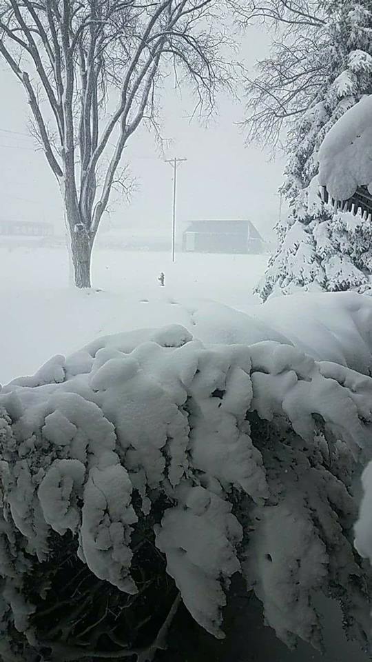
| Arcadia, NE photo by Scott Philbrick |
Worms, NE photo by Dave Nort |
Northwest of Central City photo by Jennifer Mohn Kenny |
St. Paul photo by Lori Patsios |
 |
Media use of NWS Web News Stories is encouraged! Please acknowledge the NWS as the source of any news information accessed from this site. |
|

