
Widespread life-threatening flash and urban flooding continues in south-central Texas, with considerable flooding impacts possible across central Texas. Wildfire smoke is impacting air quality across much of the Great Lakes region into southern New England and the Mid-Atlantic. Monsoonal thunderstorms may produce isolated to scattered flash flooding across the Southwest into the Great Basin. Read More >
Last Map Update: Fri, Jul 17, 2026 at 12:00:13 pm PDT
|
Text Product Selector (Selected product opens in current window)
|
|


 KBHX Radar
 Satellite
 Weather Map
 Forecast Weather Tables
 Monthly Past Weather Graphs
 Yearly Past Weather
 Become A Rain/Snow/Hail Observer
 TsunamiReady
 Water Temperatures for NW California
 NW CA Mtn Pass Forecasts
 NW CA Daily Graphicast
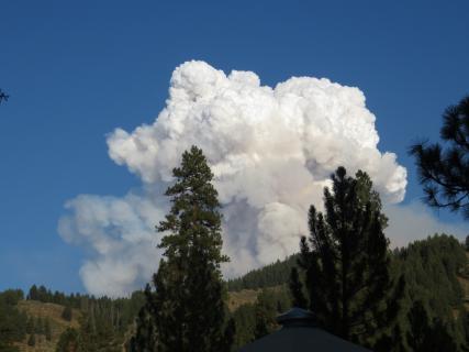 Area Smoke Forecast
 Drought Monitor
 Air Quality
 Winter Weather
 Probabilistic QPF Experiment
 Submit a Storm Report