| Latest Briefing | Weather Story | Forecast Discussion | NWPS Page |
| ~ ~ ~ All Sites ~ ~ ~ |
| Maquoketa & Wapsipinicon |
| ~ ~ ~ Cedar ~ ~ ~ |
| English & Iowa |
| Skunk, Des Moines, & Fox |
| ~ ~ ~ Mississippi ~ ~ ~ |
| Pecatonica, Rock, Green, & La Moine |
| ~ ~ ~ More Information ~ ~ ~ |
| Cedar River | Green River | Mississippi River | Pecatonica River | ||||
 |
Waterloo | 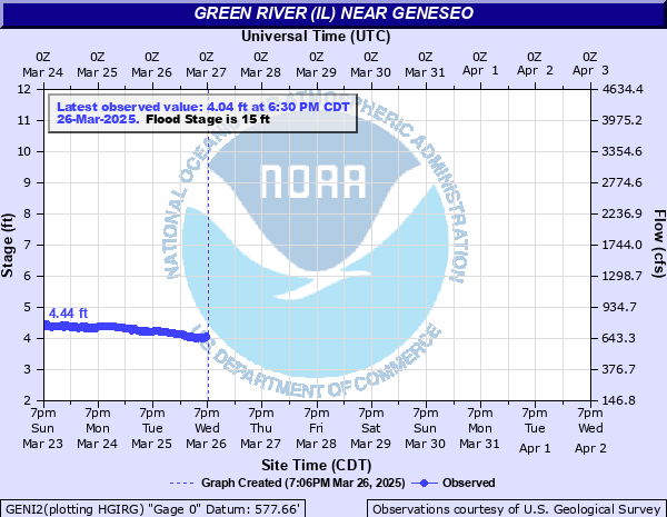 |
Geneseo | 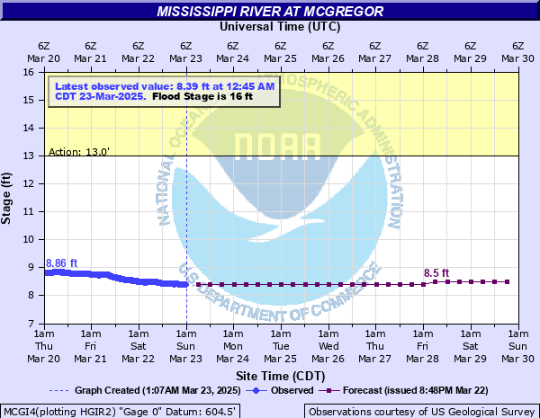 |
McGregor | 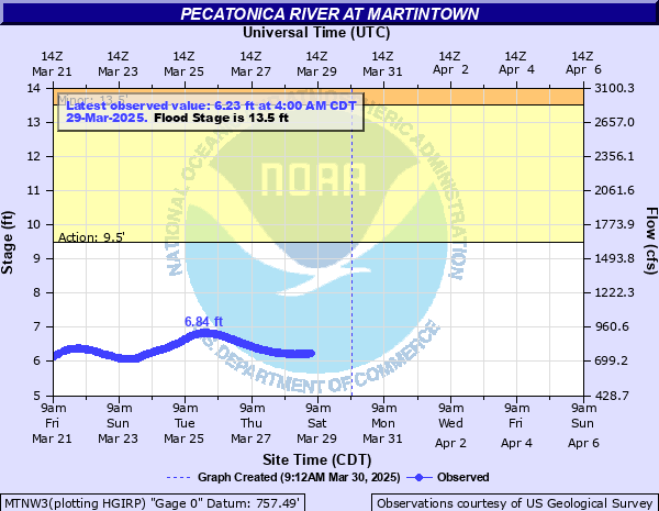 |
Martintown |
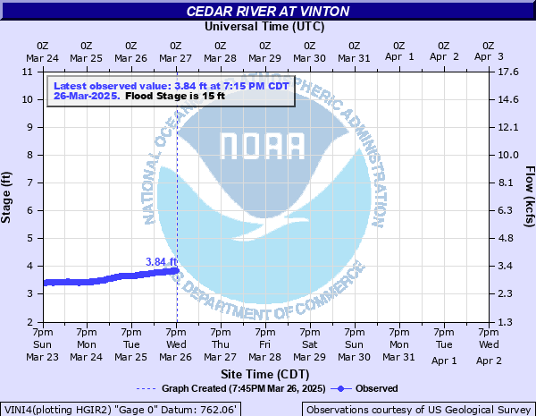 |
Vinton | 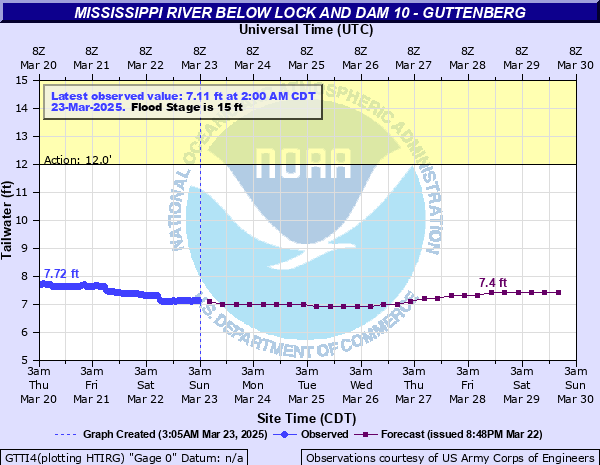 |
Guttenburg | 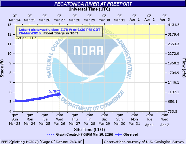 |
Freeport | ||
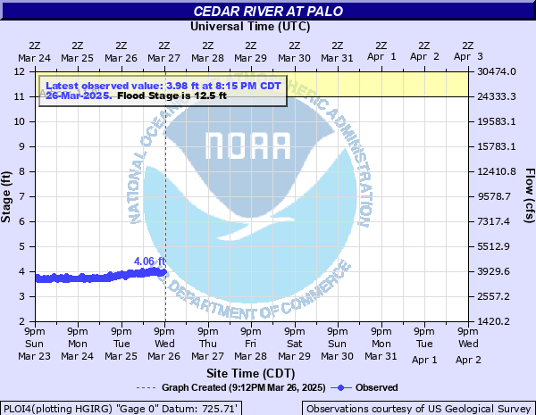 |
Palo | Iowa River | 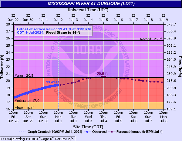 |
Dubuque LD11 | |||
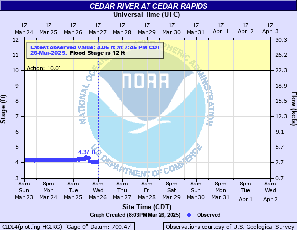 |
Cedar Rapids |  |
Marshalltown | 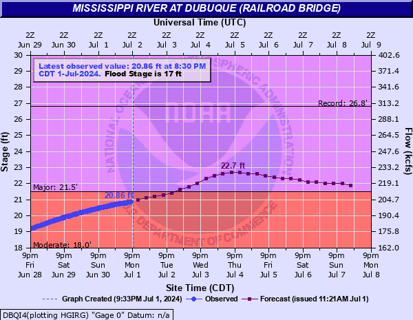 |
Dubuque RR Bridge | Rock River | |
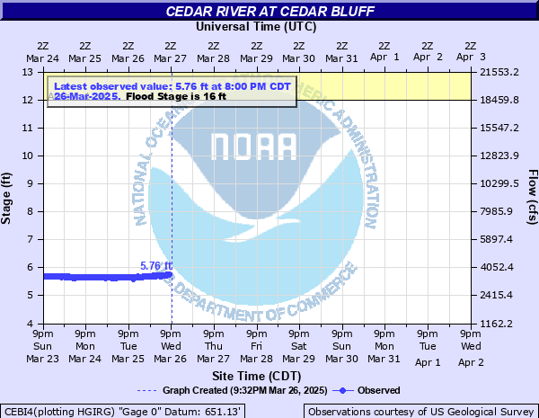 |
Cedar Bluff |  |
Tama | 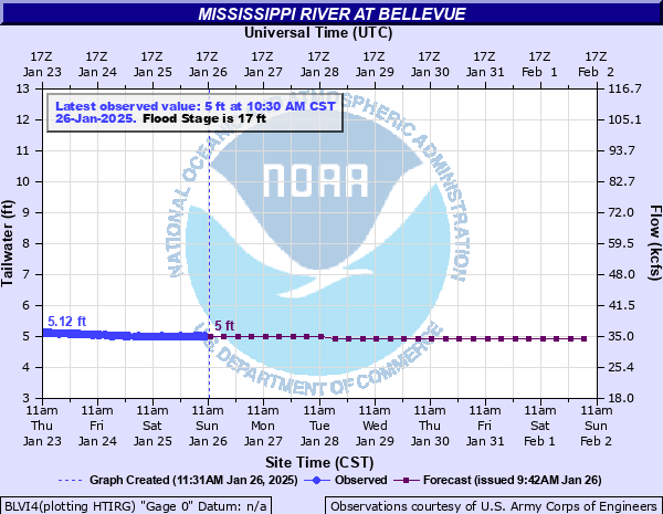 |
Bellevue | 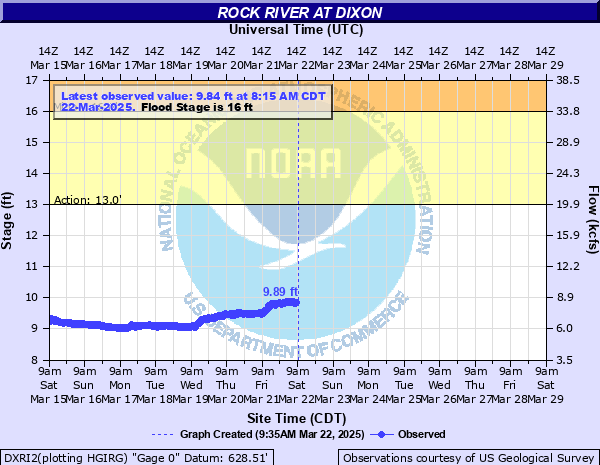 |
Dixon |
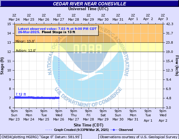 |
Conesville | 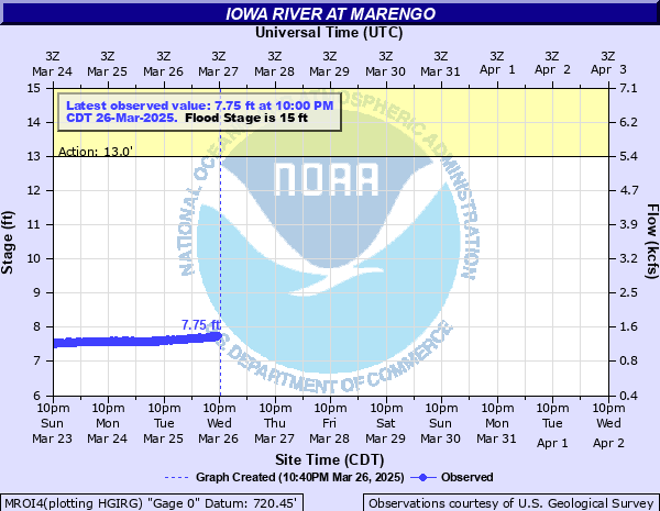 |
Marengo | 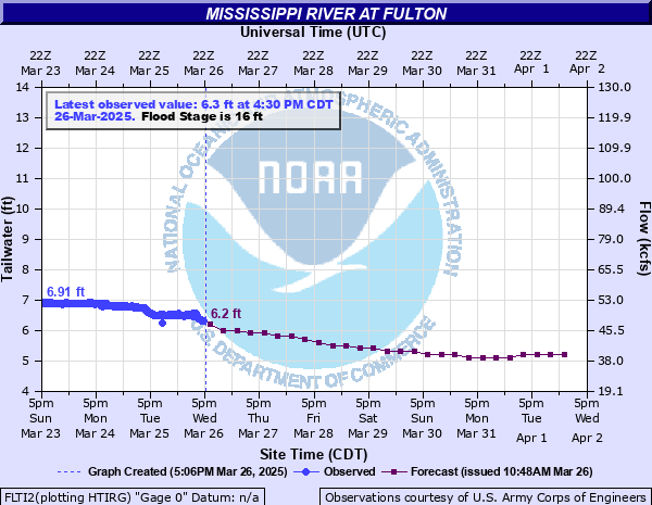 |
Fulton | 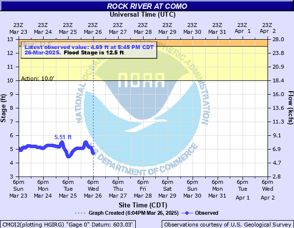 |
Como |
 |
Iowa City | 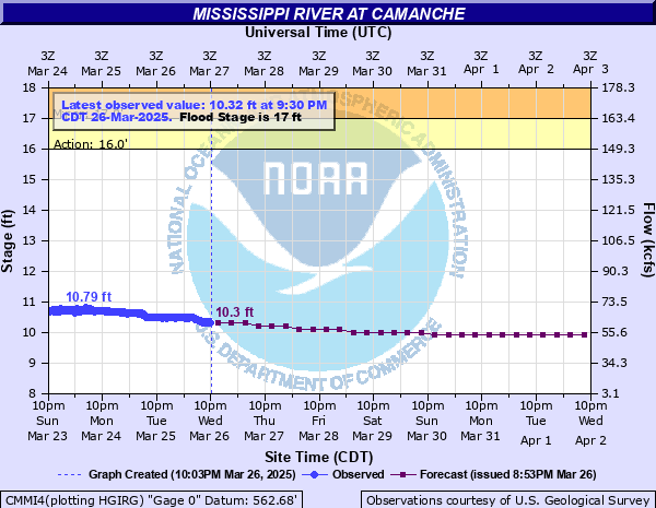 |
Camanche | 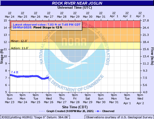 |
Joslin | ||
| Des Moines River | 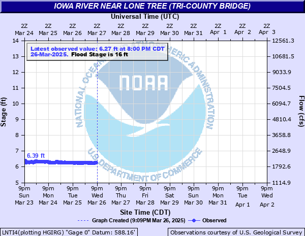 |
Lone Tree | 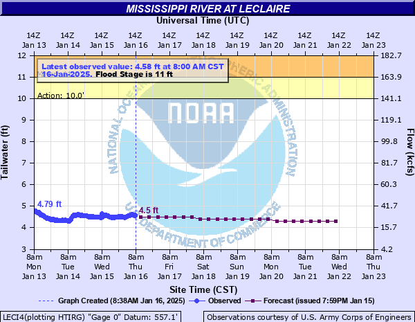 |
Le Claire | 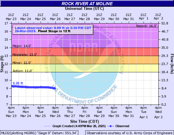 |
Moline | |
 |
Eddyville | 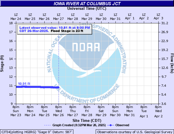 |
Columbus Jct | 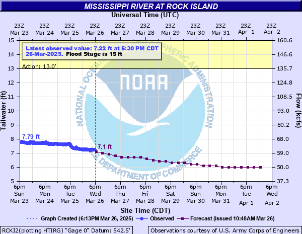 |
Rock Island | ||
 |
Ottumwa | 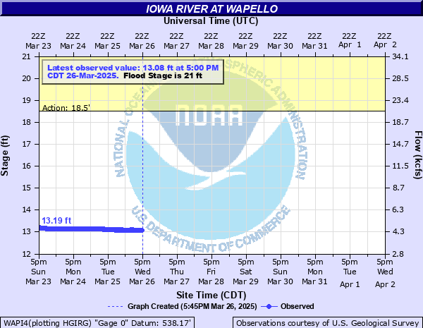 |
Wapello | 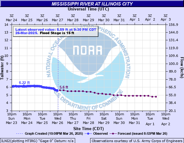 |
Illinois City | Skunk River | |
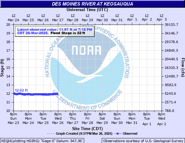 |
Keosauqua | 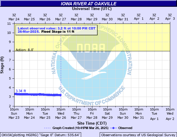 |
Oakville | 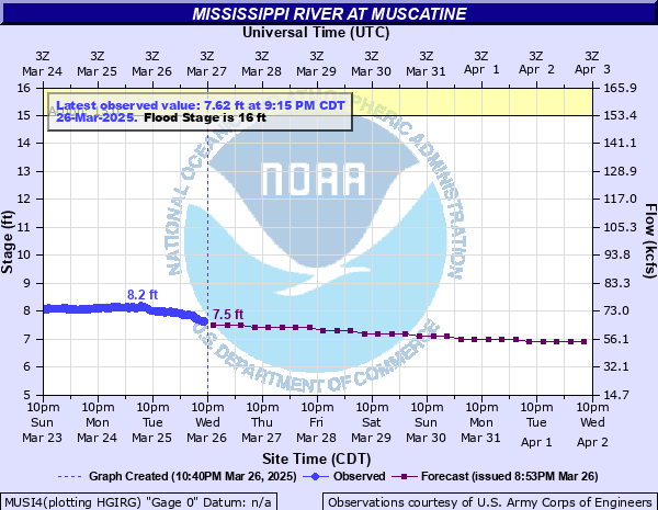 |
Muscatine | 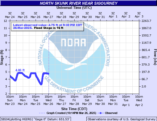 |
Sigourney |
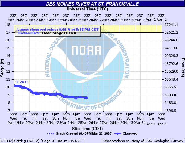 |
St. Francisville | 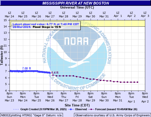 |
New Boston | 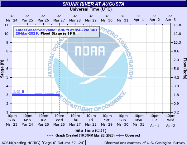 |
Augusta | ||
| La Moine River | 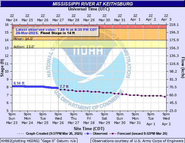 |
Keithsburg | |||||
| English River | 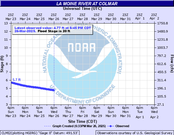 |
Colmar | 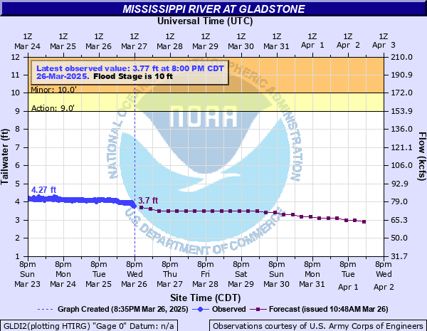 |
Gladstone | Wapsipinicon River | ||
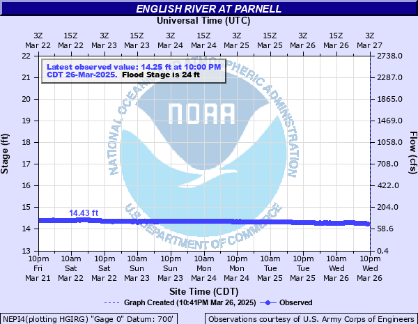 |
Parnell |  |
Ripley | 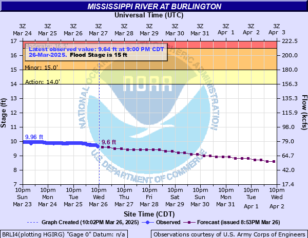 |
Burlington | 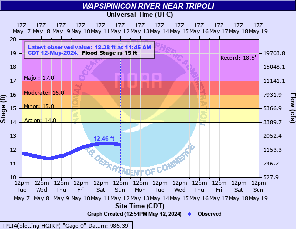 |
Tripoli |
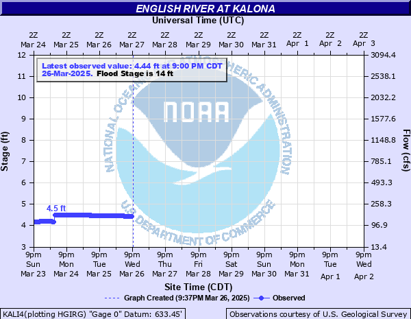 |
Kalona | 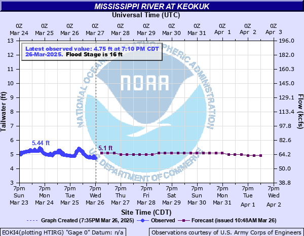 |
Keokuk | 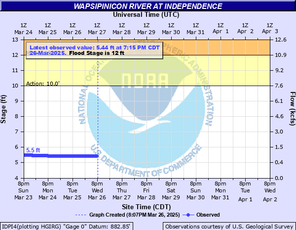 |
Independence | ||
| Maquoketa River | 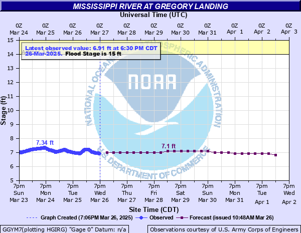 |
Gregory Landing | 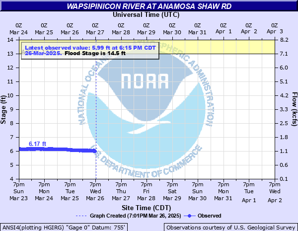 |
Anamosa Shaw Rd | |||
| Fox River | 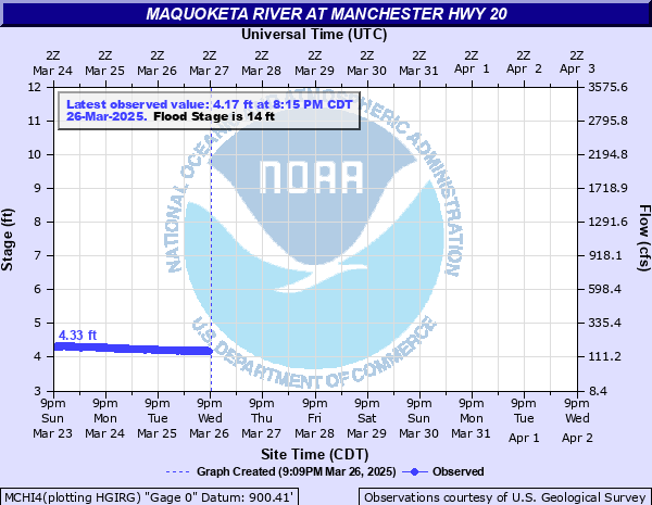 |
Manchester Hwy20 |  |
Canton | 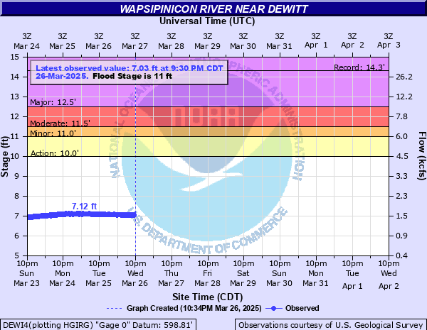 |
De Witt | |
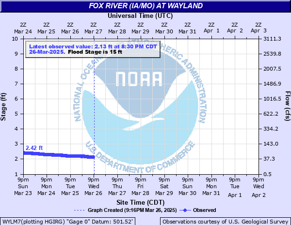 |
Wayland | 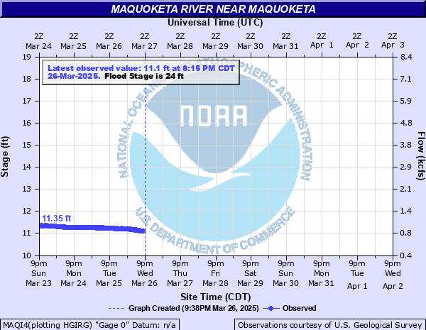 |
Maquoketa | ||||
|
|||||||||||||||||||||||||||||||||||
|
|||||||||||||||||||||
|
||||||||||||||||||||||||||||||||||||||||||
|
||||||||||||||||||||||||||||||||||||||||||
|
||||||||||||||||||||||||||||||||||||||||||||||||||||||||
| AHPS Page / Map | |||||
| River Level Summary | |||||
| River Level Forecast | |||||
| River Flood Information | |||||
Flood safety and flood insurance information:
Precipitation, temperature, and soil moisture information:
|
|
|||||||||||||||||||||||||
|
|
|||||||
| Local Watches & Warnings | Snow Cover & Water Content | Soil Moisture | Regional 24 Hour Rainfall | ||||
 |
 |
||||||
|
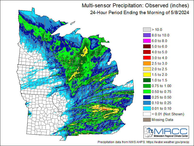
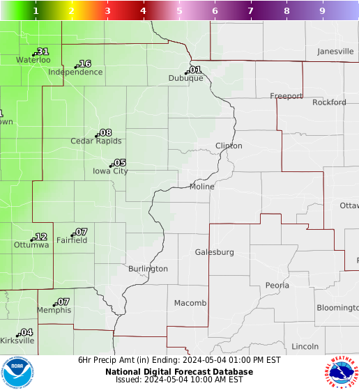
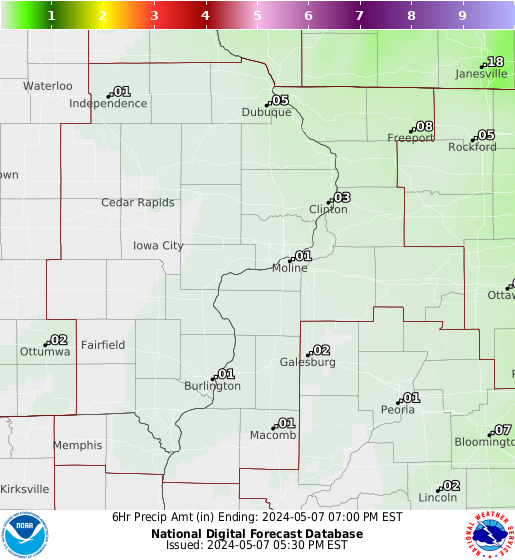
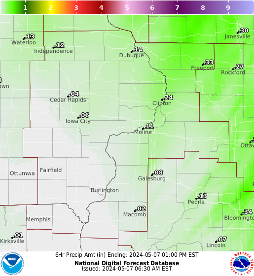
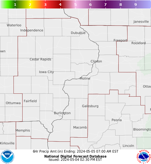
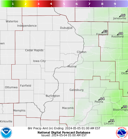
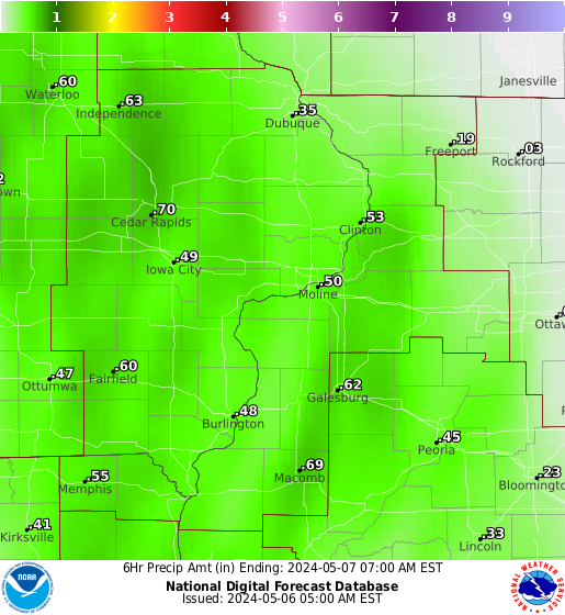
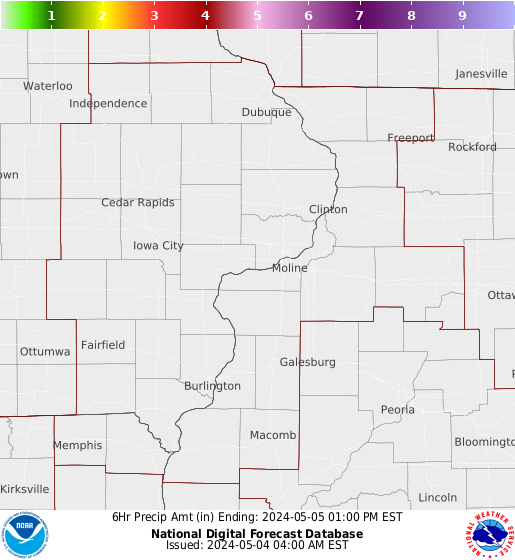
Forecast Rainfall Amounts The graphics below are for 6 hour rainfall amounts, from the most current time to 48 hours. |
|||||||
| 0 - 6 Hours | 6 - 12 Hours | 12 - 18 Hours | 18 - 24 Hours | 24 - 30 Hours | 30 - 36 Hours | 36 - 42 Hours | 42 - 48 Hours |
 |
 |
 |
 |
 |
 |
 |
 |
|
|
|||||||