NWS All NOAA
Duluth, MN
Weather Forecast Office
Fire Weather Briefing
1. Past & Current Conditions
MesoWest: Current and Past Conditions
Precipitation Summary (Radar Estimated)
Observed Soundings
Upper Level Maps
Surface Fronts/Analysis
SPC Mesoanalysis
Satellite Images: NOAA / College of DuPage
Radar: MN and WI (zoomable radar map for all of MN & WI, including local radars)
Upper Mississippi Loop with Watches/Warnings
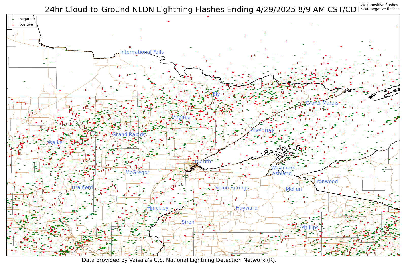
Past Lightning Strikes: MN (NE & NC) and WI (NW) (past 8 days of lightning strikes in the Northland)
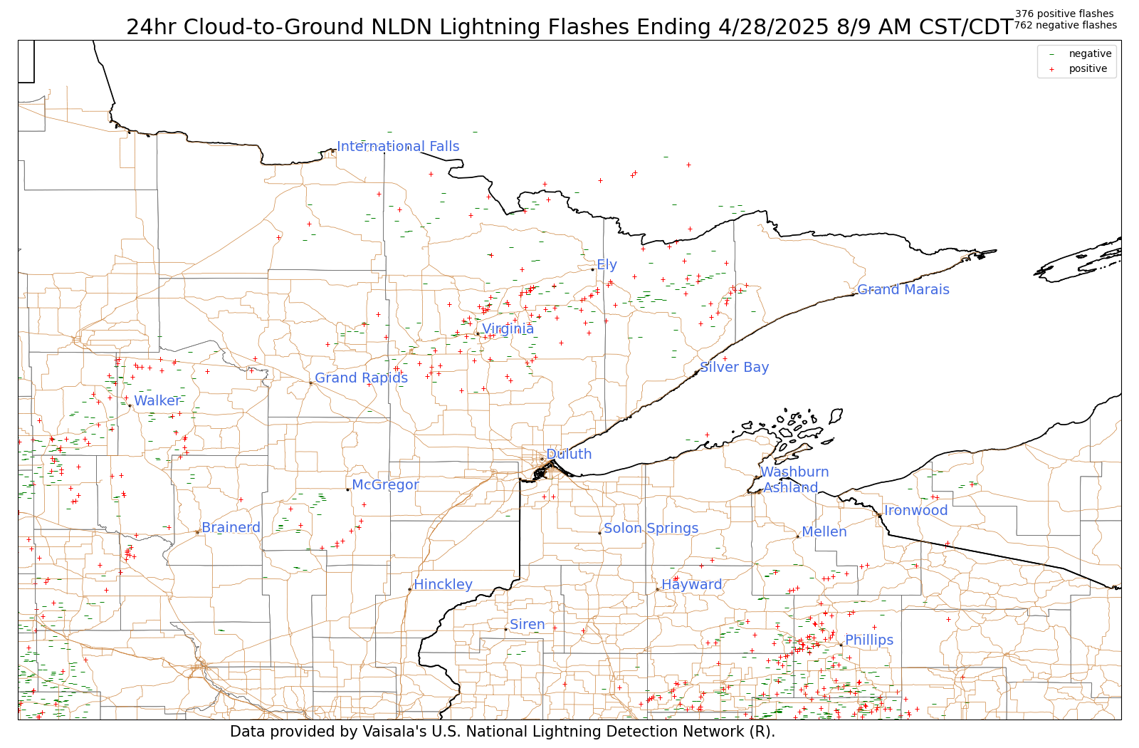
Lightning Strikes 1 Day Ago
2. Forecasts
NWS National Fire Weather Page
NWS Graphical Forecasts
Local NWS Offices: Grand Forks / Twin Cities / Duluth / La Crosse / Aberdeen / Sioux Falls
Click on area of Map to be directed to that local NWS Office
Surface Fronts - 7 Day Loop
3. Outlooks
Precipitation Outlooks
Today
Tomorrow
Day 3
Days 4 & 5
6-10 Day Temp/Precip Outlook
8-14 Day Temp/Precip Outlook
8-14 Day Fire Weather Anomaly Forecasts
SPC Thunderstorm Outlooks
Today (Day 1)
Tomorrow (Day 2)
SPC Critical Fire Weather Outlooks
Days 3-8
Climate Prediction Center
Climate Normals
Past Weather Data
Drought Monitor (Updated Thursdays)
Air Quality Index for MN
IMET Briefing Page
Problems/Questions, Contact: nws.duluth@noaa.gov


