| Operating Plans |
|
|
| Fire Danger Assessment Information |
|
Click on map to see larger version.
|
National Fire Danger
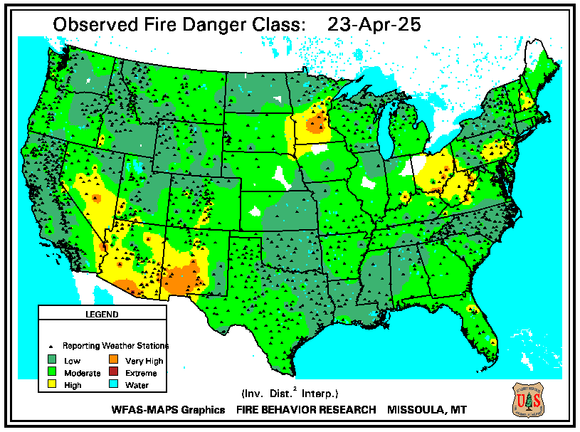
|
Maine Fire Danger

|
SPC Fire Outlook

|
Keetch-Byram Drought Index
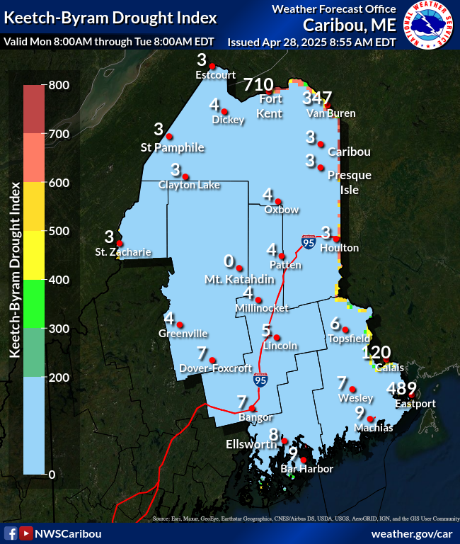
|
10-hour Fuel Moisture
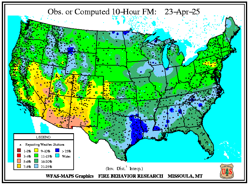
|
100-hour Fuel Moisture
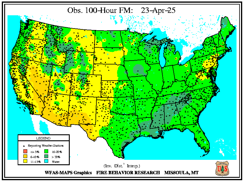
|
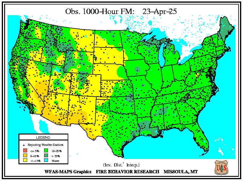
1000-hour Fuel Moisture
|
1-month EDDI Categories

|
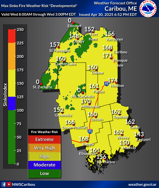
Day 1 SFWR Index (Developmental)
|
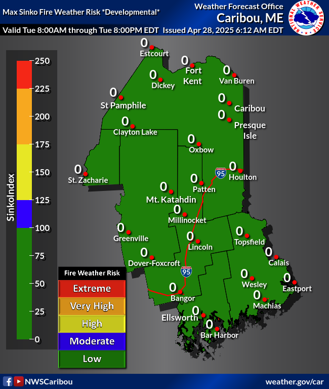
Day 2 SFWR Index
(Developmental)
|
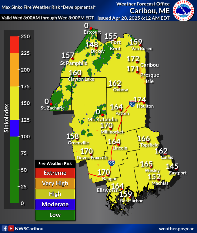
Day 3 SFWR Index
(Developmental)
|
Day 1 Maine SFWR Index (Developmental)

|
Day 2 Maine SFWR Index (Developmental)

|
Day 3 Maine SFWR Index (Developmental)

|
|
|
This tool is Developmental and is NOT operationally supported.
Sinko Index Description
Other Maps
|
| Forecast Information for Preparation and Planning |
Fire Weather Matrix

|
Graphical Fire Forecast

|
National Forecast Maps
|
Weather Planner

|
|
| For point forecasts, enter your location in the box at the top left or click your location on the map on our home page. |
| Narrative Discussions
Text Forecast Products
|
| Current Conditions and Information |
Caribou Radar Loop
|
Current Observations Map

|
MODIS True Color Imagery
.png)
|
Fire Weather Snooper

|
MODIS False Color Imagery

|
Current Satellite Imagery

|
Current Snow Depth

|
|
|
Surface Analysis Maps
Upper Level Analysis Maps and Data
|
| Other Information |
| Other National Weather Service Sites
Maine Forest Service
|