National Weather Service United States Department of Commerce


For realtime Pilot Briefings, please call 1-800-WXBRIEF


NWS Products

AWC Products
Graphical Airmet
Sigmets
Icing Graphic
Turbulence Graphic
Convective Graphic
Winds And Temperatures Aloft


Jacksonville CWSU
Atlanta CWSU

SPC Products
Convective Watches
Day 1 Convective Outlook
Day 2 Convective Outlook
Meso Analysis Page

NCEP Products
SE US 6 Hour Winds and Temp
SE US 12 Hour Winds and Temp
SE US 24 Hour Winds and Temp

Real-Time Observations
METAR Observations
1 Columbia Metropolitan Airport
2 Hamilton-Owens Airport
3 Orangeburg Municipal Airport
4 Augusta Bush Field
5 Augusta Daniel Field
6 Shaw Air Force Base
7 McIntire Air National Guard


Pilot Reports
1 Text Pilot Reports
2 Pilot Reports of Icing
3 Pilot Reports of Turbulence
4 Pilot Reports of Sky Conditions

Satellite Imagery
Visible Satellite Imagery
1 Contiguous US Image and Loop
4 Mid-Atlantic Image and Loop
7 East US Image With Overlays


Color Satellite Imagery
1 Contiguous US Image and Loop
4 Mid-Atlantic Image and Loop
 

Infrared Satellite Imagery
1 Contiguous US Image and Loop
4 Mid-Atlantic Image and Loop


Water Vapor Satellite Imagery
1 Contiguous US Image and Loop
4 Mid-Atlantic Image and Loop

 
Radar Imagery
Mid-Atlantic Radar Imagery
1 Columbia
2 Greenville-Spartanburg
2 Raleigh
4 Wilmington
3 Charleston
5 Robins Air Force Base

Latest Aviation Discussion


LAST UPDATED:  932 PM TUESDAY, MARCH 25 2025

.AVIATION /00Z WEDNESDAY THROUGH SUNDAY/...
VFR conditions very likely through the TAF period.

Expect southwest winds to continue through about 05-06z,
followed by a switch to more northwesterly. A low-level jet
developing should provide some shear in the lower levels, but
not expecting it to be strong enough to include in the TAF.
Winds transition to more westerly after about 15z, gusting to
20-25 kts after 18z through the end of the TAF period. Only
periodic few clouds are expected as well. With winds staying
elevated overnight, fog is not expected.

EXTENDED AVIATION OUTLOOK...No widespread aviation hazards 
expected outside of patchy river fog each morning through 
Saturday.


Terminal Aerodrome Forecasts
Columbia Metropolitan
Jim Hamilton-L.B. Owens Airport
Orangeburg Municipal
Augusta Bush Field
Augusta Daniel Field


Tactical Decision Aids (Graphical Representation)
arrowColumbia Metropolitan
arrowJim Hamilton-L.B. Owens Airport
arrowOrangeburg Municipal
arrowAugusta Bush Field
arrowAugusta Daniel Field

FAA Links
Flight Delay Information
Federal Aviation Administration
Notices to Airmen

Pilot Guides
ASOS guide for Pilots
Pilot's Guide to Aviation Weather Services

Airport Information
Columbia Metropolitan
Jim Hamilton-L.B. Owens Airport
Orangeburg Municipal
Augusta Bush Field
Augusta Daniel Field

National Weather Service Links
Aviation Weather Center
Aviation Digital Data Services
Storm Prediction Center
Environmental Prediction Center
Atlanta Center Weather Service Unit
Jacksonville Center Weather Service Unit
National Weather Service


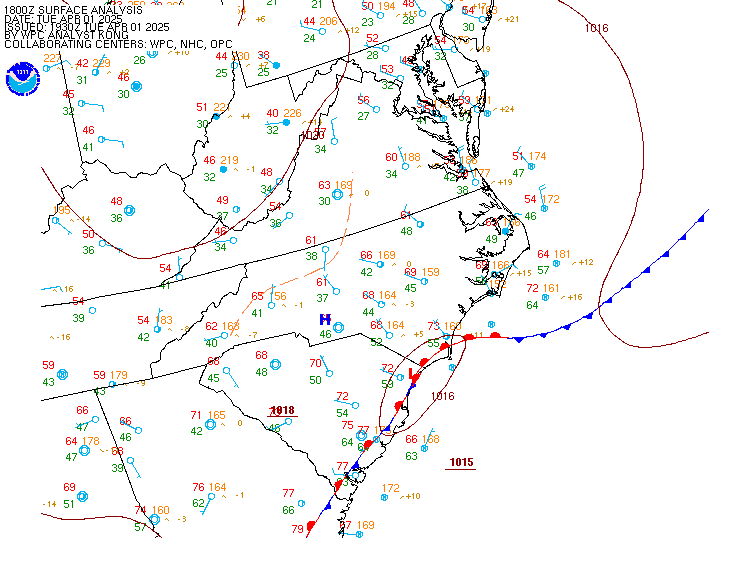
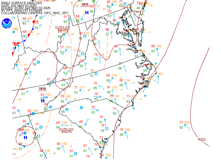
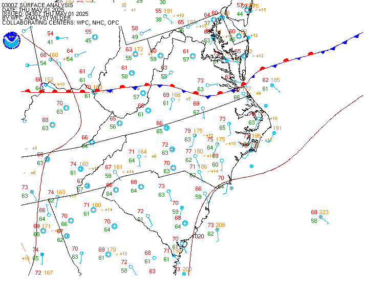
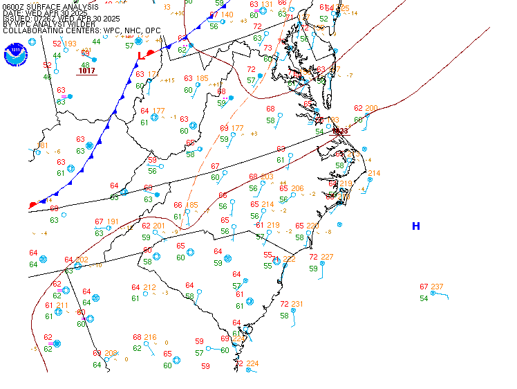
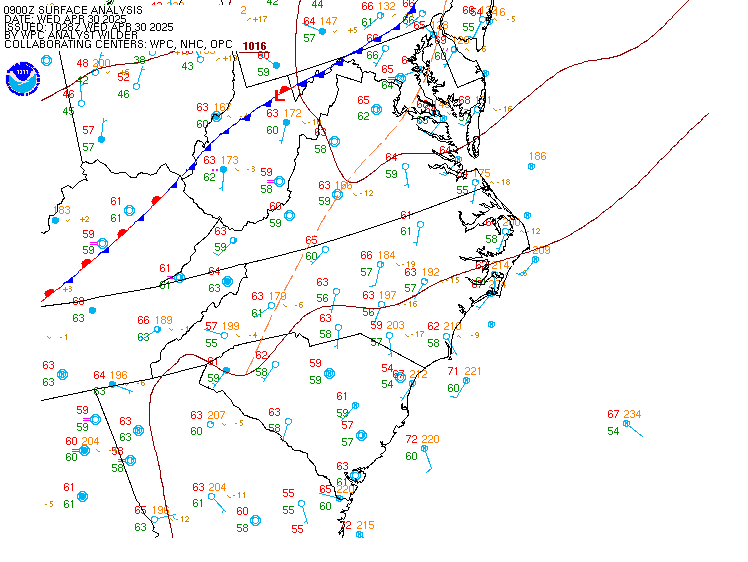
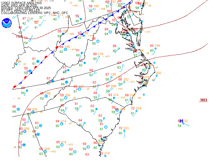
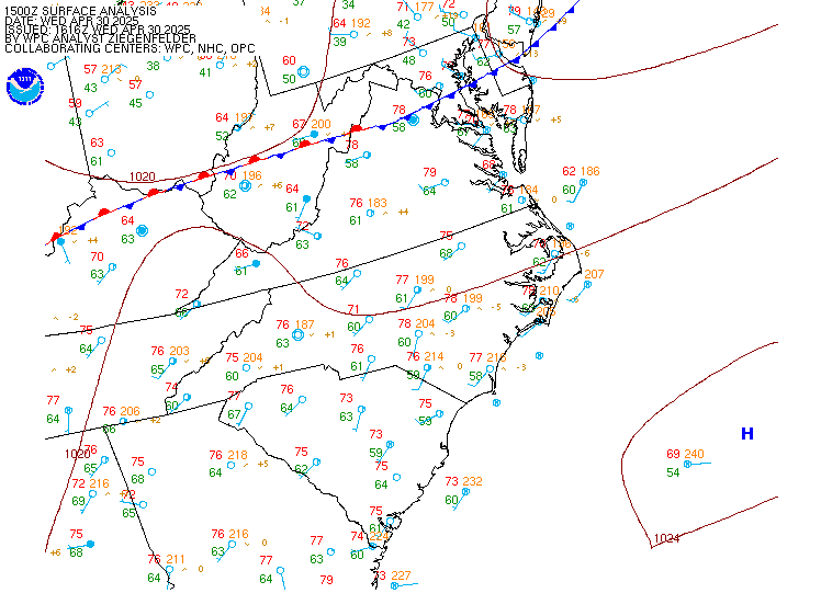
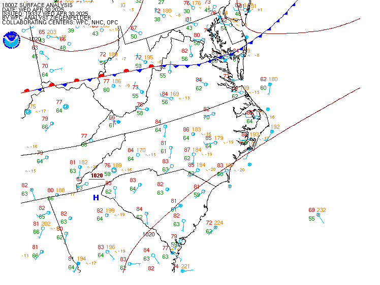
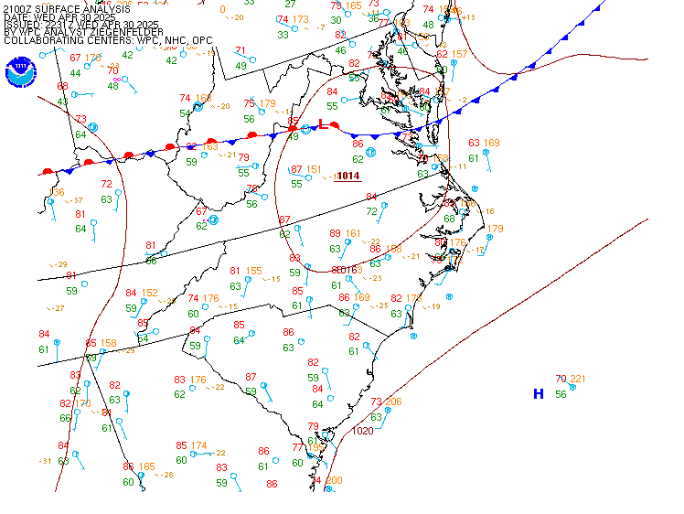
Current and Recent Mid-Atlantic Surface Analyses
For local time, subtract 5 hrs during EST (or 4hrs EDT)
(12Z would be 7 am EST)
| 00Z | 03Z | 06Z | 09Z | 12Z | 15Z | 18Z | 21Z | Other Plots
Click hour to enlarge, or move mouse over links to change images
current analysis map


If you have any comments or questions concerning this page, please contact

the web team.