Columbia, SC
Weather Forecast Office
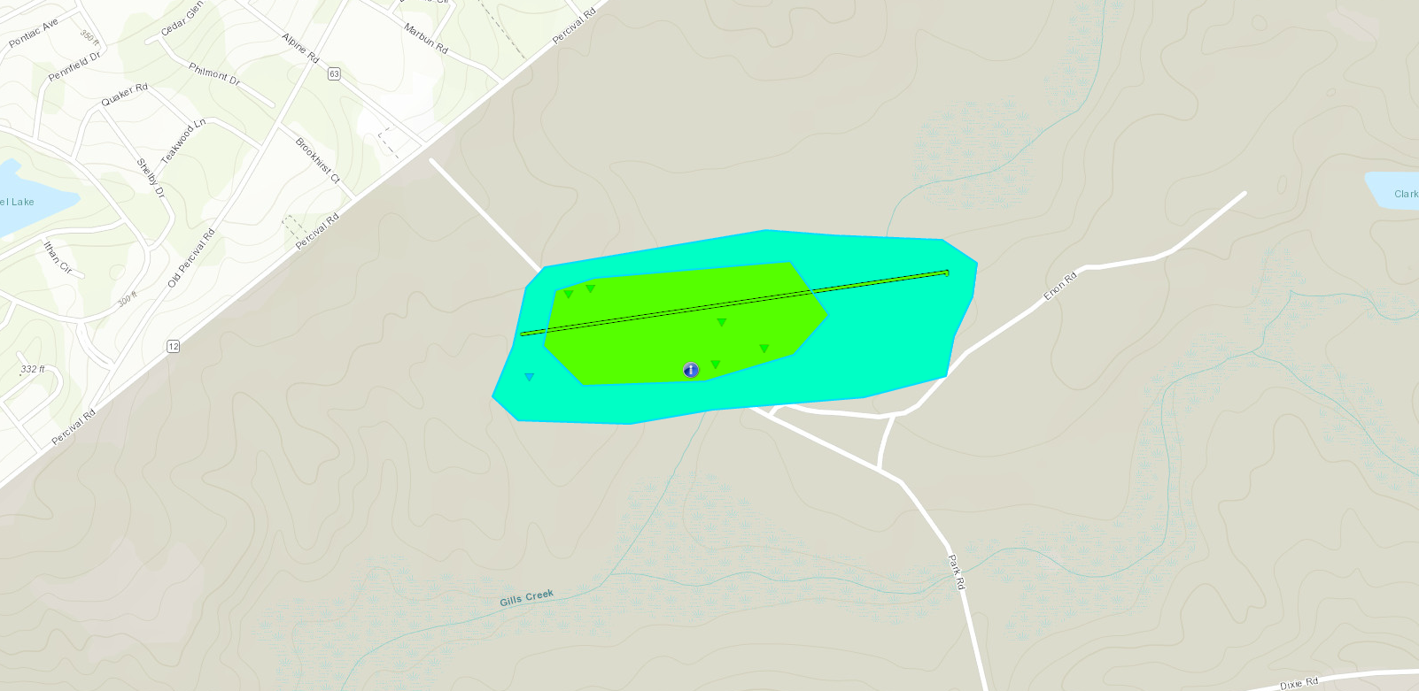
The National Weather Service in Columbia confirmed that an EF1 tornado touched down at Ft.Jackson in South Carolina on March 3rd, 2019.
|
|
Click image for larger view
Fort Jackson personnel surveyed damage on the base and provided the National Weather Service with detailed damage photos which are consistent with a tornado. The tornado uprooted and snapped multiple pine trees in the vicinity of Park Road near Gills Creek. The tornado touched down about half a mile southeast of the intersection of Percival Road and Alpine Road. The tornado path length was approximately 0.6 miles with a width of about 200 yards.
Statistics Summary of the EF-1 Tornado at Ft.Jackson in SC on March 3rd, 2019
| Location | Estimated Start Time | Maximum EF-Scale Rating | Estimated Maximum Wind Speed | Maximum Path Width | Path Length | Fatalities | Injuries |
|---|---|---|---|---|---|---|---|
| Ft.Jackson, SC | 7:33 P | EF1 | 95 MPH | 200 yards | 0.6 miles | 0 | 0 |
*This information is preliminary and subject to change pending final review of the event and publication in NWS Storm Data.
Hazards
Georgia
South Carolina
National Warnings
Hazardous Outlook
Tropical Weather
Weather Briefing
Provide Storm Reports
Email Alerts
Enhanced Hazardous Weather Outlook
GIS
KML/KMZ Data
Shapefile Data
Current Conditions
Observations
Satellite Images
Five Points
River and Lake Levels
River and Lake NWPS
Coop Reports
Lake Observations
Met Calculator
Mesonet Data
Radar
Nationwide
Charlotte TDWR
Columbia Radar
Forecasts
Winter
Activity Planner
Graphic Forecasts
Text Products
Aviation
Marine
Fire Weather
Air Quality
Forecast Discussion
RSS/XML
Experimental FRET
Hydrology
SC Streamflow
GA Streamflow
Drought Info
River and Lakes NWPS
Climate
Climate Plots
National
Local Climo
CoCoRaHs
Weather History Calendar
SERCC
NCEI
US Dept of Commerce
National Oceanic and Atmospheric Administration
National Weather Service
Columbia, SC
2909 Aviation Way
West Columbia, SC 29170-2102
(803) 822-8135
Comments? Questions? Please Contact Us.