HOME
FORECAST
Local
Graphical
Aviation
Marine
Rivers and Lakes
Hurricanes
Severe Weather
Fire Weather
Sunrise/Sunset
Long Range Forecasts
Climate Prediction
Space Weather
PAST WEATHER
Past Weather
Heating/Cooling Days
Monthly Temperatures
Records
Astronomical Data
SAFETY
Tsunamis
Floods
Beach Hazards
Wildfire
Cold
Tornadoes
Fog
Air Quality
Heat
Hurricanes
Lightning
Rip Currents
Safe Boating
Thunderstorms
Space Weather
Sun (Ultraviolet Radiation)
Wind
Drought
Winter Weather
INFORMATION
Wireless Emergency Alerts
Weather-Ready Nation
Brochures
Cooperative Observers
Daily Briefing
Damage/Fatality/Injury Statistics
Forecast Models
GIS Data Portal
NOAA Weather Radio
Publications
SKYWARN Storm Spotters
StormReady
TsunamiReady
Service Change Notices
EDUCATION
Be A Force of Nature
NWS Education Home
NEWS
NWS News
Events
Pubs/Brochures/Booklets
NWS Media Contacts
SEARCH
Search For
NWS
All NOAA
ABOUT
About NWS
Organization
Strategic Plan
For NWS Employees
International
National Centers
Careers
Contact Us
Glossary
Social Media
Local forecast by
"City, St" or ZIP code
Sorry, the location you searched for was not found. Please try another search.
Multiple locations were found. Please select one of the following:
Location Help
News Headlines
Drought Information Statement April 10, 2025
Customize Your
Weather.gov
Enter Your City, ST or ZIP Code
Remember Me
LOADING...
Bismarck, ND
Weather Forecast Office
Hazardous Travel Conditions Continue Across Western and Central ND
Weather.gov
>
Bismarck, ND
> Hazardous Travel Conditions Continue Across Western and Central ND
Current Hazards
Experimental Graphical Hazardous Weather Outlook
Storm and Precipitation Reports
Outlooks
Submit a Storm Report
Current Conditions
Local Ice Accumulation Reports
Satellite
Observed Precipitation
Snowfall Analysis
Observations
Local Storm Reports
Local Snowfall Reports
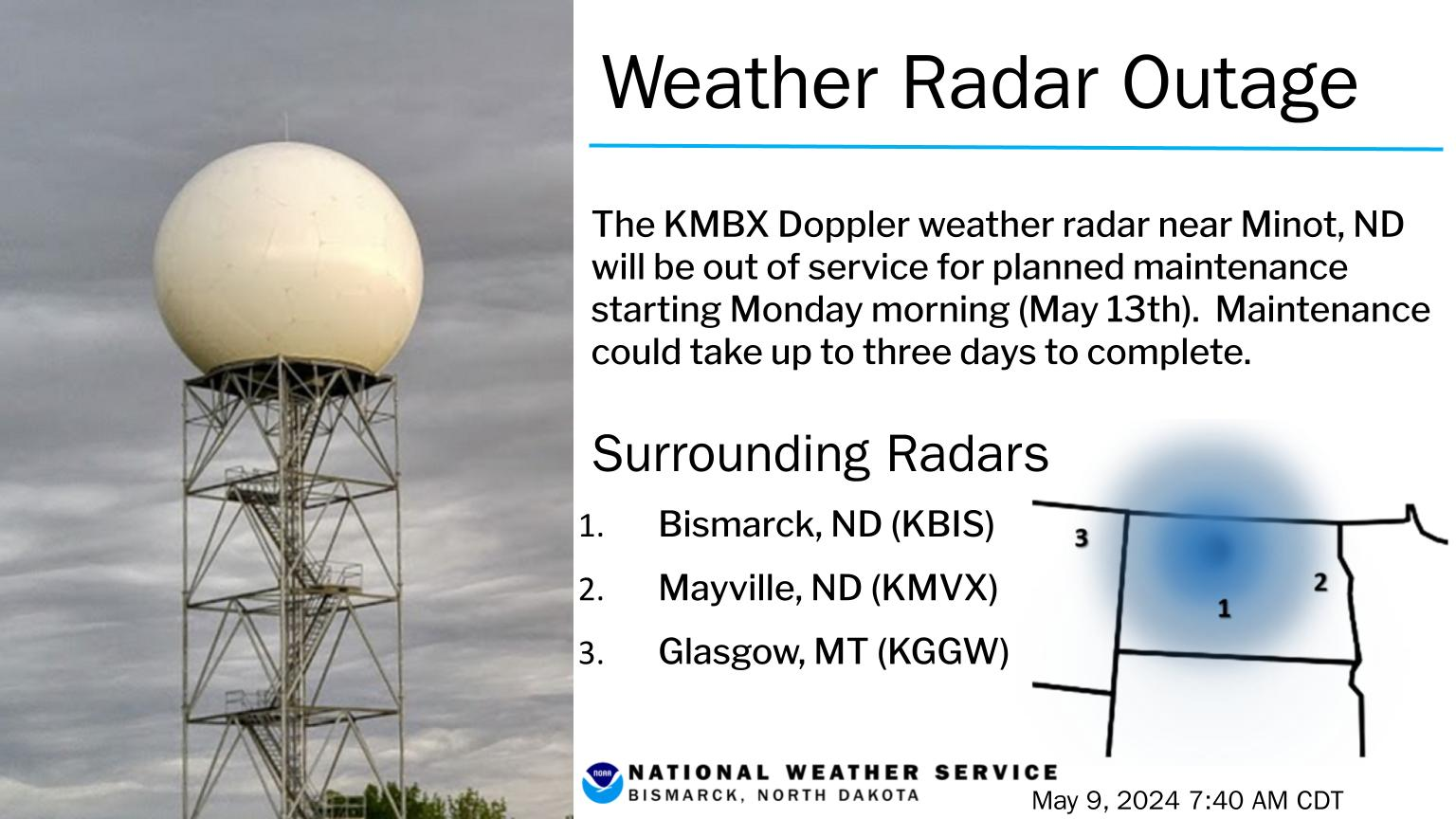
Radar
Local Standard Radar (low bandwidth)
Local Enhanced Radar
Regional Standard Radar (low bandwidth)
Local Standard Radar (low bandwidth) Minot AFB
Williston, ND
Bowman, ND
Forecasts
Experimental Heat Risk
Fire Weather
Hourly Forecasts
Winter Weather
Forecast Discussion
Experimental Probabilistic Quantitative Precipitation Forecast
Rivers and Lakes
National Water Prediction Service (NWPS)
Climate and Past Weather
NOAA Climate Service
Event Summaries
Drought
Local
Local Programs
Publications
Blog
Bismarck Weather Station History
Student Volunteer Information
Lightning Archive
Bismarck Weather Education Center
Aviation Weather
Climate Records and Normals
Climate Top Ten Daily Weather Records
CoCoRaHs
Cold Advisory For Newborn Livestock (CANL)
COOP Program
Farm and Ranch Weather
El Nino and La Nina Information
ND Winter Briefing Page
ND Drought Briefing Page
Severe Weather History
SkyWarn
Storm Data
StormReady
Text Products
Weather Prediction Center
Winter Storm Severity Index
This page will be around all winter and we constantly update it.
BOOKMARK IT! for all your winter weather needs.
Western and Central ND Weather Briefing Page
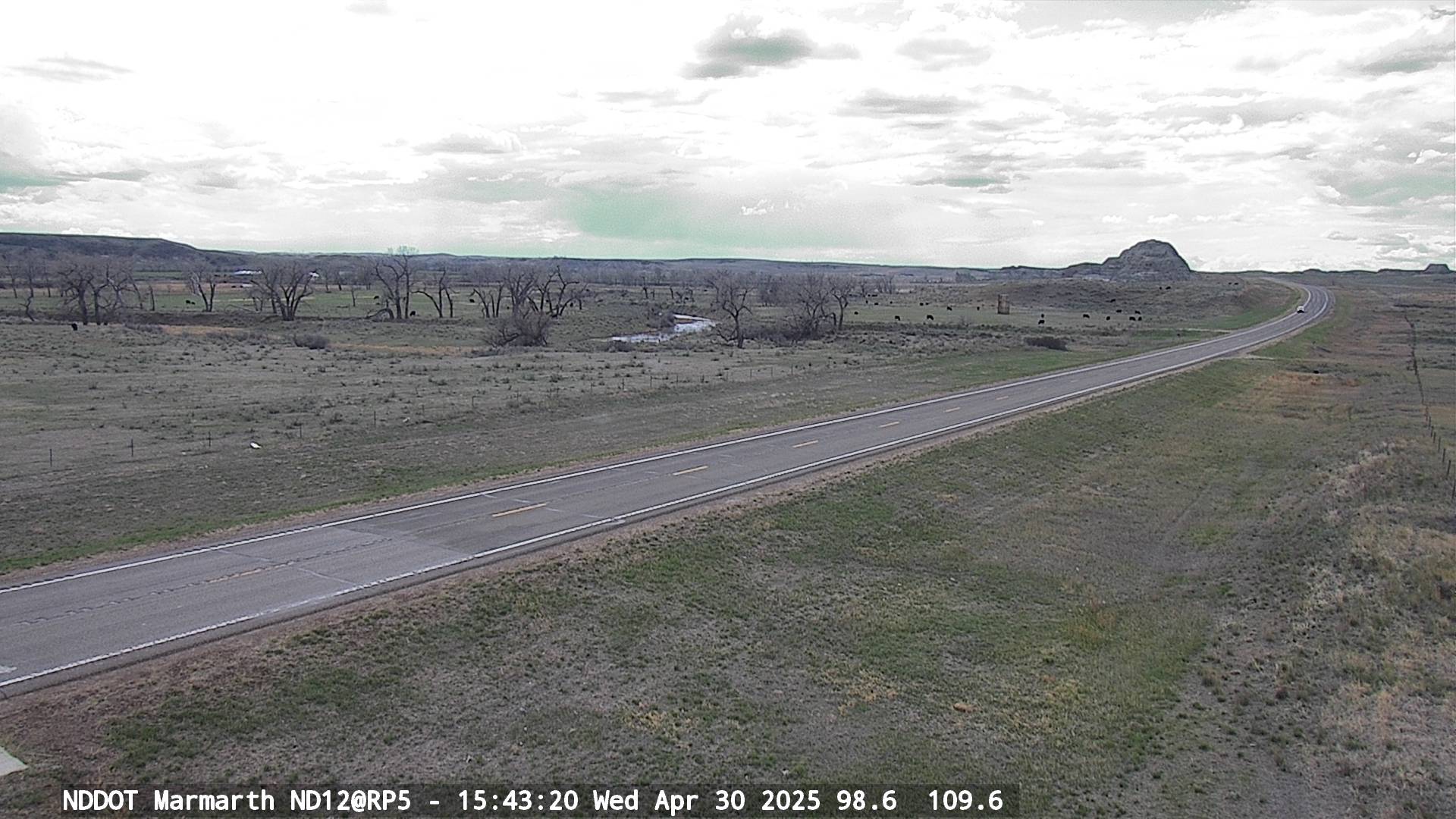
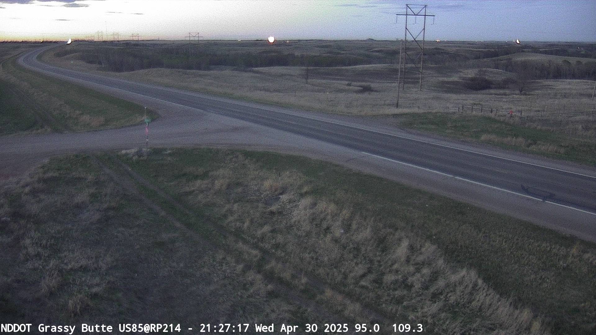
NDDOT Western ND Webcams
(Click to Expand)
Beach
Marmarth
Bowman
Amidon
Trotters 15N
P. Canyon
Grassy Butte
TRNP N
Lost Bridge
Killdeer 4NW
Killdeer
Mott 10 N
Watford City
Dickinson
Gladstone
Manning
Seninel Butte
Belfield 6N
New Town
Williston
NDDOT Central ND Webcams
(Click to Expand)
Ryder
Whiteshield
Portal
Carpio
Westhope
Minot AFB
Kenmare
Bottineau
Garrison Dam
Coleharbor
Blaisdell
Washburn
W. New Salem
Golden Valley
Mandan
Bismarck
Menoken
Sterling
Tappen
Jamestown
Wishek
Kulm
Ashley
Verona
Pettibone
Denhoff
Bowdon
Esmond
Rugby
Dunseith
NDDOT Eastern ND Webcams
(Click to Expand)
Fargo
Grand Forks
Devils Lake
Pembina
Binford
I-29 SD Border
Casselton
Leeds
Drayton
Cavalier
Watches/Warnings/Advisories
Blizzard Warning
Winter Storm Warning
Winter Weather Advisory
Ice Storm Warning
Freezing Rain Advisory
Wind Chill Warning
Blizzard Watch
Winter Storm Watch
Wind Chill Watch
Special Weather Statement
High Wind Watch
High Wind Warning
NDDOT Road Conditions
MN Road Conditions
SD Road Conditions
MT Road Conditions
Current Observations
Storm Reports
Public Information Statement
Observed Highs/Lows/Precipitation
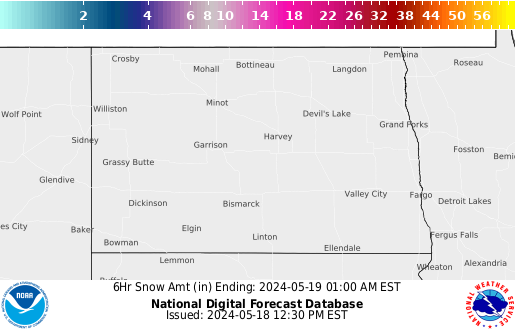
Hours 0-6 Snowfall
Hours 6-12 Snowfall
Hours 12-18 Snowfall
Follow us on X
Follow us on Facebook
Follow us on YouTube
BIS RSS Feed


 Blizzard Warning
 Winter Storm Warning
 Winter Weather Advisory
 Ice Storm Warning
 Freezing Rain Advisory
 Wind Chill Warning
 Blizzard Watch
 Winter Storm Watch
 Special Weather Statement
 High Wind Watch
 High Wind Warning