Overview
|
A strong low pressure system trekking across southern Canada interacted with a weaker secondary low lifting through northern Michigan on January 7. Abundant moisture was in place as this system moved through to allow for an impressive amount of precipitation across the region. On the north side of the low, eastern Upper Michigan received a swath of heavy snow that exceeded a foot in many areas. Strong winds gusting 40 to 50 mph at times also created localized blizzard conditions across portions of eastern Upper, with whiteout conditions and blowing and drifting snow. Somewhat warmer air over northern Lower Michigan supported a messy wintry mix of snow, sleet, freezing rain, and rain which led to sloppy slush-covered roads in many areas. Precipitation lifted into northern Michigan during the evening hours of January 6, overspreading the entire area by the following morning. Heavy snow continued across eastern Upper through the day on the 7th, while the wintry mix over northern Lower transitioned to a period of freezing rain in many areas, resulting in around a tenth of an inch of ice accumulation. Gusty southeast winds, combined with the icing and heavy, wet snowfall, led to isolated power outages across eastern Upper and northern Lower Michigan during the day. Precipitation tapered off and winds diminished by late evening. |
 Radar loop of the January 6-7, 2019 winter storm |
Snowfall Map
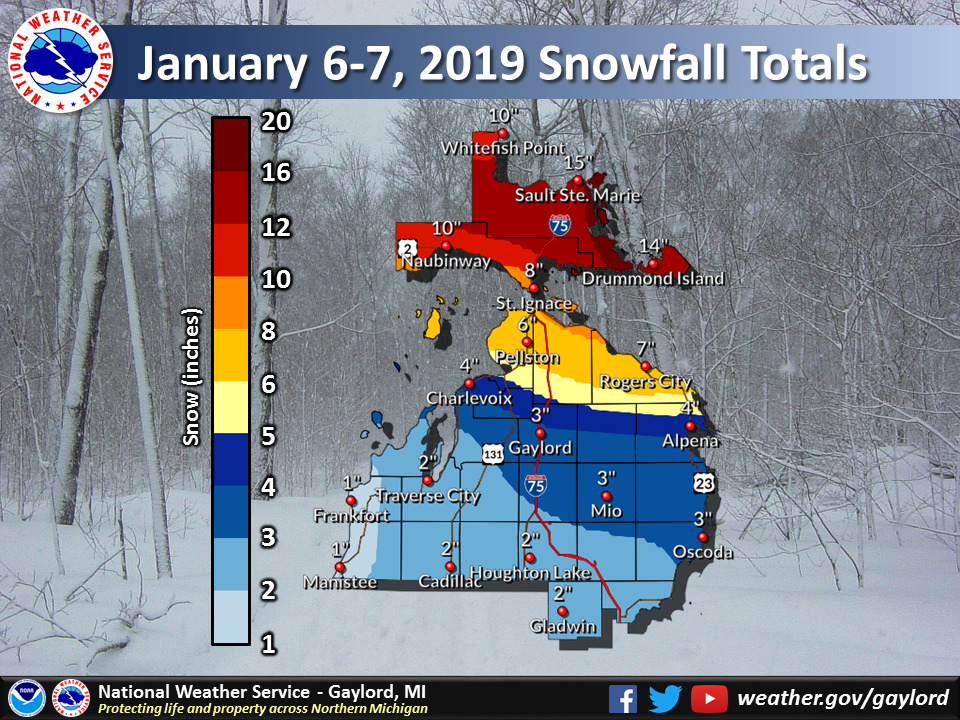 Storm total snowfall January 6-7, 2019 |
Photos & Video:
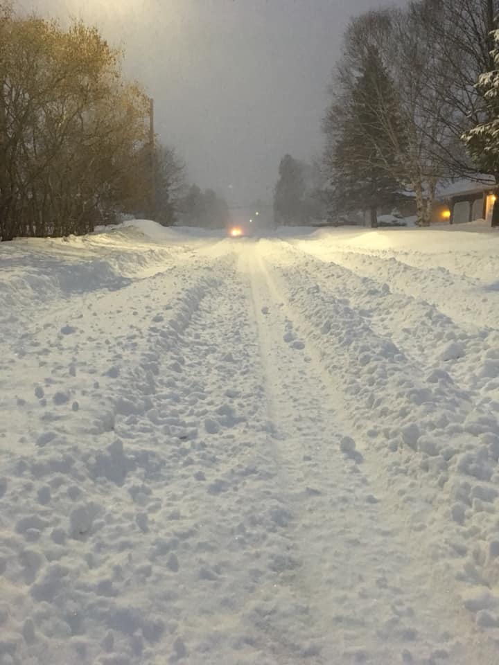
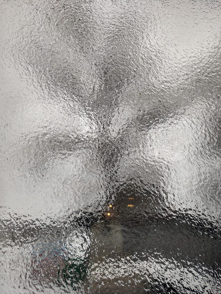
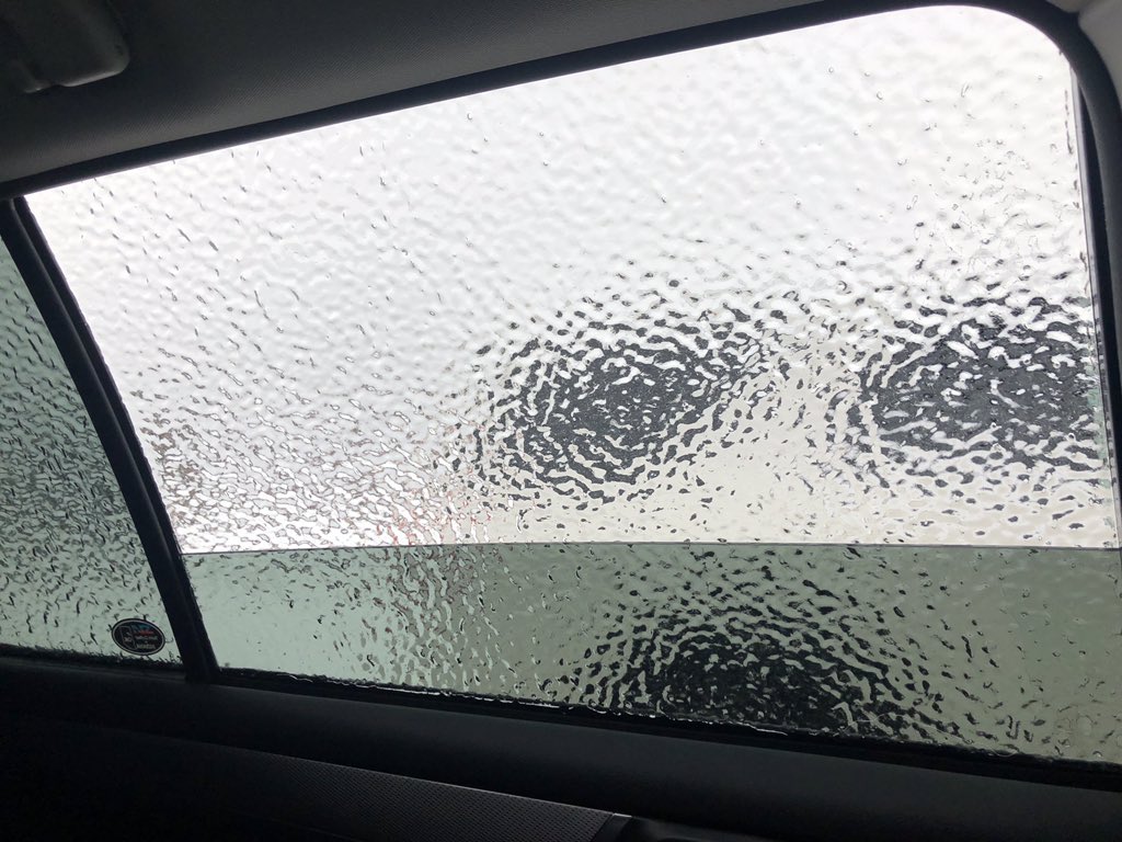
Submitted Via Social Media
 |
 |
 |
 |
| Sault Ste. Marie, MI Chelsea Murawski |
Sault Ste. Marie, MI Jerett Godeke |
Sault Ste. Marie, MI Jerett Godeke |
Sault Ste. Marie, MI Kari Yipe O'Gorman |
 |
 |
 |
 |
| Antrim County, MI Blake Hansen |
NWS Gaylord Office Sabrina Jauernic |
Lake Ann, MI Kimberly Hankamp-Kroupa |
Lovells, MI Heather Nimlin Lovell |
 |
 |
 |
 |
| Mancelona, MI Sherry Bailey |
Mancelona, MI Nicki Williams |
Petoskey, MI Anon Muss |
Traverse City, MI Joe Charlevoix |
Snowfall Reports
PUBLIC INFORMATION STATEMENT
NATIONAL WEATHER SERVICE GAYLORD MI
351 PM EST TUE JAN 8 2019

...SNOWFALL REPORTS OVER THE LAST 36 HOURS...

LOCATION                     AMOUNT    TIME/DATE       LAT/LON

...MICHIGAN...

...ALCONA COUNTY...
2 SE GLENNIE                 0.5 IN    0730 AM 01/08   44.54N/83.70W

...ALPENA COUNTY...
ALPENA - PHELPS COLLINS FIEL 2.8 IN    0654 AM 01/08   45.08N/83.56W
1 NNE OSSINEKE               2.0 IN    0830 AM 01/08   44.92N/83.43W
1 SSW ALPENA                 1.2 IN    0700 AM 01/08   45.05N/83.45W

...ANTRIM COUNTY...
MANCELONA                    1.0 IN    0800 AM 01/08   44.90N/85.05W

...BENZIE COUNTY...
5 S BENZONIA                 0.6 IN    0800 AM 01/08   44.54N/86.11W

...CHARLEVOIX COUNTY...
CHARLEVOIX                   2.5 IN    0800 AM 01/08   45.32N/85.27W
2 NNW EAST JORDAN            1.3 IN    0700 AM 01/08   45.19N/85.15W

...CHEBOYGAN COUNTY...
CHEBOYGAN                    3.0 IN    0845 PM 01/07   45.64N/84.47W

...CHIPPEWA COUNTY...
11 ESE GOETZVILLE            18.0 IN   0800 AM 01/08   46.00N/83.90W
1 ENE SAULT STE. MARIE       16.0 IN   1200 AM 01/08   46.49N/84.35W
BARBEAU                      16.0 IN   0728 PM 01/07   46.28N/84.28W
SAULT STE. MARIE             15.3 IN   0817 AM 01/08   46.48N/84.37W
DAFTER                       15.0 IN   1200 AM 01/08   46.37N/84.43W
5 NNW RABER                  14.0 IN   0557 AM 01/08   46.18N/84.12W
2 E SAULT STE. MARIE         12.5 IN   0700 AM 01/08   46.49N/84.32W
TROUT LAKE                   12.0 IN   0624 PM 01/07   46.18N/85.02W
PARADISE                     9.4 IN    0800 AM 01/08   46.60N/85.04W
TAHQUAMENON FALLS ST PK      5.6 IN    0800 AM 01/08   46.60N/85.22W

...EMMET COUNTY...
PETOSKEY                     3.8 IN    0800 AM 01/08   45.36N/84.95W
PETOSKEY                     2.0 IN    0800 AM 01/08   45.37N/84.98W

...GLADWIN COUNTY...
GLADWIN                      2.0 IN    0700 AM 01/08   43.98N/84.50W

...GRAND TRAVERSE COUNTY...
TRAVERSE CITY MUNSON         1.3 IN    0611 AM 01/08   44.76N/85.64W

...IOSCO COUNTY...
LOUD DAM                     2.0 IN    0900 AM 01/08   44.46N/83.72W
EAST TAWAS                   1.4 IN    0830 AM 01/08   44.28N/83.50W

...LEELANAU COUNTY...
MAPLE CITY 1E                2.0 IN    0615 PM 01/07   44.85N/85.84W

...MACKINAC COUNTY...
MORAN                        8.6 IN    0800 AM 01/08   45.99N/84.84W
SAINT IGNACE                 7.5 IN    0700 AM 01/08   45.86N/84.72W

...MANISTEE COUNTY...
TIPPY DAM                    2.0 IN    0800 AM 01/08   44.26N/85.95W

...MONTMORENCY COUNTY...
ATLANTA 1SW                  0.8 IN    0700 AM 01/08   44.99N/84.16W

...OGEMAW COUNTY...
3 SE WEST BRANCH             3.0 IN    0800 AM 01/07   44.25N/84.20W

...OSCODA COUNTY...
MIO WWTP                     0.8 IN    0830 AM 01/08   44.65N/84.12W

...OTSEGO COUNTY...
NWS GAYLORD                  2.3 IN    1200 AM 01/08   44.91N/84.72W
GAYLORD                      1.7 IN    0800 AM 01/08   45.03N/84.68W

...PRESQUE ISLE COUNTY...
ROGERS CITY                  6.0 IN    0750 PM 01/07   45.42N/83.81W

...ROSCOMMON COUNTY...
HOUGHTON LAKE - ROSCOMMON CO 0.7 IN    0653 AM 01/08   44.35N/84.67W

...WEXFORD COUNTY...
2 SW CADILLAC                1.5 IN    0730 AM 01/08   44.23N/85.42W

OBSERVATIONS ARE COLLECTED FROM A VARIETY OF SOURCES WITH VARYING
EQUIPMENT AND EXPOSURES. WE THANK ALL VOLUNTEER WEATHER OBSERVERS
FOR THEIR DEDICATION. NOT ALL DATA LISTED ARE CONSIDERED OFFICIAL.

$$
Wind Reports
PUBLIC INFORMATION STATEMENT
NATIONAL WEATHER SERVICE GAYLORD MI
358 PM EST MON JAN 7 2019

...WIND REPORTS OVER THE LAST 12 HOURS...

LOCATION                     SPEED     TIME/DATE       LAT/LON

...MICHIGAN...

...ALPENA COUNTY...
ALPENA - PHELPS COLLINS FIEL 41 MPH    0916 AM 01/07   45.08N/83.56W

...ANTRIM COUNTY...
BELLARIE - ANTRIM COUNTY ARP 38 MPH    1116 AM 01/07   44.99N/85.20W
MANCELONA                    36 MPH    1115 AM 01/07   44.90N/85.07W

...BENZIE COUNTY...
FRANKFORT - DOW MEMORIAL FIE 35 MPH    0136 PM 01/07   44.63N/86.21W

...CHARLEVOIX COUNTY...
IRONTON                      41 MPH    1220 PM 01/07   45.26N/85.22W
BEAVER ISLAND                36 MPH    0755 AM 01/07   45.69N/85.57W
CHARLEVOIX - MUNICIPAL ARPT  33 MPH    1035 AM 01/07   45.30N/85.27W

...CHEBOYGAN COUNTY...
CHEBOYGAN - CHEBOYGAN COUNTY 32 MPH    1156 AM 01/07   45.65N/84.53W

...CHIPPEWA COUNTY...
KINROSS - CHIPPEWA COUNTY IN 48 MPH    0956 AM 01/07   46.25N/84.47W
SAULT STE MARIE - MUNICIPAL  39 MPH    0238 PM 01/07   46.47N/84.37W
DRUMMOND ISLAND              38 MPH    1015 AM 01/07   46.01N/83.74W

...CRAWFORD COUNTY...
GRAYLING - ARMY AIRFIELD     40 MPH    1210 PM 01/07   44.68N/84.73W

...EMMET COUNTY...
PELLSTON - RGNL AIRPORT OF E 40 MPH    1122 AM 01/07   45.57N/84.80W
PETOSKEY                     33 MPH    1223 PM 01/07   45.36N/84.95W

...GRAND TRAVERSE COUNTY...
TRAVERSE CITY - CHERRY CAPIT 48 MPH    1057 AM 01/07   44.74N/85.58W

...IOSCO COUNTY...
OSCODA - WURTSMITH AFB       31 MPH    0136 PM 01/07   44.42N/83.35W

...MACKINAC COUNTY...
MACKINAC ISLAND              36 MPH    0255 PM 01/07   45.87N/84.64W

...OTSEGO COUNTY...
1 WNW WATERS                 44 MPH    0659 AM 01/07   44.91N/84.72W
GAYLORD - OTSEGO COUNTY AIRP 39 MPH    0928 AM 01/07   45.02N/84.70W

...PRESQUE ISLE COUNTY...
ROGERS CITY - PRESQUE ISLE C 41 MPH    1116 AM 01/07   45.41N/83.81W
ROGERS CITY                  30 MPH    0930 AM 01/07   45.42N/83.81W

...ROSCOMMON COUNTY...
HOUGHTON LAKE - ROSCOMMON CO 41 MPH    1058 AM 01/07   44.35N/84.67W

...WEXFORD COUNTY...
CADILLAC - WEXFORD COUNT ARP 39 MPH    0856 AM 01/07   44.28N/85.42W

OBSERVATIONS ARE COLLECTED FROM A VARIETY OF SOURCES WITH VARYING
EQUIPMENT AND EXPOSURES. WE THANK ALL VOLUNTEER WEATHER OBSERVERS
FOR THEIR DEDICATION. NOT ALL DATA LISTED ARE CONSIDERED OFFICIAL.

$$
 |
Media use of NWS Web News Stories is encouraged! Please acknowledge the NWS as the source of any news information accessed from this site. |
|


 Follow us on YouTube