
A storm over the southwest U.S. will shift east through Thursday while another Pacific storm pivots over the region Friday through the weekend. Widespread low elevation rain and high elevation snow showers are expected with each storm. Both storms will shift over the central U.S. with the first occurring tonight through Thursday and the second Saturday night into Monday. Flood Watches issued. Read More >
Overview
Wednesday morning a cold front came through the Texas Panhandle and stalled along a line from just south of Hereford up through Lefors, TX to the far northeastern corner of the Texas Panhandle. This cold front was associated with a low-pressure system in southeastern New Mexico that eventually moved into the Texas Panhandle from around the Clovis area. The front and low pressure system both played a role in providing lift for this event as daytime heating was hindered by cloud cover. Plenty of instability was present creating a concern for severe thunderstorms mainly in the central and eastern Texas and Oklahoma Panhandles. The first severe thunderstorm warning was issued around 1:10 PM in parts of Armstrong and Donley County. Storms continued to pop up across the area producing hail between 1-2 inches. The largest hail reported was 2 inches in Wheeler County near Twitty, TX at 3:11 PM. While another storm up near Glazier, Texas started dropping and lifting small rope tornadoes in the northeast Texas Panhandle between 3:30 PM and 4:30 PM, with several confirmed reports of tornadoes touching down. Later, different outflow boundaries started to collide and produce brief spin ups, such as a land spout tornado and several gustnados, east and southeast of Amarillo. Overall the office received 21 reports of hail at least 1 inch in diameter. Furthermore, a total of 4 tornadoes were confirmed to have touched down, one of which was a land spout seen from the Amarillo – Rick Husband International Airport tower. Many areas also reported accumulating hail, making it look like it had snowed, with one report in Randall County stating it had accumulated several inches deep.
Photos & Video
Tornadoes
 |
 |
 |
 |
|
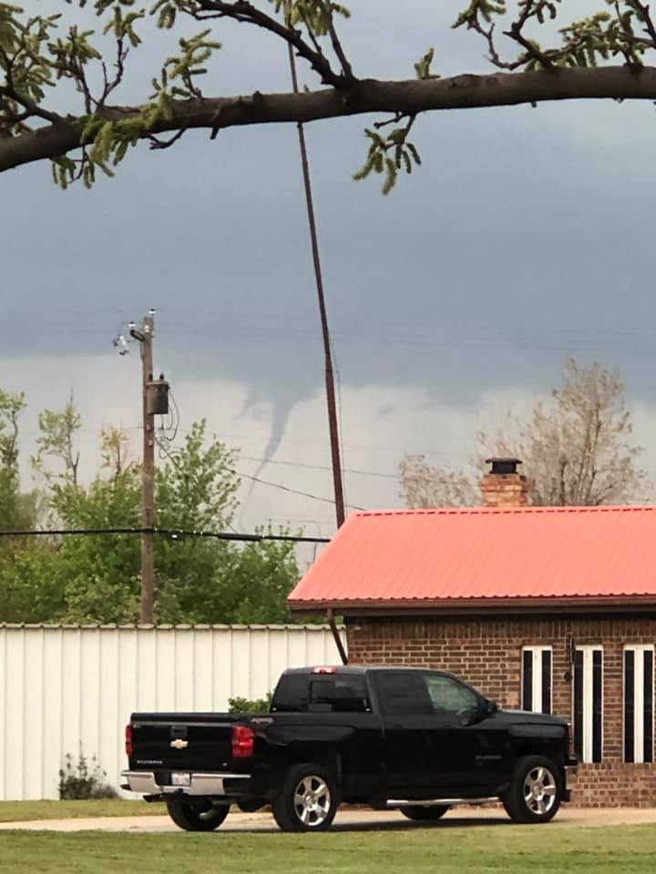
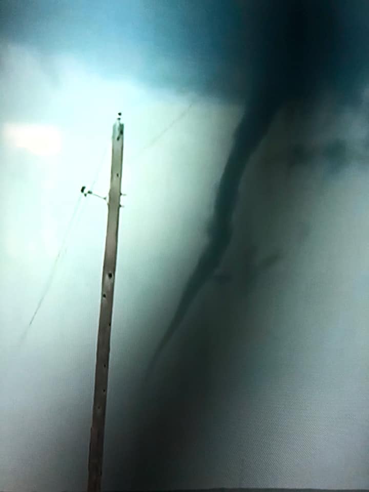
Tornado West of Higgins, TX (Photo Credit: Heather Tarr) |
Same Tornado West of Higgins, TX
|
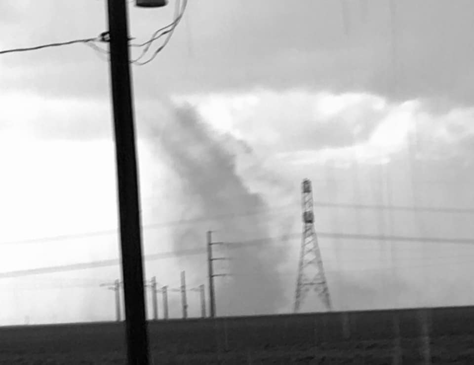
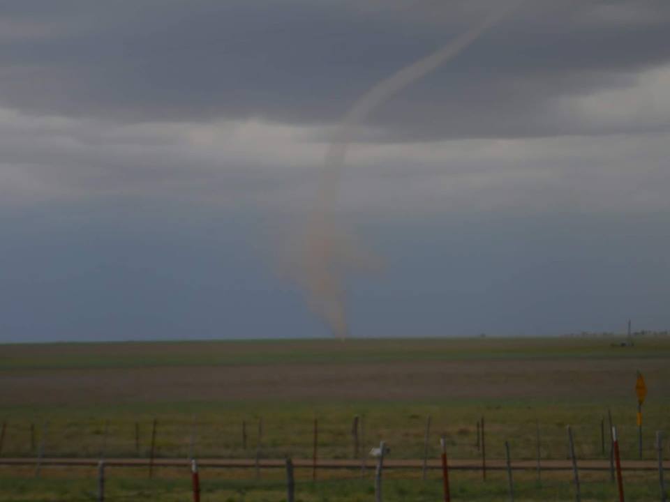
Land Spout Tornado East of Amarillo, South of Panhandle, TX |
Land Spout Tornado East of Amarillo South of Panhandle, TX |
Hail
 |
 |
 |
|
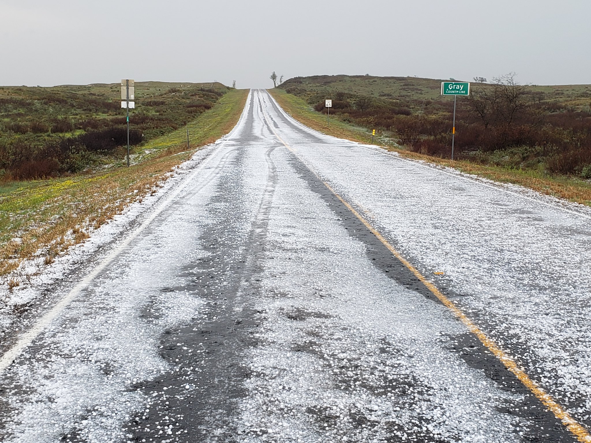
Accumulating Hail South of McLean, TX |
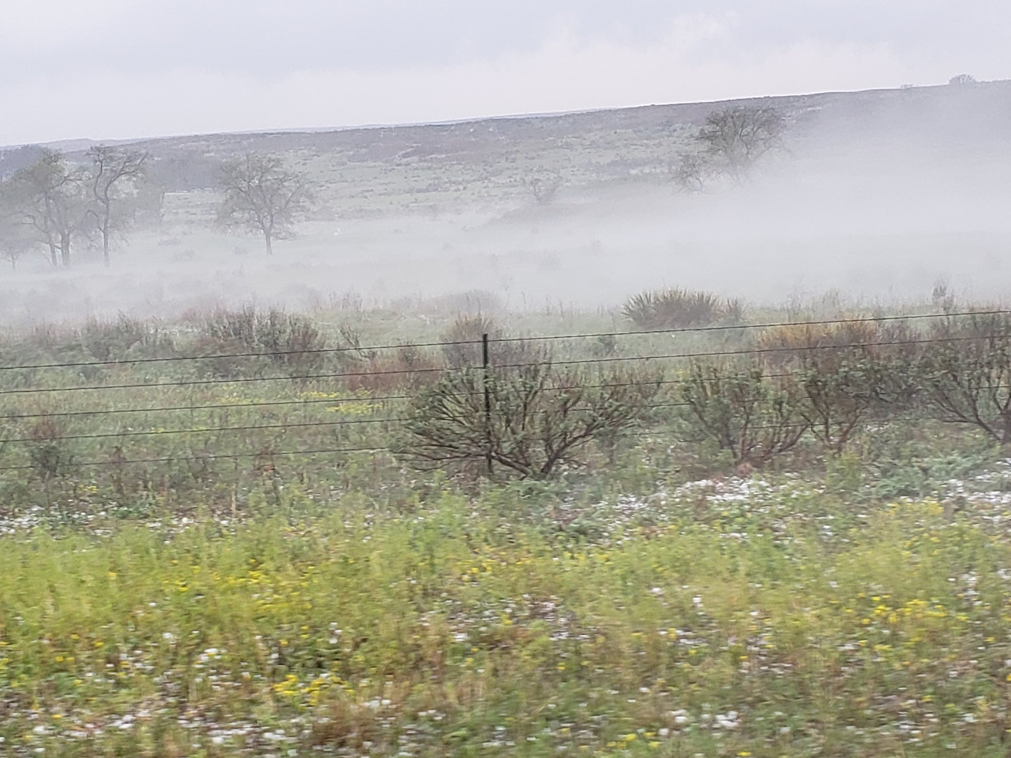
Hail Fog South of McLean, TX |
Large Hail Dozier, TX |
Radar
|
Radar Time Lapse For April 17th |
Storm Reports
PRELIMINARY LOCAL STORM REPORT...SUMMARY
NATIONAL WEATHER SERVICE AMARILLO TX
830 PM CDT THU APR 18 2019

..TIME...   ...EVENT...      ...CITY LOCATION...     ...LAT.LON...
..DATE...   ....MAG....      ..COUNTY LOCATION..ST.. ...SOURCE....
            ..REMARKS..

0146 PM     HAIL             GOODNIGHT               35.04N 101.19W
04/17/2019  E1.00 INCH       ARMSTRONG          TX   PUBLIC

            HAIL FROM DIMES TO QUARTERS REPORTED, ACCUMULATING UP
            TO AN INCH DEEP IN SPOTS.

0213 PM     HAIL             HOWARDWICK              35.03N 100.91W
04/17/2019  M1.00 INCH       DONLEY             TX   FIRE DEPT/RESCUE

            ACCUMULATING HAIL OF BETWEEN DIME AND QUARTER SIZE.

0218 PM     HAIL             2 NE HOWARDWICK         35.06N 100.89W
04/17/2019  M1.00 INCH       DONLEY             TX   PUBLIC

0232 PM     FLOOD            HOWARDWICK              35.04N 100.91W
04/17/2019                   DONLEY             TX   FIRE DEPT/RESCUE

            WATER OVER ROADWAY ON TEXAS HIGHWAY 70 IN HOWARDWICK,
            ACCUMULATING HAIL SEVERAL INCHES DEEP.

0232 PM     HAIL             HOWARDWICK              35.04N 100.91W
04/17/2019  M1.00 INCH       DONLEY             TX   FIRE DEPT/RESCUE

            WATER OVER ROADWAY ON TEXAS HIGHWAY 70 IN HOWARDWICK,
            ACCUMULATING HAIL SEVERAL INCHES DEEP.

0244 PM     HAIL             MCLEAN                  35.23N 100.60W
04/17/2019  E0.75 INCH       GRAY               TX   BROADCAST MEDIA

            REPORT RELAYED FROM BROADCAST MEDIA.

0246 PM     HAIL             4 S MCLEAN              35.18N 100.61W
04/17/2019  M1.75 INCH       DONLEY             TX   LAW ENFORCEMENT

0247 PM     HAIL             6 S MCLEAN              35.15N 100.60W
04/17/2019  M1.25 INCH       DONLEY             TX   NWS EMPLOYEE

0251 PM     HAIL             3 S MCLEAN              35.19N 100.60W
04/17/2019  M1.00 INCH       GRAY               TX   NWS EMPLOYEE

            TWEET FROM NWS EMPLOYEE REPORTING ACCUMULATING HAIL UP
            TO THE SIZE OF QUARTERS.

0311 PM     HAIL             3 N TWITTY              35.35N 100.24W
04/17/2019  M2.00 INCH       WHEELER            TX   TRAINED SPOTTER

0317 PM     HAIL             1 WSW SIMMS             35.03N 102.67W
04/17/2019  M1.00 INCH       DEAF SMITH         TX   EMERGENCY MNGR

            ACCUMULATING HAIL REPORTED JUST WEST OF SIMMS.

0326 PM     HAIL             1 ENE CANADIAN          35.92N 100.36W
04/17/2019  M1.75 INCH       HEMPHILL           TX   TRAINED SPOTTER

0328 PM     HAIL             CANADIAN                35.91N 100.38W
04/17/2019  M1.00 INCH       HEMPHILL           TX   FIRE DEPT/RESCUE

0339 PM     TORNADO          3 SW GLAZIER            35.98N 100.30W
04/17/2019                   HEMPHILL           TX   BROADCAST MEDIA

            CHANNEL 9 OKC LIVE BROADCAST OF A TORNADO TOUCHDOWN.
            NWS SURVEY INFORMATION SUGGESTS THE TORNADO TOUCHDOWN
            FIRST OCCURRED ABOUT 3 MILES SOUTHWEST OF GLAZIER AT
            0339 PM AND LIFTED AROUND 0354 PM APPROXIMATELY 5 MILES
            NORTH NORTHEAST OF CANADIAN. THE TORNADO WAS RATED
            EF-UNKNOWN SINCE NO DAMAGE WAS OBSERVED. THE TORNADO
            TRACK AND TIMES WERE BASED ON SEVERAL REPORTS AND RADAR
            DATA.

0342 PM     HAIL             1 NW CLARENDON          34.95N 100.90W
04/17/2019  M1.25 INCH       DONLEY             TX   TRAINED SPOTTER

0345 PM     HAIL             3 NNE KELTON            35.45N 100.10W
04/17/2019  M2.00 INCH       WHEELER            TX   TRAINED SPOTTER

0352 PM     HAIL             4 NE KELTON             35.44N 100.07W
04/17/2019  M1.00 INCH       WHEELER            TX   PUBLIC

            MPING REPORT RECEIVED OF QUARTER SIZE HAIL.

0354 PM     TORNADO          2 NE GLAZIER            36.03N 100.24W
04/17/2019                   HEMPHILL           TX   FIRE DEPT/RESCUE

            MULTIPLE SOURCES REPORTED A TORNADO TOUCHDOWN. NWS
            SURVEY INFORMATION SUGGESTS THE TORNADO TOUCHDOWN BEGAN
            AT 0354 PM 2 MILES NORTHEAST OF GLAZIER AND LIFTED AT
            0421 PM APPROXIMATELY 6 MILES NORTHEAST OF GLAZIER. A
            FEW TREES WERE DAMAAGED ALONG HIGHWAY 60 SOUTHWEST OF
            COBURN, AND SOME LARGE TREE LIMBS WERE SNAPPED. THE
            TORNADO WAS RATED EF0 WITH AN ESTIMATED PEAK WIND SPEED
            OF 75 MPH.

0403 PM     HAIL             20 SE SPEARMAN          35.99N 100.95W
04/17/2019  M1.00 INCH       ROBERTS            TX   TRAINED SPOTTER

0429 PM     TORNADO          4 SW HIGGINS            36.08N 100.08W
04/17/2019                   LIPSCOMB           TX   BROADCAST MEDIA

            BROADCAST MEDIA AND MULTIPLE SPOTTERS REPORTED A NEW
            TORNADO TOUCHDOWN NEAR HIGGINS, TX. NWS SURVEY
            INFORMATION SUGGESTS THE TORNADO TOUCHDOWN FIRST
            OCCURRED ABOUT 4 MILES SOUTHWEST OF HIGGINS AT 0429 PM
            AND LIFTED AT 0432 PM APPROXIMATELY 4 MILES SOUTHWEST OF
            HIGGINS. THE TORNADO WAS RATED EF-UNKNOWN SINCE NO
            DAMAGE WAS OBSERVED. THE TORNADO TRACK AND TIMES WERE
            BASED ON SPOTTER REPORTS AND RADAR DATA.

0455 PM     HAIL             2 N DOZIER              35.11N 100.34W
04/17/2019  E1.75 INCH       COLLINGSWORTH      TX   TRAINED SPOTTER

            LATE REPORT OF GOLF BALL SIZE HAIL.

0502 PM     HAIL             6 WSW PANHANDLE         35.31N 101.47W
04/17/2019  E0.75 INCH       CARSON             TX   TRAINED SPOTTER

0505 PM     TORNADO          6 NE WASHBURN           35.24N 101.51W
04/17/2019                   CARSON             TX   BROADCAST MEDIA

            A LANDSPOUT TORNADO WAS REPORTED BY BROADCAST MEDIA AND
            FAA TOWER PERSONNEL AT RICK HUSBAND INTERNATIONAL
            AIRPORT. NWS SURVEY INFORMATION SUGGESTS THE TORNADO
            TOUCHDOWN BEGAN AT 0505 PM 6 MILES NORTHEAST OF WASHBURN
            AND LIFTED AT 0519 PM APPROXIMATELY 4 MILES NORTHEAST OF
            WASHBURN. THE TORNADO WAS RATED EF-UNKNOWN SINCE NO
            DAMAGE WAS OBSERVED. THE TORNADO TRACK AND TIMES WERE
            BASED ON A COMBINATION OF SPOTTER REPORTS, THE KAMA ASOS
            OBSERVATION FROM FAA TOWER PERSONNEL, AND RADAR DATA.

0515 PM     HAIL             4 ESE PANTEX            35.29N 101.51W
04/17/2019  M1.25 INCH       CARSON             TX   TRAINED SPOTTER

0517 PM     HAIL             VALLEY DE ORO           35.45N 102.11W
04/17/2019  M0.88 INCH       POTTER             TX   TRAINED SPOTTER

0523 PM     HAIL             DAWN                    34.91N 102.20W
04/17/2019  M1.00 INCH       DEAF SMITH         TX   TRAINED SPOTTER

            ACCUMULATING HAIL REPORTED.

0535 PM     HAIL             13 SSE KELTON           35.23N 100.01W
04/17/2019  E1.25 INCH       WHEELER            TX   PUBLIC

            LATE REPORT RECEIVED OF HAIL ALONG INTERSTATE 40 NEAR
            THE OKLAHOMA AND TEXAS STATE LINE.

0549 PM     HAIL             7 NW CANYON             35.05N 102.00W
04/17/2019  M0.88 INCH       RANDALL            TX   TRAINED SPOTTER

0553 PM     HAIL             6 WNW TIMBERCREEK CANYO 35.09N 101.92W
04/17/2019  E1.00 INCH       RANDALL            TX   TRAINED SPOTTER

            LATE REPORT OF ACCUMULATING HAIL RANGING FROM DIMES TO
            QUARTERS. GROUND WAS COVERED UP TO SEVERAL INCHES DEEP.

0556 PM     HAIL             7 NW CANYON             35.05N 102.01W
04/17/2019  M0.75 INCH       RANDALL            TX   TRAINED SPOTTER

            ACCUMULATING HAIL ON THE GROUND. LOTS OF HAIL REDUCING
            VISIBILITY.

0700 PM     FLOOD            3 SW AMARILLO           35.17N 101.85W
04/17/2019                   RANDALL            TX   NWS EMPLOYEE

            SOUTH WASHINGTON STREET DOWN TO ONE LANE IN EITHER
            DIRECTION DUE TO WATER ON ROAD WAY. JUST SOUTH OF I-27.
            TIME ESTIMATED BASED ON RADAR.
 |
Media use of NWS Web News Stories is encouraged! Please acknowledge the NWS as the source of any news information accessed from this site. |
|

