
Moderate to heavy mountain snow and strong winds are expected across the Northern Rockies. Lake effect snow will continue downwind of the Lower Great Lakes. Gusty winds and dry conditions will result in critical fire weather conditions in the Southwest and Southern Plains Wednesday through Friday. Extremely critical fire weather conditions are expected Thursday in portions of New Mexico. Read More >
Overview
An upper-level disturbance interacted with a very moist atmosphere on July 1, generating widespread thunderstorms across areas mainly along and north of I- 90. These storms resulted in torrential rainfall and flash flooding in portions of Herkimer, Fulton, Warren, Washington, and Rensselaer Counties. It was the second straight day of heavy rainfall for some of these areas. The village of Hoosick Falls was particularly hard-hit by flash flooding, with several residences experiencing basement and first-floor flooding and several roads washed out. Rainfall amounts up to 5" were recorded in Washington County. Several area rivers reached minor and moderate flood stage. A microburst in Sandgate, VT snapped and uprooted many trees with peak winds estimated around 100 mph. A few other reports of wind damage occurred as well.Flooding
River flooding occurred along several area rivers, with three sites reaching moderate flood stage. The West Canada Creek at Kast Bridge, NY recorded its 9th highest crest on record at 7.83 feet, while the Mettawee River at Granville, NY recorded its 7th highest crest on record at 9.95 feet, coming up just inches short of major flood stage.
Hydrographs
 |
 |
 |
| Mettawee River at Granville, NY | West Canada Creek at Kast Bridge, NY | Walloomsac River near North Bennington, VT |
Radar:
Loop from 7 am July 1 to 1 am July 2. Courtesy Iowa Environmental Mesonet.

Storm Reports

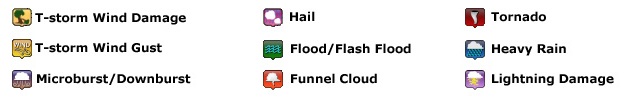
Image courtesy of Iowa Environmental Mesonet (IEM). Local Storm Reports (LSR) are shown plotted on the map according to the legend below.
PRELIMINARY LOCAL STORM REPORT...SUMMARY
NATIONAL WEATHER SERVICE ALBANY NY
542 AM EDT SUN JUL 02 2017

..TIME...   ...EVENT...      ...CITY LOCATION...     ...LAT.LON...
..DATE...   ....MAG....      ..COUNTY LOCATION..ST.. ...SOURCE....
            ..REMARKS..

0906 AM     LIGHTNING        MOREAU                  43.25N  73.68W
07/01/2017                   SARATOGA           NY   911 CALL CENTER

            LIGHTNING STRUCK TWO BUILDINGS.

0906 AM     TSTM WND DMG     2 S LAKE SUNNYSIDE      43.35N  73.64W
07/01/2017                   WARREN             NY   TRAINED SPOTTER

            LARGE MAPLE TREE LIMB 4.5 IN DIAMETER AND 12 FEET LONG
            SNAPPED.

0100 PM     FLASH FLOOD      NEWPORT                 43.19N  75.02W
07/01/2017                   HERKIMER           NY   EMERGENCY MNGR

            MUDSLIDE NEAR NEWPORT... NY IN WESTERN HERKIMER COUNTY
            ALONG ROUTE 28.

0247 PM     TSTM WND DMG     3 SSE LYNNWOOD          43.26N  73.90W
07/01/2017                   SARATOGA           NY   LAW ENFORCEMENT

            TREES DOWN AND POWER POLE SNAPPED

0310 PM     TSTM WND DMG     QUEENSBURY              43.36N  73.67W
07/01/2017                   WARREN             NY   FACEBOOK

            TREE DOWN

0400 PM     FLASH FLOOD      2 NNE COUNTRYMAN        43.11N  74.98W
07/01/2017                   HERKIMER           NY   TRAINED SPOTTER

            ROUTE 28 CLOSED DUE TO FLOODING

0405 PM     FLOOD            1 S HAGUE               43.73N  73.50W
07/01/2017                   WARREN             NY   DEPT OF HIGHWAYS

            ROUTE9 SB CLOSED DUE TO FLOODING

0410 PM     TSTM WND DMG     1 N COUNTRYMAN          43.10N  74.99W
07/01/2017                   HERKIMER           NY   TRAINED SPOTTER

            TREES DOWN

0410 PM     FLASH FLOOD      1 WSW EAST SCHUYLER     43.05N  75.10W
07/01/2017                   HERKIMER           NY   TRAINED SPOTTER

            PERSON TRAPPED IN HOUSE DUE TO FLOODING

0410 PM     FLASH FLOOD      HERKIMER                43.03N  74.99W
07/01/2017                   HERKIMER           NY   911 CALL CENTER

            ROUTE 5 CLOSED FROM TOWN OF SCHUYLER TO LITTLE FALLS
            DUE TO FLOODING. WALMART EVACUATED DUE TO FLOODING
            CONCERNS. TIME ESTIMATED.

0410 PM     FLASH FLOOD      FRANKFORT               43.04N  75.07W
07/01/2017                   HERKIMER           NY   911 CALL CENTER

            WEST MAIN STREET... ROUTE 171...AND ROUTE 5S CLOSED IN
            FRANKFORT DUE TO FLOODING. STATE OF EMERGENCY WAS IN
            EFFECT FOR TOWN OF FRANKFORT. TIME ESTIMATED.

0440 PM     FLASH FLOOD      2 NE STRATFORD          43.20N  74.66W
07/01/2017                   FULTON             NY   911 CALL CENTER

            SEELY ROAD WASHED OUT

0450 PM     FLASH FLOOD      1 SSE BALDWIN CORNER    43.38N  73.49W
07/01/2017                   WASHINGTON         NY   DEPT OF HIGHWAYS

            ROUTE 149 CLOSED NEAR ROUTE 4 INTERSEECTION

0500 PM     FLASH FLOOD      1 E GLENS FALLS         43.31N  73.63W
07/01/2017                   WARREN             NY   DEPT OF HIGHWAYS

            ROUTE 32 CLOSED NEAR HASKELL AVE INTERSECTION

0515 PM     FLASH FLOOD      2 WNW SOUTH GRANVILLE   43.38N  73.32W
07/01/2017                   WASHINGTON         NY   DEPT OF HIGHWAYS

            ROUTE 149 EB/WB CLOSED AT SEARLS ROAD DUE TO FLOODING

0610 PM     FLASH FLOOD      1 NE ADAMSVILLE         43.33N  73.46W
07/01/2017                   WASHINGTON         NY   TWITTER

            ROAD CLOSED AND WASHED OUT

0628 PM     DOWNBURST        1 NNE SANDGATE          43.16N  73.19W
07/01/2017  E100 MPH         BENNINGTON         VT   NWS STORM SURVEY

            A NATIONAL WEATHER SERVICE SURVEY TEAM CONFIRMED A
            MICROBURST IN SANDGATE... VERMONT ON SATURDAY... JULY
            1... 2017. THE TEAM OBSERVED MANY SNAPPED AND UPROOTED
            TREES WITHIN THE MICROBURST SWATH. NO DAMAGE TO HOMES OR
            OTHER STRUCTURES WAS NOTED. BASED ON THE DEGREE OF
            DAMAGE TO TREES... PEAK WINDS ASSOCIATED WITH THE
            MICROBURST ARE ESTIMATED AT 100 MPH.

0650 PM     TSTM WND DMG     LONDONDERRY             43.23N  72.81W
07/01/2017                   WINDHAM            VT   TWITTER

            TREES DOWN

0730 PM     FLASH FLOOD      HOOSICK FALLS           42.90N  73.35W
07/01/2017                   RENSSELAER         NY   CITY OFFICIAL

            SEVERE FLOODING IN MULTIPLE PARTS OF VILLAGE. FLOODING
            COVERED MULTIPLE ROADS... CAUSING DAMAGE TO ROADS. ROADS
            COMING INTO THE VILLAGE WERE BLOCKED DUE TO FLOOD
            WATERS. MULTIPLE HOUSES REPORTED FLOODING IN THEIR
            BASEMENTS AND SOME IN THEIR FIRST FLOOR. LOCAL STATE OF
            EMERGENCY DECLARED. TIME ESTIMATED.

0800 PM     FLASH FLOOD      1 NNW HAYNERSVILLE      42.81N  73.58W
07/01/2017                   RENSSELAER         NY   PUBLIC

            A CREEK FLOODED OVER COOKSBORO ROAD

0825 PM     FLOOD            HOOSICK FALLS           42.90N  73.35W
07/01/2017                   RENSSELAER         NY   EMERGENCY MNGR

            REPORTS OF ROAD CLOSURES AT CHURCH STREET AND HALL
            STREET DUE TO HIGH WATER

0950 PM     FLASH FLOOD      2 ESE RAYMERTOWN        42.80N  73.50W
07/01/2017                   RENSSELAER         NY   TRAINED SPOTTER

            WATER RUNNING OVER ROAD AND ROAD CLOSED

0950 PM     FLASH FLOOD      1 NE CENTER BRUNSWICK   42.77N  73.60W
07/01/2017                   RENSSELAER         NY   DEPT OF HIGHWAYS

            NY 7 CLOSED DUE TO FLOODING BETWEEN VERMONT STATE LINE
            IN HOOSICK AND BRICK CHURCH ROAD IN BRUNSWICK
Rain Reports
2-Day Totals (June 30 through July 2)

PUBLIC INFORMATION STATEMENT
SPOTTER REPORTS
NATIONAL WEATHER SERVICE ALBANY NY
115 PM EDT TUE JUL 04 2017

THE FOLLOWING ARE UNOFFICIAL 2-DAY STORM TOTAL RAINFALL OBSERVATIONS
TAKEN FROM FRIDAY MORNING (JUNE 30) THROUGH SUNDAY MORNING (JULY 2).
APPRECIATION IS EXTENDED TO HIGHWAY DEPARTMENTS...COOPERATIVE
OBSERVERS...SKYWARN SPOTTERS AND MEDIA FOR THESE REPORTS. THIS
SUMMARY IS ALSO AVAILABLE ON OUR HOME PAGE AT WEATHER.GOV/ALBANY

********************STORM TOTAL RAINFALL********************

LOCATION          STORM TOTAL     TIME/DATE   COMMENTS
                     RAINFALL           OF
                     /INCHES/   MEASUREMENT

CONNECTICUT

...LITCHFIELD COUNTY...
   2 ENE NEW HARTFORD    2.56   800 AM  7/02  CWOP
   2 NW TERRYVILLE       2.47   754 AM  7/02  CWOP
   THOMASTON DAM         2.00   700 AM  7/02  CO-OP OBSERVER
   1 N THOMASTON         1.72   700 AM  7/02  COCORAHS
   1 WNW WOODBURY CENTE  1.63   923 AM  7/02  CWOP
   1 SE TORRINGTON       1.60   747 AM  7/02  CWOP
   WOODBURY CENTER       1.54   915 AM  7/02  HADS
   2 ESE TORRINGTON      1.45   759 AM  7/02  CWOP
   3 ENE TORRINGTON      1.37   751 AM  7/02  CWOP
   1 S WATERTOWN         1.32   745 AM  7/02  COCORAHS
   BAKERSVILLE           1.30   700 AM  7/02  CO-OP OBSERVER
   3 SW NEW HARTFORD CE  1.27   700 AM  7/02  COCORAHS
   5 NNW WINSTED         1.20   800 AM  7/02  CWOP
   1 SSW OAKVILLE        1.18   804 AM  7/02  CWOP
   2 N NEW HARTFORD CEN  1.17   700 AM  7/02  COCORAHS
   2 WSW NEW HARTFORD    1.14   753 AM  7/02  CWOP
   3 SW TORRINGTON       0.83   932 AM  7/02  CWOP
   1 NE COLEBROOK        0.75   700 AM  7/02  COCORAHS
   5 SSW TOLLAND         0.55   945 AM  7/02  HADS
   WINSTED               0.48   754 AM  7/02  CWOP
   3 E TORRINGTON        0.46   946 AM  7/02  CWOP

MASSACHUSETTS

...BERKSHIRE COUNTY...
   1 S STAMFORD          1.67   745 AM  7/02  CWOP
   2 SE ADAMS            1.57   754 AM  7/02  CWOP
   HARRIMAN-AND-WEST AI  1.49   752 AM  7/02  ASOS
   3 SW WILLIAMSTOWN     1.44   754 AM  7/02  CWOP
   2 NNW PITTSFIELD      1.10   700 AM  7/02  COCORAHS
   3 NNE PITTSFIELD      1.09   750 AM  7/02  CWOP
   3 N GREAT BARRINGTON  1.06   700 AM  7/02  COCORAHS
   2 WSW EAST WINDSOR    0.92   906 AM  7/02  CWOP
   2 WNW TYRINGHAM       0.88   700 AM  7/02  COCORAHS
   1 SE PITTSFIELD       0.86   804 AM  7/02  CWOP
   PITTSFIELD MUNICIPAL  0.85   754 AM  7/02  ASOS
   1 NE GREAT BARRINGTO  0.82   717 AM  7/02  CWOP
   NNE STOCKBRIDGE       0.57   600 AM  7/02  COCORAHS
   GREAT BARRINGTON      0.47   740 AM  7/02  CWOP
   5 NW OTIS             0.41   747 AM  7/02  CWOP
   6 SSW BECKET          0.41   640 AM  7/02  COCORAHS

NEW YORK

...ALBANY COUNTY...
   COHOES                3.10   929 PM  7/01  CWOP
   1 ESE COHOES          1.92   759 AM  7/02  COCORAHS
   SOUTH BERNE           1.75   530 AM  7/02  WEATHERNET6
   WESTMERE              1.43   801 AM  7/02  CWOP
   3 SW GLENMONT         1.33   700 AM  7/02  COCORAHS
   ALBANY INTL AP        1.11   751 AM  7/02  ASOS
   NWS ALBANY            1.06   700 AM  7/02  COCORAHS
   COLONIE               1.05   800 AM  7/02  CWOP
   2 E WESTMERE          1.05   750 AM  7/02  CWOP
   2 SSE DELMAR          0.92   758 AM  7/02  CWOP
   1 ESE ALBANY          0.89  1000 AM  7/02  COCORAHS
   2 NNW RENSSELAERVILL  0.88   700 AM  7/02  COCORAHS
   6 SSW SCHENECTADY     0.85   700 AM  7/02  COCORAHS
   1 SW ALBANY           0.60   700 AM  7/02  COCORAHS
   3 SSW ALTAMONT        0.56   655 AM  7/02  COCORAHS

...COLUMBIA COUNTY...
   3 ESE CATSKILL        0.68   745 AM  7/02  CWOP
   CHATHAM               0.42   754 AM  7/02  CWOP
   8 S HUDSON            0.37   700 AM  7/02  COCORAHS

...DUTCHESS COUNTY...
   3 NE LAGRANGEVILLE    2.26   700 AM  7/02  COCORAHS
   6 ESE PLEASANT VALLE  1.98   721 AM  7/02  CWOP
   2 ENE WINGDALE        1.50   815 AM  7/02  HADS
   5 WNW PINE PLAINS     1.22   700 AM  7/02  COCORAHS
   FAIRVIEW              1.10   210 AM  7/02  CWOP
   1 NE HOPEWELL JUNCTI  1.09   753 AM  7/02  CWOP
   3 SE MILLBROOK        0.98   559 PM  6/30  COCORAHS
   2 W MILLBROOK         0.95   710 AM  7/02  GOES
   RED HOOK              0.93   716 PM  6/30  WEATHERNET6
   NY MILLBROOK 3 W      0.81   710 AM  7/02  GOES
   1 NE FISHKILL         0.69   700 AM  7/02  COCORAHS
   2 SSE HOPEWELL JUNCT  0.65   700 AM  7/02  COCORAHS
   3 ENE HOPEWELL JUNCT  0.65   800 AM  7/02  COCORAHS
   ARLINGTON             0.64   320 AM  7/01  CWOP
   2 ESE WAPPINGERS FAL  0.49   700 AM  7/02  COCORAHS
   1 NNW WAPPINGERS FAL  0.47   425 AM  7/02  CWOP
   BEACON                0.37   940 AM  7/02  CWOP
   2 NNE HOPEWELL JUNCT  0.21   754 AM  7/02  CWOP

...FULTON COUNTY...
   GLOVERSVILLE          3.07   556 AM  7/02  WEATHERNET6
   FISHHOUSE             2.00   546 PM  7/01  WEATHERNET6
   7 NW GLOVERSVILLE     1.95   700 AM  7/02  CO-OP OBSERVER
   1 SE OPPENHEIM        1.40   630 PM  7/01  MESONET

...GREENE COUNTY...
   CATSKILL              1.19   713 AM  7/02  WEATHERNET6
   1 E GREENVILLE        0.84   530 AM  7/02  COCORAHS
   SE NEW BALTIMORE      0.84   520 AM  7/02  COCORAHS
   4 NE FLEISCHMANNS     0.55   800 AM  7/02  CWOP
   2 NNW ATHENS          0.51   900 AM  7/02  COCORAHS
   4 NNW CAIRO           0.28   759 AM  7/02  CWOP

...HAMILTON COUNTY...
   2 SW INDIAN LAKE      2.58   730 AM  7/02  CO-OP OBSERVER
   2 NNE RUDESTON        2.37   630 PM  7/01  MESONET
   10 SSW SPECULATOR     2.35   700 AM  7/02  COCORAHS
   SSE LONG LAKE         0.87   700 AM  7/02  COCORAHS

...HERKIMER COUNTY...
   1 WNW ILION           3.29   600 AM  7/02  COCORAHS
   DOLGEVILLE            3.25   941 PM  7/01  CWOP
   1 WSW ILION           2.63   700 AM  7/02  COCORAHS
   1 NW HERKIMER         2.33   630 PM  7/01  MESONET
   1 N HURRICANE         2.13   630 PM  7/01  MESONET
   3 S DOLGEVILLE        1.36   502 AM  7/02  CWOP
   BIG MOOSE             1.03   549 AM  7/02  CWOP

...MONTGOMERY COUNTY...
   SE FORT PLAIN         2.32   700 AM  7/02  COCORAHS
   4 ENE EAST SPRINGFIE  2.30   450 AM  7/02  CWOP
   2 WSW HESSVILLE       1.58   740 AM  7/02  COCORAHS
   5 W FONDA             1.48   900 AM  7/02  COCORAHS
   2 E CANAJOHARIE       1.48   805 AM  7/02  CWOP
   3 ESE CHARLESTON FOU  1.20   758 AM  7/02  CWOP

...RENSSELAER COUNTY...
   3 WSW HOOSICK FALLS   4.36   936 AM  7/02  CWOP
   7 NE TROY             3.54   700 AM  7/02  COCORAHS
   SPEIGLETOWN           2.80   949 PM  7/01  WEATHERNET6
   TROY                  2.60   700 AM  7/02  CO-OP OBSERVER
   2 NNE TROY            2.35   700 AM  7/02  COCORAHS
   1 N SYCAWAY           1.64  1100 PM  7/01  NWS EMPLOYEE
   5 ESE WATERFORD       1.62   754 AM  7/02  CWOP
   CENTER BRUNSWICK      1.42  1055 PM  7/01  WEATHERNET6
   2 ENE WYANTSKILL      0.99   802 AM  7/02  CWOP
   1 SE MENANDS          0.91   750 AM  7/02  CWOP
   5 WNW POWNAL          0.77   800 AM  7/02  HADS

...SARATOGA COUNTY...
   3 ENE CLIFTON PARK    3.78   642 AM  7/02  CWOP
   1 S SARATOGA SPRINGS  3.37   600 AM  7/02  COCORAHS
   SARATOGA SPRINGS      3.23   638 AM  7/02  CWOP
   1 WNW GANSEVOORT      3.17   630 AM  7/02  COCORAHS
   2 S ROUND LAKE        3.09   805 AM  7/02  CWOP
   2 ESE CLIFTON PARK    2.46   559 AM  7/02  CWOP
   3 N ROUND LAKE        2.27   857 AM  7/02  COCORAHS
   3 N BALLSTON SPA      2.26   700 AM  7/02  COCORAHS
   4 ESE NISKAYUNA       2.06   919 AM  7/02  CWOP
   5 NNW MILTON          1.82   600 AM  7/02  COCORAHS
   1 E BURNT HILLS       1.72   615 AM  7/02  CWOP
   2 S ROCK CITY FALLS   1.17   620 AM  7/02  CWOP
   3 S CLIFTON PARK      1.05   600 AM  7/02  COCORAHS

...SCHENECTADY COUNTY...
   3 NW DUANESBURG       2.31   534 AM  7/02  CWOP
   1 NW SCOTIA           2.16   600 AM  7/02  COCORAHS
   1 N SCHENECTADY       1.85   800 AM  7/02  CWOP
   3 E SCHENECTADY       1.45   900 AM  7/02  COCORAHS

...SCHOHARIE COUNTY...
   GILBOA DAM            1.87   725 AM  7/02  GOES
   SCHOHARIE             0.72   710 AM  7/02  CO-OP OBSERVER

...ULSTER COUNTY...
   3 WSW HYDE PARK       2.30   800 AM  7/02  CWOP
   PHOENICIA             1.14   700 AM  7/02  CO-OP OBSERVER
   5 NNW STONE RIDGE     1.14   800 AM  7/02  COCORAHS
   1 W LINCOLN PARK      1.14   601 AM  7/02  CWOP
   S WEST HURLEY         1.12   700 AM  7/02  COCORAHS
   1 NE RUBY             1.07   700 AM  7/02  COCORAHS
   4 E PHOENICIA         1.05   748 AM  7/02  CWOP
   PORT EWEN             0.98   805 AM  7/02  CWOP
   1 W KINGSTON          0.90   700 AM  7/02  COCORAHS
   2 NNE ROSENDALE VILL  0.83   607 AM  7/02  COCORAHS
   1 N STONE RIDGE       0.78   856 AM  7/02  COCORAHS
   1 SSE KINGSTON        0.77   700 AM  7/02  COCORAHS

...WARREN COUNTY...
   2 NNE GLENS FALLS     4.57   758 AM  7/02  CWOP
   LAKE LUZERNE          4.15   600 AM  7/02  CO-OP OBSERVER
   3 E QUEENSBURY        3.82   700 AM  7/02  COCORAHS
   GLENS FALLS           3.65   753 AM  7/02  CO-OP OBSERVER
   5 ENE LAKE GEORGE VI  2.66   742 AM  7/02  CWOP
   5 SE NORTH CREEK      2.48   700 AM  7/02  CO-OP OBSERVER
   2 WNW WARRENSBURG     1.71   720 AM  7/02  COCORAHS

...WASHINGTON COUNTY...
   HUDSON FALLS          5.10   600 PM  7/01  WEATHERNET6
   HARTFORD              5.00   949 PM  7/01  WEATHERNET6
   4 N ARGYLE            4.79   620 AM  7/02  CWOP
   FORT EDWARD           4.52   646 PM  7/01  WEATHERNET6
   GRANVILLE             4.29   742 AM  7/02  CWOP
   5 SW NORTH HEBRON     3.82   700 AM  7/02  CO-OP OBSERVER
   HEBRON                3.55   607 AM  7/02  WEATHERNET6
   WHITEHALL             1.97   800 AM  7/02  CO-OP OBSERVER
   MIDDLE FALLS          1.91   625 AM  7/02  CWOP

VERMONT

...BENNINGTON COUNTY...
   BENNINGTON STATE AIR  4.86   754 AM  7/02  ASOS
   3 W SHAFTSBURY        2.28   800 AM  7/02  COCORAHS
   1 NNE LANDGROVE       1.26   630 AM  7/02  COCORAHS
   6 NNE STRATTON        1.03   751 AM  7/02  CWOP
   WOODFORD              1.02   549 AM  7/02  WEATHERNET6
   LANDGROVE             0.91  1110 PM  7/01  WEATHERNET6
   2 W MANCHESTER        0.90   746 AM  7/02  MESOWEST

...WINDHAM COUNTY...
   2 WNW PUTNEY          2.17   700 AM  7/02  COCORAHS
   1 E WESTMINSTER WEST  2.03   900 AM  7/02  COCORAHS
   SE WEST HALIFAX       1.99   744 AM  7/02  COCORAHS
   2 N EAST DOVER        1.93   600 AM  7/02  COCORAHS
   5 NNW WILMINGTON      1.85   750 AM  7/02  CWOP
   WILMINGTON            1.77   754 AM  7/02  CWOP
   3 SW WARDSBORO        1.57   920 AM  7/02  COCORAHS
   4 N TOWNSHEND         1.35   751 AM  7/02  CWOP
   1 E TOWNSHEND         1.16   744 AM  7/02  MESOWEST
   1 NNE ROCKINGHAM      1.13   700 AM  7/02  COCORAHS
   MARLBORO              0.87   700 AM  7/02  CO-OP OBSERVER
1-Day Total (July 1 through July 2)
.png)
PUBLIC INFORMATION STATEMENT
SPOTTER REPORTS
NATIONAL WEATHER SERVICE ALBANY NY
1003 AM EDT TUE JUL 04 2017

THE FOLLOWING ARE UNOFFICIAL 24-HOUR RAINFALL OBSERVATIONS TAKEN FROM
SATURDAY MORNING (JULY 1) TO SUNDAY MORNING (JULY 2). APPRECIATION IS
EXTENDED TO HIGHWAY DEPARTMENTS...COOPERATIVE OBSERVERS...SKYWARN
SPOTTERS AND MEDIA FOR THESE REPORTS. THIS SUMMARY IS ALSO AVAILABLE
ON OUR HOME PAGE AT WEATHER.GOV/ALBANY

**********************24 HOUR RAINFALL**********************

LOCATION              24 HOUR     TIME/DATE   COMMENTS
                     RAINFALL           OF
                     /INCHES/   MEASUREMENT

CONNECTICUT

...LITCHFIELD COUNTY...
   2 WNW WARREN          0.19   700 AM  7/02  COCORAHS
   2 ESE TORRINGTON      0.18   744 AM  7/02  CWOP
   1 SE TORRINGTON       0.16   747 AM  7/02  CWOP
   3 SW NEW HARTFORD CE  0.16   700 AM  7/02  COCORAHS
   BAKERSVILLE           0.16   700 AM  7/02  CO-OP OBSERVER
   3 E TORRINGTON        0.15   751 AM  7/02  CWOP
   THOMASTON DAM         0.15   700 AM  7/02  CO-OP OBSERVER
   3 SW TORRINGTON       0.14   752 AM  7/02  CWOP
   2 NW TERRYVILLE       0.12   754 AM  7/02  CWOP
   1 S WATERTOWN         0.12   745 AM  7/02  COCORAHS
   1 N THOMASTON         0.11   700 AM  7/02  COCORAHS
   WOODBURY CENTER       0.10   715 AM  7/02  HADS
   3 ENE TORRINGTON      0.10   751 AM  7/02  CWOP

MASSACHUSETTS

...BERKSHIRE COUNTY...
   1 S STAMFORD          0.71   745 AM  7/02  CWOP
   2 NNW PITTSFIELD      0.47   700 AM  7/02  COCORAHS
   3 NNE PITTSFIELD      0.46   750 AM  7/02  CWOP
   1 SE PITTSFIELD       0.41   754 AM  7/02  CWOP
   PITTSFIELD MUNICIPAL  0.37   754 AM  7/02  ASOS
   HARRIMAN-AND-WEST AI  0.34   752 AM  7/02  ASOS
   3 SW WILLIAMSTOWN     0.24   754 AM  7/02  CWOP
   2 SE ADAMS            0.24   754 AM  7/02  CWOP
   1 NE GREAT BARRINGTO  0.14   747 AM  7/02  CWOP
   2 WSW EAST WINDSOR    0.14   750 AM  7/02  CWOP
   3 N GREAT BARRINGTON  0.10   700 AM  7/02  COCORAHS

NEW YORK

...ALBANY COUNTY...
   1 ESE COHOES          1.32   759 AM  7/02  COCORAHS
   COHOES                1.26   929 PM  7/01  CWOP
   WESTMERE              1.19   751 AM  7/02  CWOP
   NWS ALBANY            0.73   700 AM  7/02  COCORAHS
   COLONIE               0.63   745 AM  7/02  CWOP
   3 SW GLENMONT         0.58   700 AM  7/02  COCORAHS
   2 E WESTMERE          0.58   750 AM  7/02  CWOP
   ALBANY INTL AP        0.57   751 AM  7/02  ASOS
   1 ESE ALBANY          0.45  1000 AM  7/02  COCORAHS
   2 SW VOORHEESVILLE    0.40   752 AM  7/02  CWOP
   6 SSW SCHENECTADY     0.37   700 AM  7/02  COCORAHS
   2 SSE DELMAR          0.32   749 AM  7/02  CWOP
   3 SSW ALTAMONT        0.22   655 AM  7/02  COCORAHS
   2 NNW RENSSELAERVILL  0.22   700 AM  7/02  COCORAHS
   1 SW ALBANY           0.21   700 AM  7/02  COCORAHS

...COLUMBIA COUNTY...
   3 ESE CATSKILL        0.11   745 AM  7/02  CWOP

...DUTCHESS COUNTY...
   2 ENE WINGDALE        0.17   715 AM  7/02  HADS
   2 SSE HOPEWELL JUNCT  0.15   700 AM  7/02  COCORAHS
   2 W MILLBROOK         0.10   710 AM  7/02  GOES

...FULTON COUNTY...
   7 NW GLOVERSVILLE     1.04   700 AM  7/02  CO-OP OBSERVER

...GREENE COUNTY...
   1 E GREENVILLE        0.19   530 AM  7/02  COCORAHS

...HAMILTON COUNTY...
   10 SSW SPECULATOR     2.06   700 AM  7/02  COCORAHS
   2 SW INDIAN LAKE      1.12   730 AM  7/02  CO-OP OBSERVER
   SSE LONG LAKE         0.51   700 AM  7/02  COCORAHS

...HERKIMER COUNTY...
   1 WNW ILION           2.33   600 AM  7/02  COCORAHS
   1 WSW ILION           1.73   700 AM  7/02  COCORAHS
   DOLGEVILLE            1.42   740 AM  7/02  CWOP
   3 S DOLGEVILLE        1.32   732 AM  7/02  CWOP
   BIG MOOSE             0.60   749 AM  7/02  CWOP

...MONTGOMERY COUNTY...
   SE FORT PLAIN         1.72   700 AM  7/02  COCORAHS
   5 W FONDA             0.97   900 AM  7/02  COCORAHS
   2 WSW HESSVILLE       0.54   740 AM  7/02  COCORAHS
   4 ENE EAST SPRINGFIE  0.50   752 AM  7/02  CWOP
   3 ESE CHARLESTON FOU  0.48   748 AM  7/02  CWOP
   2 E CANAJOHARIE       0.24   745 AM  7/02  CWOP
   1 ESE HAGAMAN         0.14   755 AM  7/02  CWOP

...RENSSELAER COUNTY...
   3 WSW HOOSICK FALLS   2.73   751 AM  7/02  CWOP
   7 NE TROY             2.44   700 AM  7/02  COCORAHS
   TROY                  2.00   700 AM  7/02  CO-OP OBSERVER
   2 NNE TROY            1.64   700 AM  7/02  COCORAHS
   5 ESE WATERFORD       1.09   754 AM  7/02  CWOP
   1 SE MENANDS          0.71   750 AM  7/02  CWOP
   2 ENE WYANTSKILL      0.65   752 AM  7/02  CWOP

...SARATOGA COUNTY...
   1 WNW GANSEVOORT      2.65   630 AM  7/02  COCORAHS
   1 S SARATOGA SPRINGS  2.31   600 AM  7/02  COCORAHS
   SARATOGA SPRINGS      2.19   754 AM  7/02  CWOP
   3 N BALLSTON SPA      1.24   700 AM  7/02  COCORAHS
   2 S ROUND LAKE        1.20   750 AM  7/02  CWOP
   3 ENE CLIFTON PARK    1.18   752 AM  7/02  CWOP
   2 ESE CLIFTON PARK    1.10   744 AM  7/02  CWOP
   3 S CLIFTON PARK      1.05   600 AM  7/02  COCORAHS
   3 N ROUND LAKE        1.05   857 AM  7/02  COCORAHS
   1 E BURNT HILLS       0.88   755 AM  7/02  CWOP
   4 ESE NISKAYUNA       0.80   753 AM  7/02  CWOP
   5 NNW MILTON          0.41   600 AM  7/02  COCORAHS
   2 S ROCK CITY FALLS   0.36   751 AM  7/02  CWOP

...SCHENECTADY COUNTY...
   1 NW SCOTIA           1.18   600 AM  7/02  COCORAHS
   3 NW DUANESBURG       0.57   750 AM  7/02  CWOP
   1 N SCHENECTADY       0.55   750 AM  7/02  CWOP
   3 E SCHENECTADY       0.52   900 AM  7/02  COCORAHS

...SCHOHARIE COUNTY...
   SCHOHARIE             0.64   710 AM  7/02  CO-OP OBSERVER
   GILBOA DAM            0.31   710 AM  7/02  GOES

...ULSTER COUNTY...
   1 N STONE RIDGE       0.54   243 PM  7/01  COCORAHS
   5 NNW STONE RIDGE     0.50   800 AM  7/02  COCORAHS
   1 W KINGSTON          0.35   700 AM  7/02  COCORAHS
   1 SSE KINGSTON        0.28   700 AM  7/02  COCORAHS
   PORT EWEN             0.27   755 AM  7/02  CWOP
   1 W LINCOLN PARK      0.20   746 AM  7/02  CWOP
   2 NNE ROSENDALE VILL  0.20   607 AM  7/02  COCORAHS

...WARREN COUNTY...
   2 NNE GLENS FALLS     3.63   753 AM  7/02  CWOP
   LAKE LUZERNE          3.53   600 AM  7/02  CO-OP OBSERVER
   GLENS FALLS           3.30   753 AM  7/02  CO-OP OBSERVER
   3 E QUEENSBURY        3.06   700 AM  7/02  COCORAHS
   5 ENE LAKE GEORGE VI  2.29   742 AM  7/02  CWOP
   5 SE NORTH CREEK      2.03   700 AM  7/02  CO-OP OBSERVER
   2 WNW WARRENSBURG     1.47   720 AM  7/02  COCORAHS

...WASHINGTON COUNTY...
   4 N ARGYLE            4.19   750 AM  7/02  CWOP
   GRANVILLE             4.04   742 AM  7/02  CWOP
   5 SW NORTH HEBRON     3.55   700 AM  7/02  CO-OP OBSERVER
   WHITEHALL             1.75   800 AM  7/02  CO-OP OBSERVER
   MIDDLE FALLS          0.70   755 AM  7/02  CWOP

VERMONT

...BENNINGTON COUNTY...
   BENNINGTON STATE AIR  3.47   754 AM  7/02  ASOS
   1 NNE LANDGROVE       0.96   630 AM  7/02  COCORAHS
   3 W SHAFTSBURY        0.75   800 AM  7/02  COCORAHS
   2 W MANCHESTER        0.44   746 AM  7/02  MESOWEST
   6 NNE STRATTON        0.23   751 AM  7/02  CWOP

...WINDHAM COUNTY...
   5 NNW WILMINGTON      1.10   750 AM  7/02  CWOP
   WILMINGTON            1.01   754 AM  7/02  CWOP
   2 WNW PUTNEY          0.93   700 AM  7/02  COCORAHS
   MARLBORO              0.87   700 AM  7/02  CO-OP OBSERVER
   2 N EAST DOVER        0.83   600 AM  7/02  COCORAHS
   SE WEST HALIFAX       0.82   744 AM  7/02  COCORAHS
   3 SW WARDSBORO        0.59   920 AM  7/02  COCORAHS
   1 E TOWNSHEND         0.58   744 AM  7/02  MESOWEST
   1 NNE ROCKINGHAM      0.51   700 AM  7/02  COCORAHS
   4 N TOWNSHEND         0.38   751 AM  7/02  CWOP
   1 E WESTMINSTER WEST  0.32   900 AM  7/02  COCORAHS
Environment
Coming soon.| Figure 1: Caption | Figure 2: Caption | Figure 3: Caption |
| Figure 4: Caption | Figure 5: Caption | Figure 6: Caption |
| Figure 7: Caption | Figure 8: Caption | Figure 9: Caption |
 |
Media use of NWS Web News Stories is encouraged! Please acknowledge the NWS as the source of any news information accessed from this site. |
|

