
A storm and trailing cold front will continue to slowly move through the Gulf Coast and Southeast U.S. through this weekend with widespread rain showers and isolated thunderstorms. A fast-moving clipper storm may bring several inches of snow to the north-central Plains, Midwest, eastern Great Lakes, and Northeast regions this weekend. Read More >
Overview
|
The afternoon of July 5th, storms developed along a boundary between very dry air and very moist air. This setup supported isolated storms and strong straightline winds. The most impressive storm produced a microburst (a very narrow area of strong winds within a thunderstorm) right over Mina Lake, causing structural damage, uprooted trees, and flipped boats and pontoons. This same storm tracked southeast and eventually produced hail and strong winds in the Northville/Mellette area. Large hail was also reported between Bath and Groton. A second area of storms further west produced large hail near Isabel and tracked southeast. Several strong wind reports from 58 to 65 mph were reported along the Missouri River Valley. |
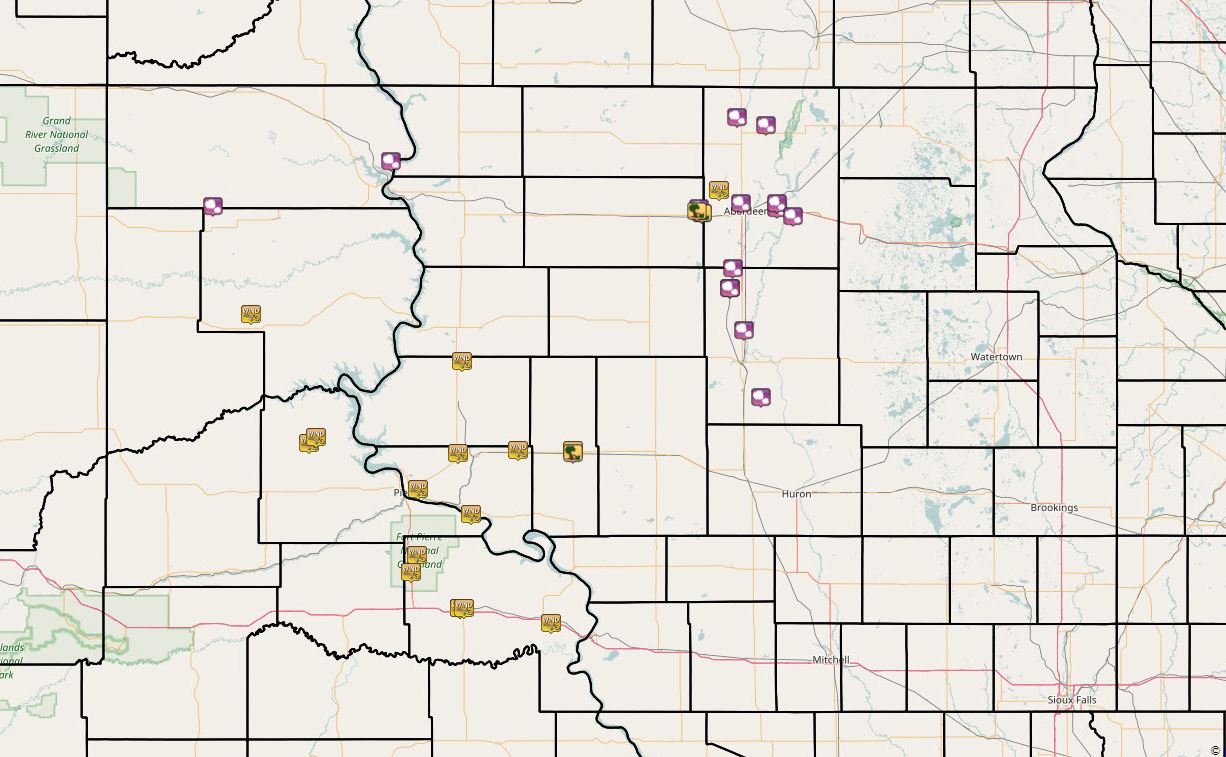 SPC Storm Reports from July 5, 2017. Interactive map here: http://www.spc.noaa.gov/climo/gmf.php?rpt=170705_rpts_filtered |
Wind & Hail:
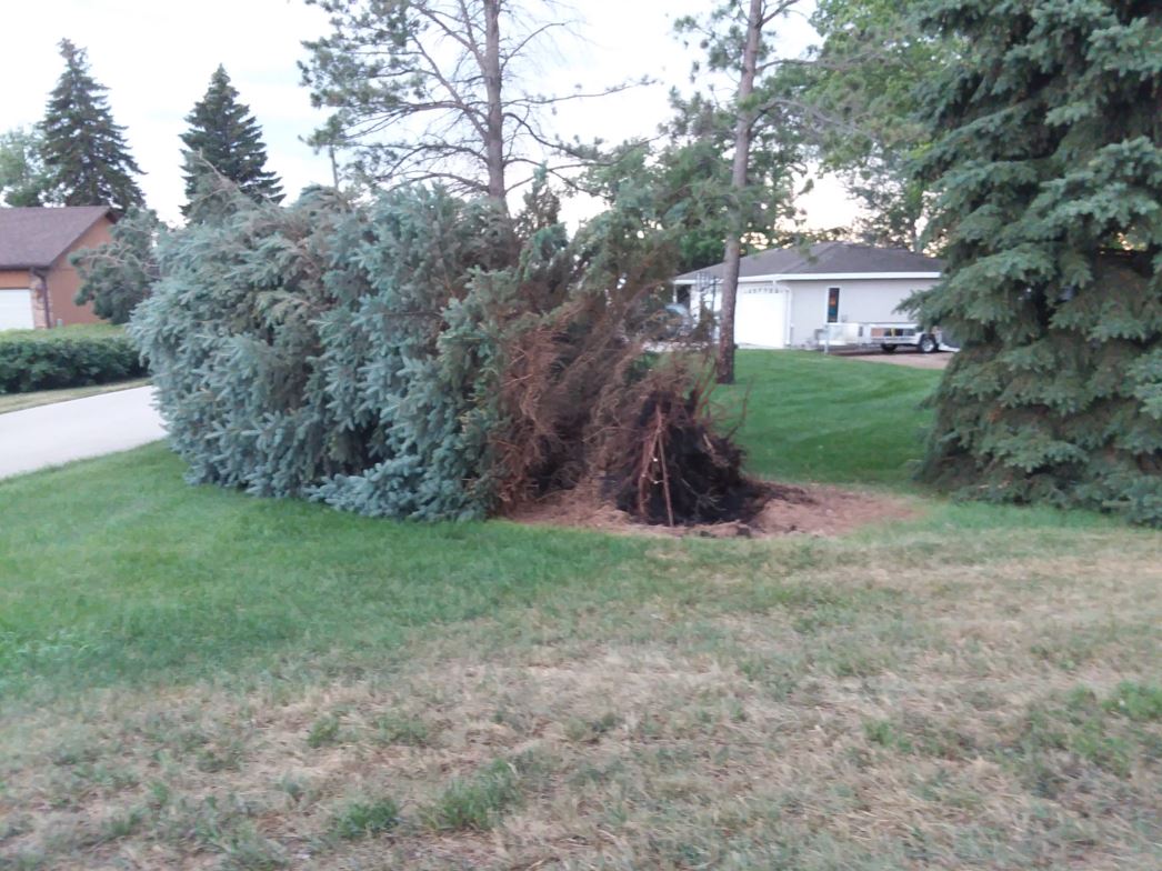
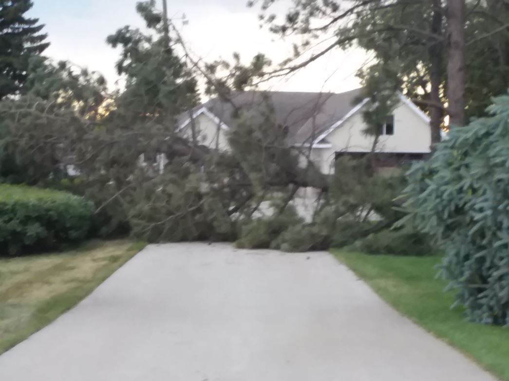
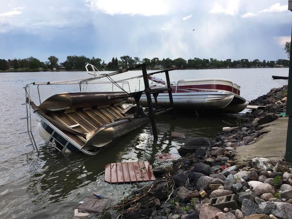
Microburst
A microburst (a very narrow area of strong winds within a thunderstorm) developed over Mina Lake in Edmunds County. Winds were estimated around 80 mph.
 |
 |
 |
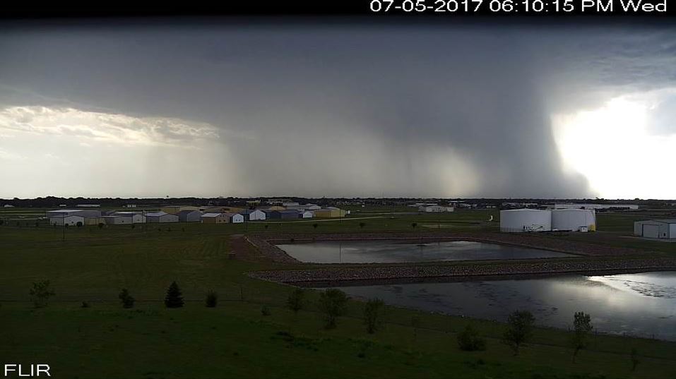 |
| Uprooted Tree at Mina Lake, Photo Credit Jennifer Pint | Downed Tree at Mina Lake, Photo Credit Jennifer Pint | Flipped Pontoon at Mina Lake, Photo Credit Sara Jo Bonn | Microburst seen from the NWS Aberdeen instrument tower cam at 6:10 pm CDT |
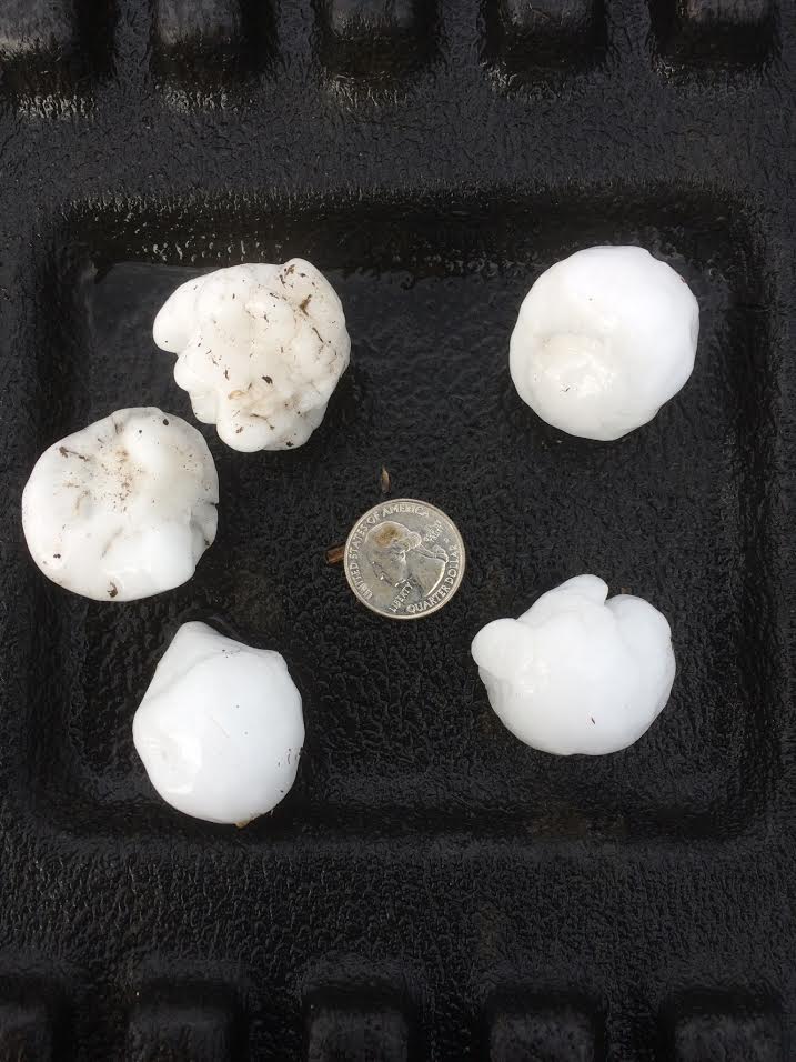
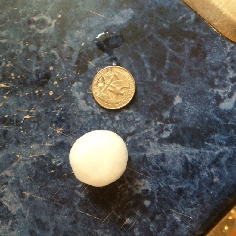
Wind & Hail
 |
 |
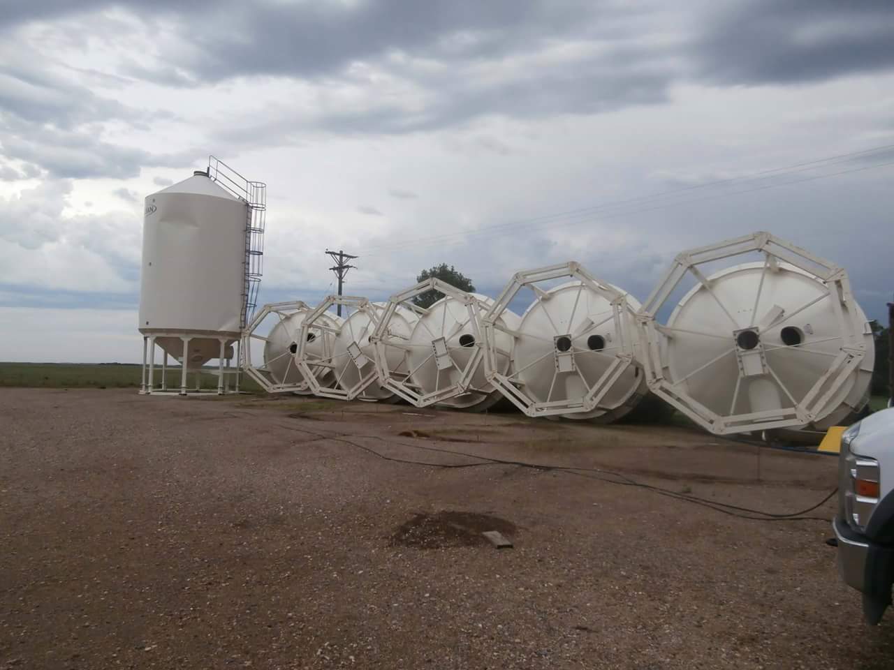 |
| Golfball Size Hail 6 W of Groton, Photo Credit: Joel | Quarter Size Hail Near Richmond Lake, Photo Credit: Gene Wolter | Grain Bins Knocked Over Near Northville, Photo Credit: Rondi Torrence |
Radar:
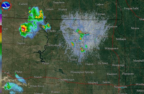 |
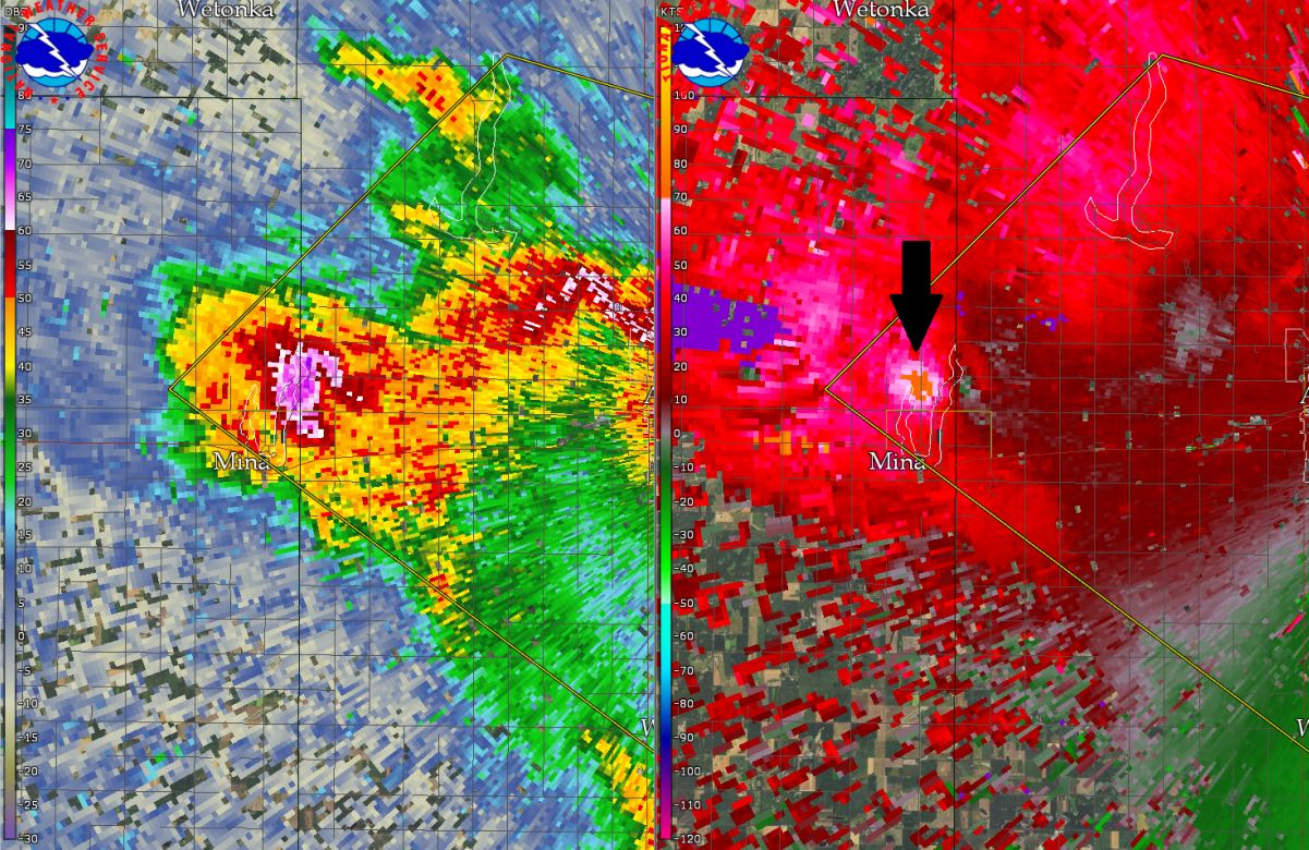 |
| Radar Reflectivity overview at around 6:30 pm CDT | Radar Reflectivity & Velocity at the time of the microburst over Mina Lake. The black arrow denotes the higher velocity values from the microburst |
 |
Media use of NWS Web News Stories is encouraged! Please acknowledge the NWS as the source of any news information accessed from this site. |
|

