
A storm system stretching from the Tennessee Valley to the Gulf Coast will bring a variety of hazards to the Eastern U.S. through Tuesday. On the south side of the system, heavy rain and thunderstorms will persist across the Southern U.S. Further north, a wintry precipitation mix is expected from the Central Appalachians to the interior Northeast through Tuesday. Read More >
Last Map Update: Tue, Dec 2, 2025 at 2:10:33 am PST
|
Text Product Selector (Selected product opens in current window)
|
|


 San Francisco Radar
 Sacramento Radar
 Satellite
 Weather Map
 Local Graphical Forecast
 U.S. Graphical Forecasts
 Forecast Weather Tables
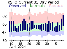 Recent MTR Temperatures
 Fire Weather
 Probabilistic Snowfall Forecasts
 Heat Risk Link