
A storm system will progressively develop over the Eastern U.S. into the weekend. Scattered strong-severe thunderstorms may produce hail and damaging winds from portions of the lower Ohio Valley into the Deep South this afternoon. Areas of mixed rain and wet snow showers will impact the the Great Lakes to interior New England. Heavy rain will spread into the Mid-Atlantic and Northeast on Friday. Read More >
Last Map Update: Thu, Apr 10, 2025 at 7:52:24 am PDT

|
Text Product Selector (Selected product opens in current window)
|
|


 Social Media
 San Francisco Radar
 Sacramento Radar
 Satellite
 Weather Map
 Local Graphical Forecast
 U.S. Graphical Forecasts
 Forecast Weather Tables
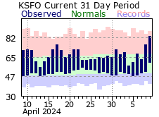 Recent MTR Temperatures
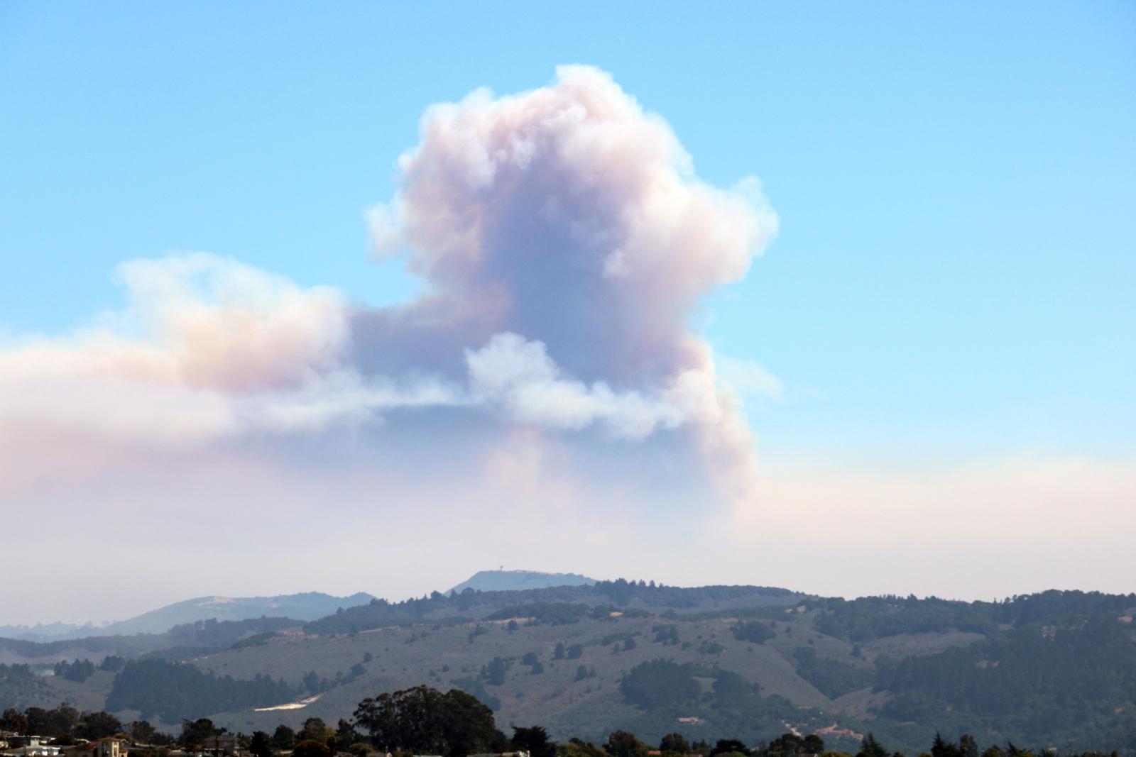 Fire Weather
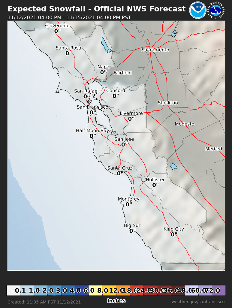 Probabilistic Snowfall Forecasts
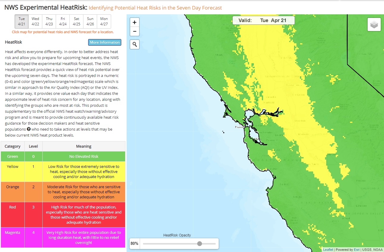 Heat Risk Link