
| Reports & Outlooks | |||
| SPC Outlooks | SPC Storm Reports | SPC Event Archive | |
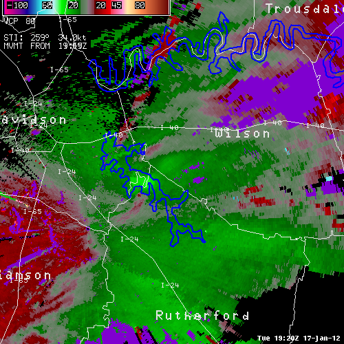
| EF0 Rutherford County Tornado | |
| Counties: | Rutherford |
| Time: | 1:27 PM CST |
| EF Scale: | EF0 |
| Damage Path Length: | 1.69 Miles |
| Damage Path Width: | 125 Yards |
| Fatalities: | 0 |
| Injuries: | 0 |
| Damage: Initial damage was noted at the Lamar Hill Access Area to Percy Priest Lake where dozens of mainly cedar trees were snapped or uprooted. The top of one cedar tree was broken off and thrown northwest into the lake. A nearly continuous 1.69 mile damage path was then noted heading to the east northeast. The most significant damage was along North Lamar Road near Victory Road. Several homes suffered moderate roof damage, a camper was blown on its side, and dozens more trees were snapped or uprooted. The last evidence of damage was near the intersection of North Lamar Road and Lamar Hill Road where a couple trees were snapped. |
|
|
TBNA Radar Loop:
|
|


 Follow us on YouTube